Interactive Map – how to use
On a PC, drag the map around and zoom in/out. On a mobile device, use 2 fingers to move the map around and to pinch for zoom. Click or tap on a track or a waypoint dot for more details about that feature. Mouse or finger slide over the elevation profile graph and look to see where that point is located on the map as you move along it.
Click the white arrow in the lower right corner of the main map to expand a mini-map that gives reference to the surrounding area around it.
Download this map file for your own use:
Download the tracks and waypoints files in various different formats via clicking the small icons on the top right corner (GPX, GeoJSON, KML, or GeoRSS) and saving to your computer/mobile. GPX format is the most versatile, and has all track and waypoint data. The KML download feature currently is only providing some waypoints, but no track data.
![]()
Mouse over this icon (if visible) in the upper right corner of the map to get an option to select an individual track section for which you’d like to see details, or to see it on the elevation profile graph below the map. (for maps with multiple tracks only)
![]()
Date: August 8, 2017
Distance: 8.74 miles
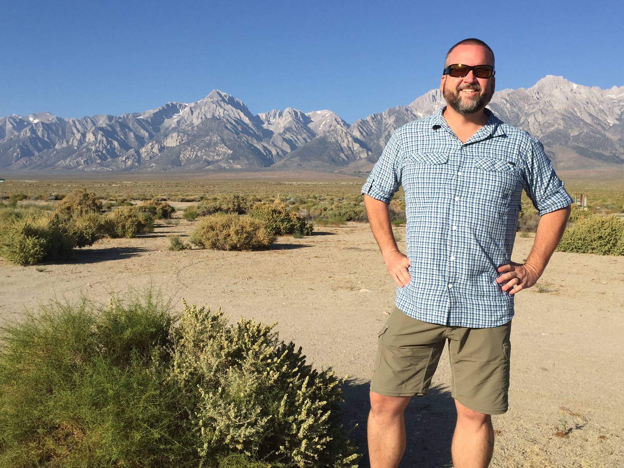
After a 9 hour drive from Phoenix, 1 night in Mammoth Lakes, parking my truck at the roadside long-term parking just below Mammoth Mountain Inn, a shuttle into Mammoth Lakes, a bus to Bishop, and a final bus to Independence, I arrived at the Mt. Williamson Motel and Base Camp for a good night’s rest only a few miles from the Onion Valley trailhead. That would be my starting point for this journey, and I couldn’t sleep that night because I was so full of anticipation. Final gear checks were done in my cozy room and everything was packed up again. This was my last chance to make sure that I had everything that I needed for the next 18 days. I felt confident.
The next morning I woke up early to be sure I was showered and ready for my last “regular” breakfast for the next 7 days. The call to breakfast came right on time, and I sat down on a picnic bench outside with a half dozen strangers who were either resupplying at the motel or about to start their own adventure in the Eastern Sierra.
After breakfast, we loaded up in 2 different private vehicles provided by amazing volunteers who worked with Strider at the motel. Off we went to Onion Valley trailhead to start our day.
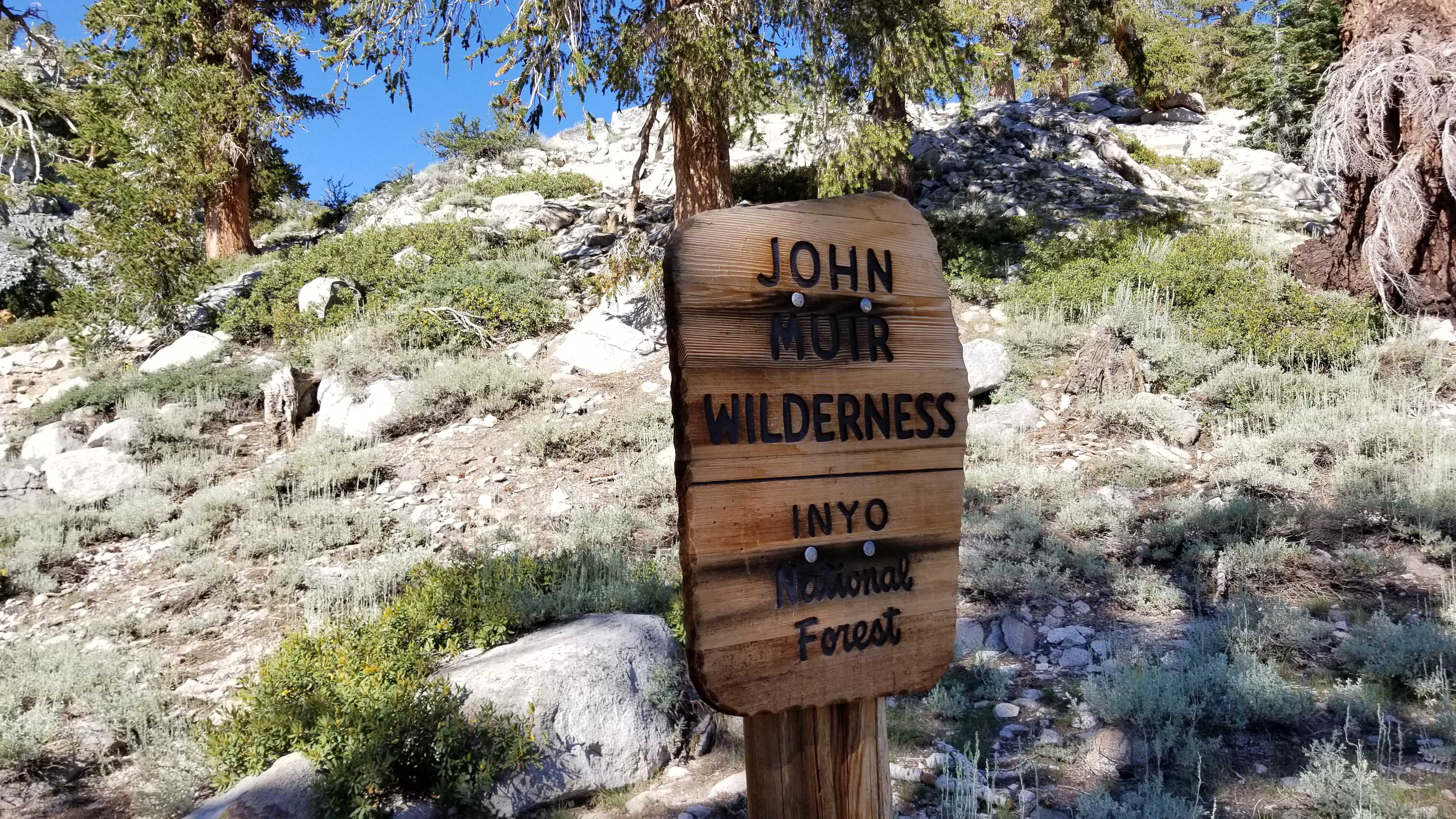
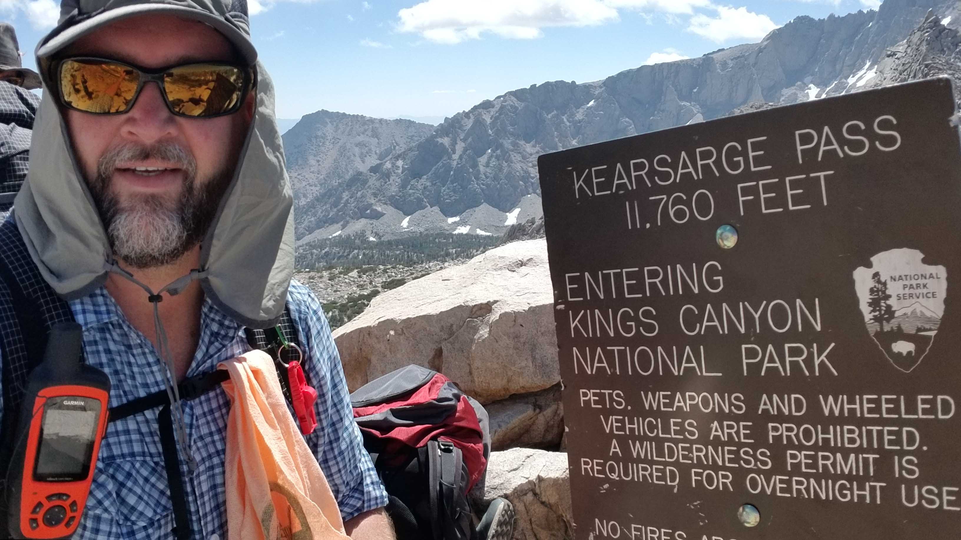
We all arrive at the Onion Valley Trailhead which leads up to the 11,800′ high Kearsarge Pass and eventually down to join the JMT after about 7 miles. This was the route that Channan and came in to join our southbound JMT journey back in 2016. This time I’m headed north, and I’m on my own.
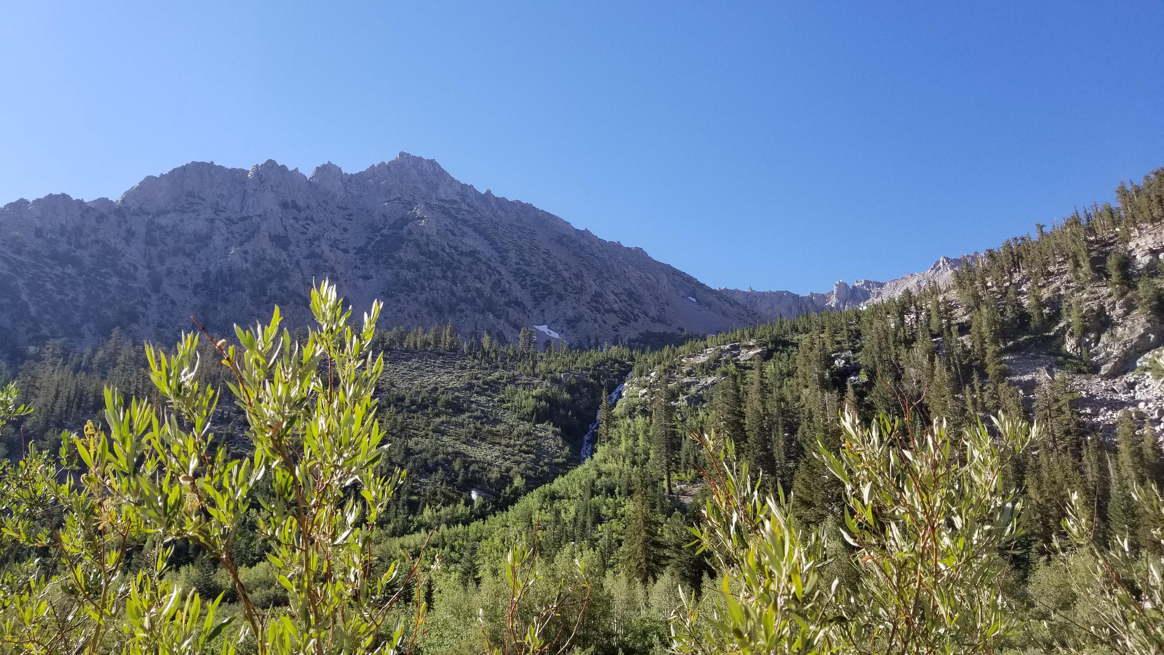
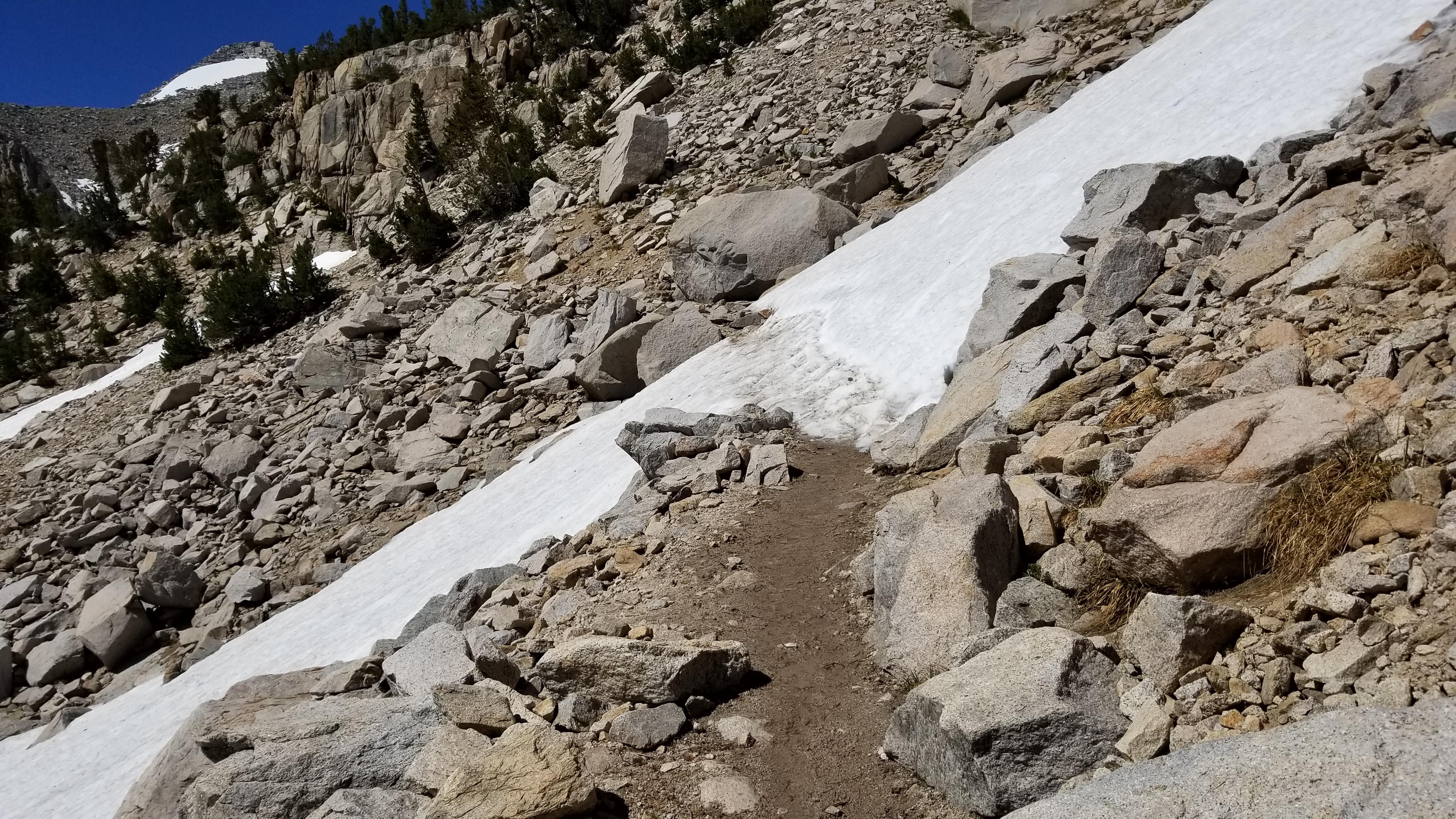
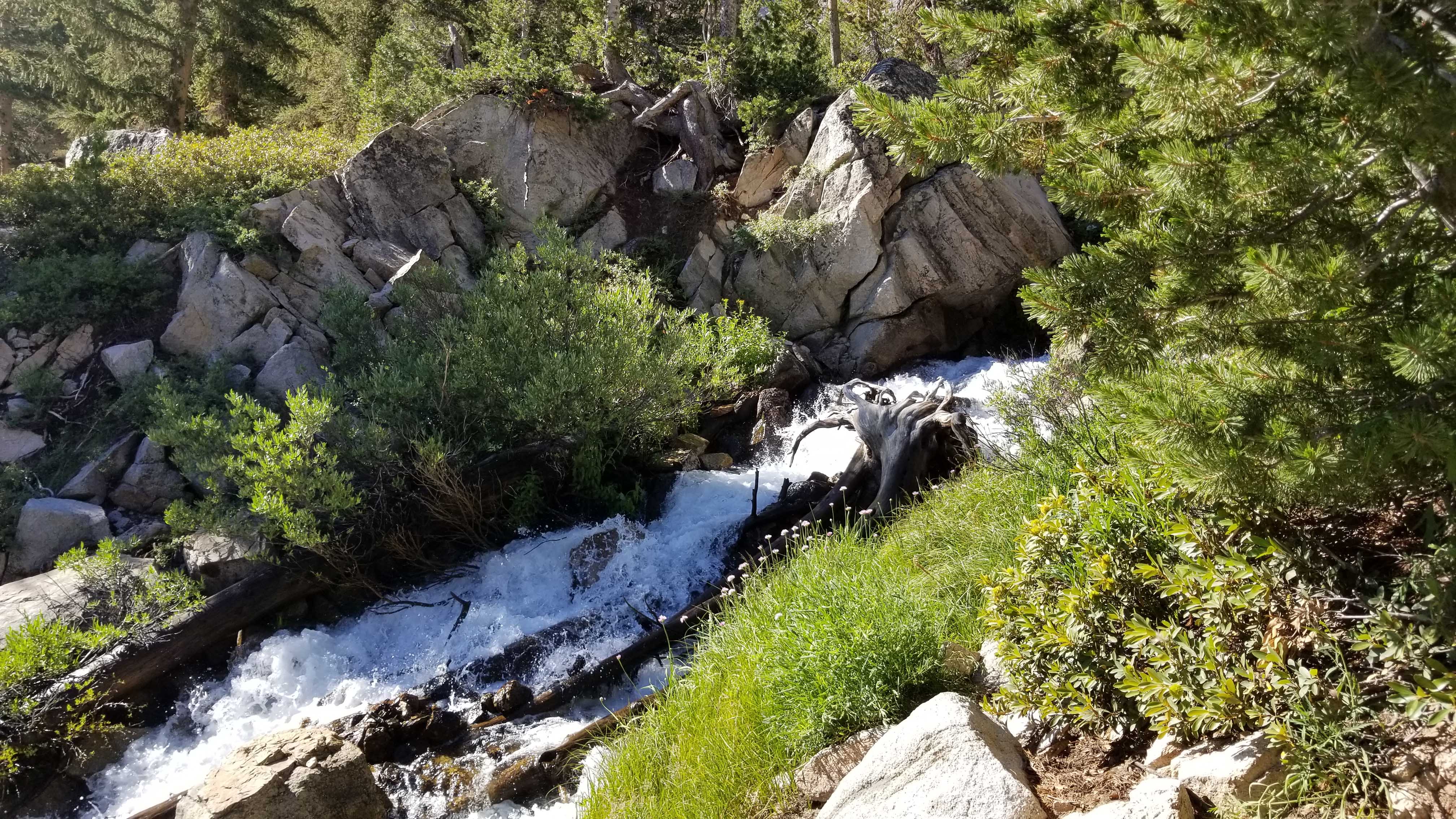
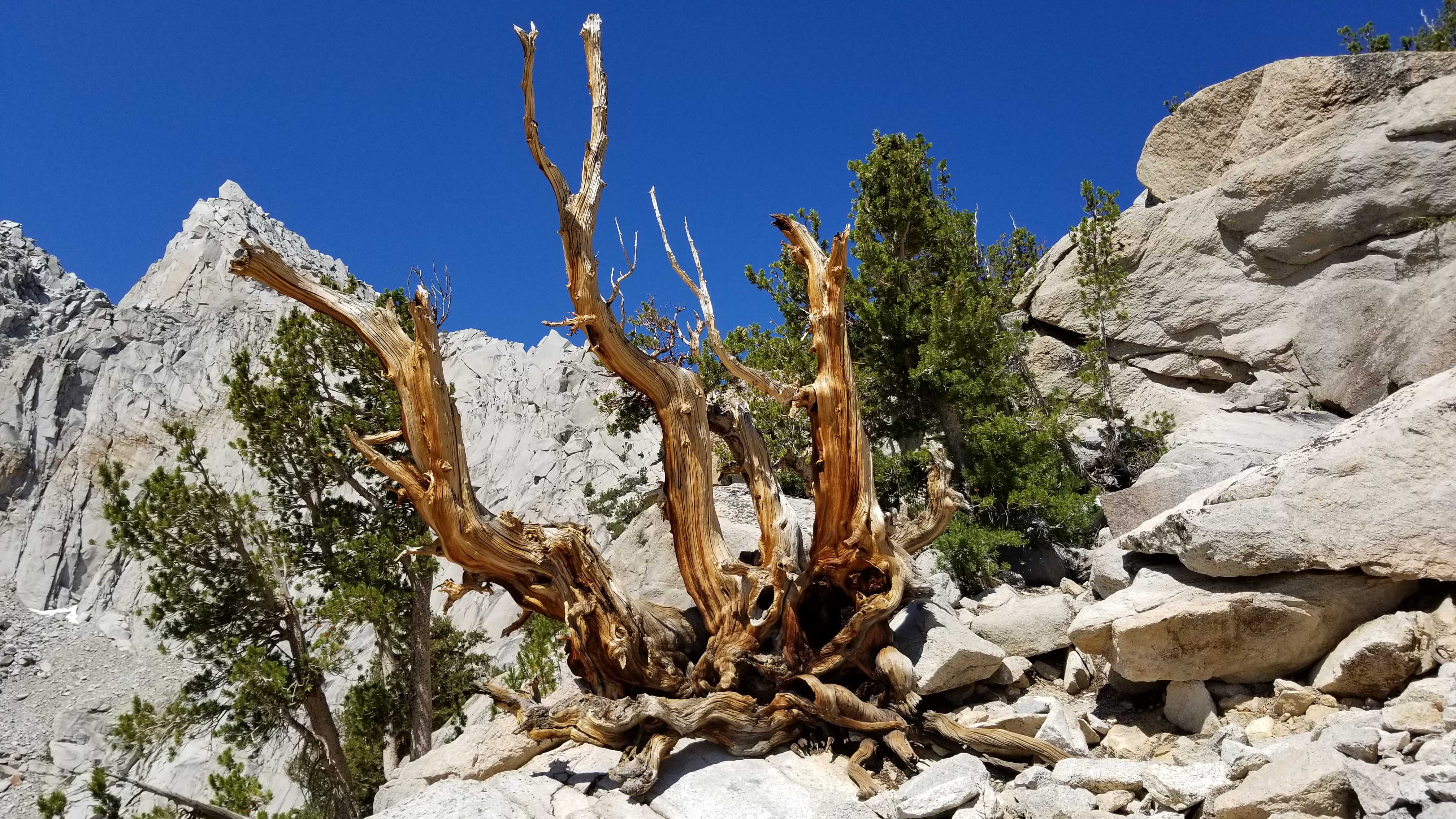
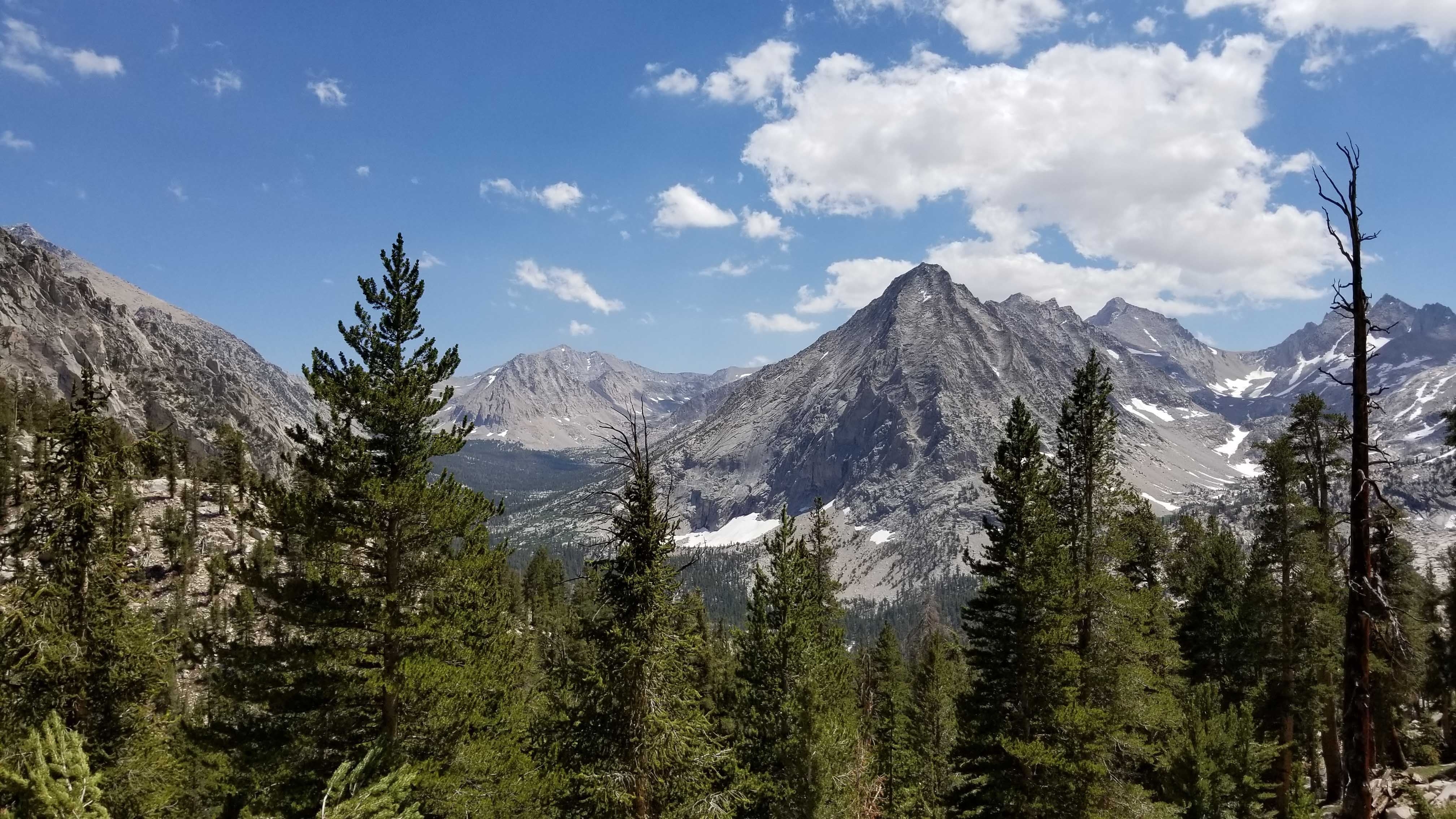
The trail starts out at 9,100′ but it has the feel of a high desert biome. Rocky and covered with scrub, the ascent starts right away. Not long after this first section, the forest thickens yet I hike in and out of it along flowing drainages from the lakes above and across scree fields from past landslides. I stop to filter water only once in this section, as I am carrying no more than 2 liters at any time. Passing by Little Pothole Lake and Gilbert Lake, I come across my first snow crossing of the trip on a steep but small slope, reminding me of what lies ahead for the next 2 1/2 weeks. I pass by Heart Lake and continue to the treeline and beyond.
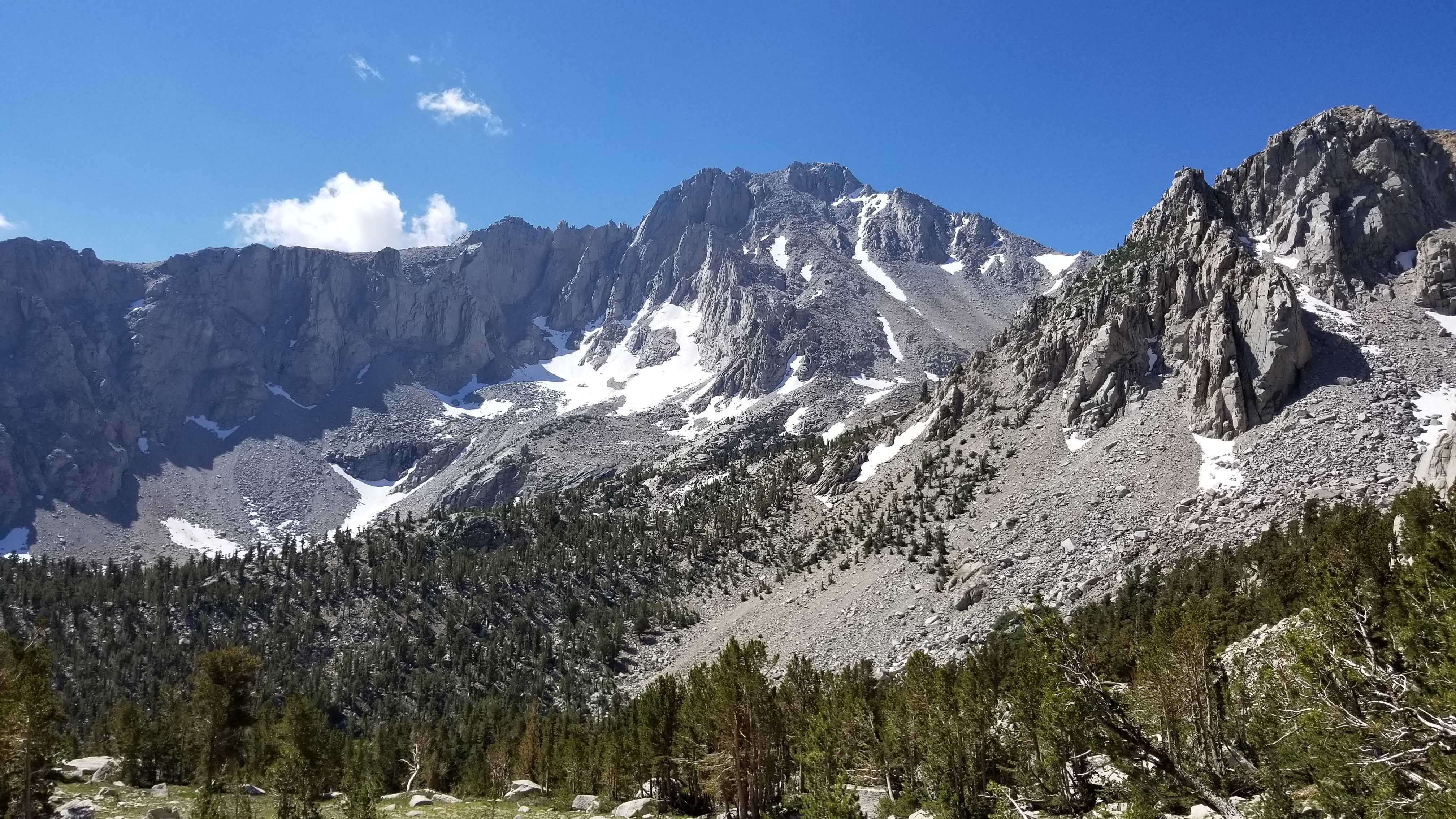
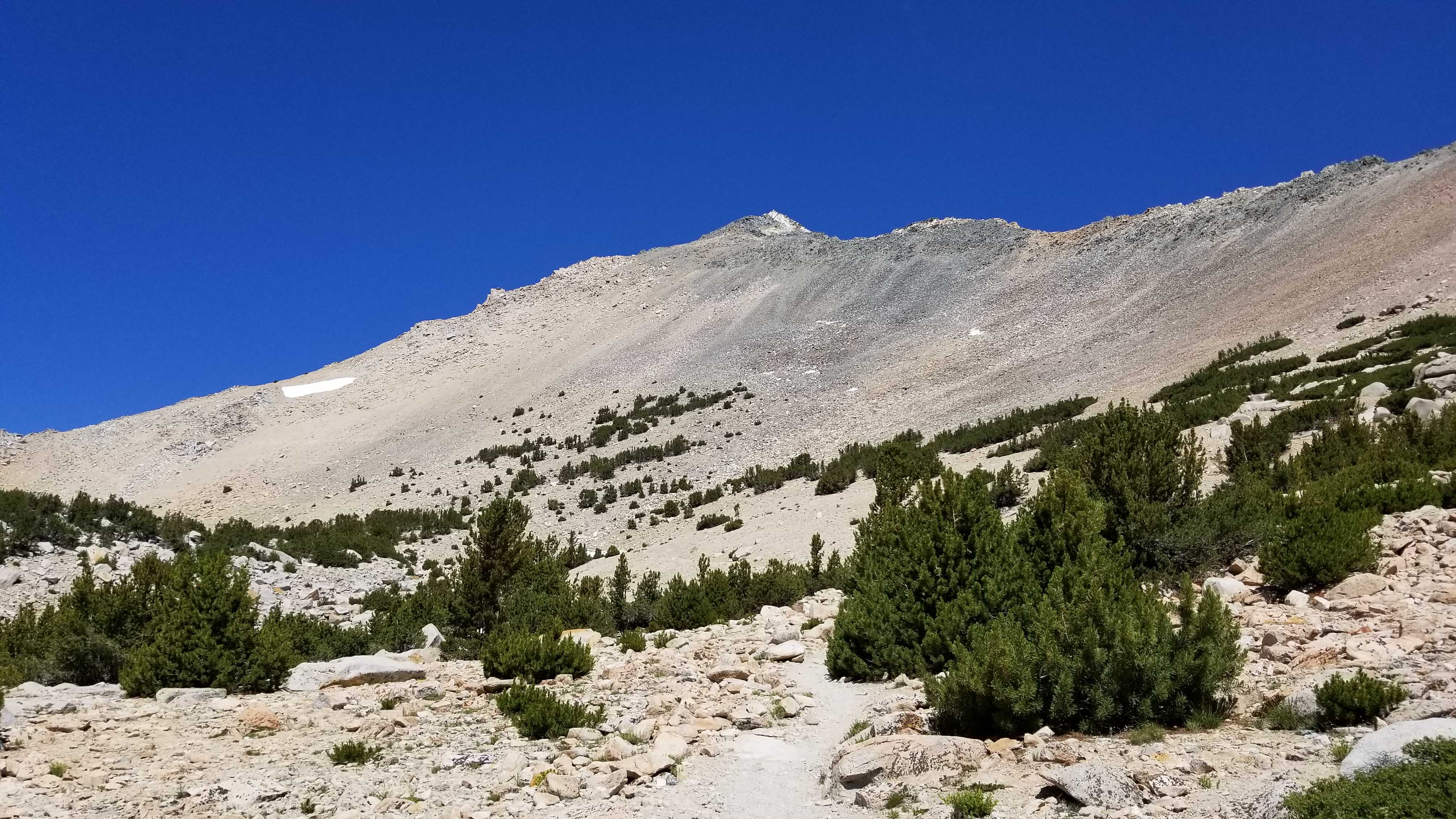
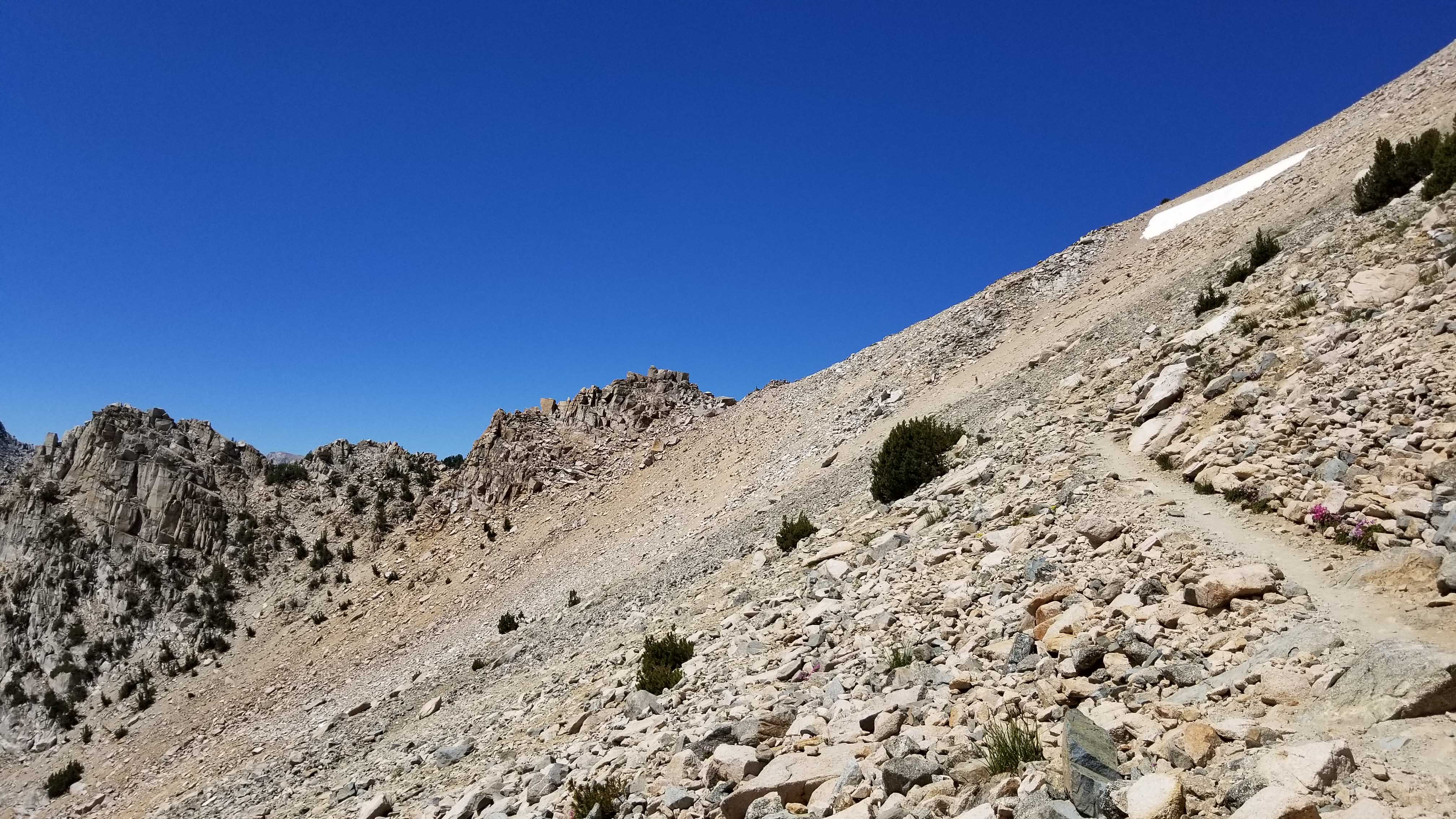
Continuing up to the treeline, the views drastically change to alpine conditions. This is what I’ve been waiting for. The views become more grand as the vegetation gives way to ridges and vistas all around me. I come to a level spot for a bit, and then the ascent up the last slopes of Kearsarge Pass begin. On the final push, Big Pothole Lake is 300′ below me.
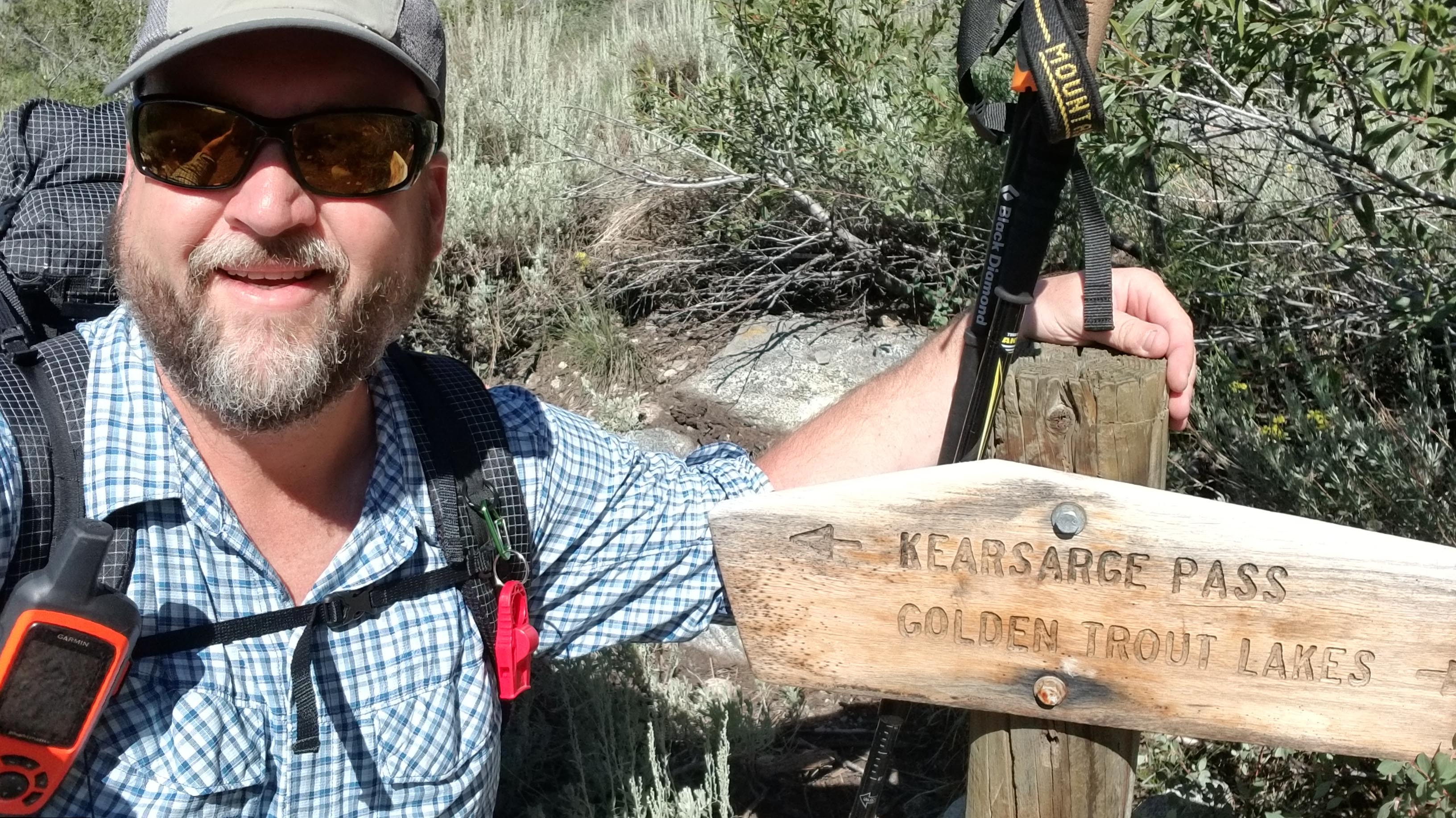
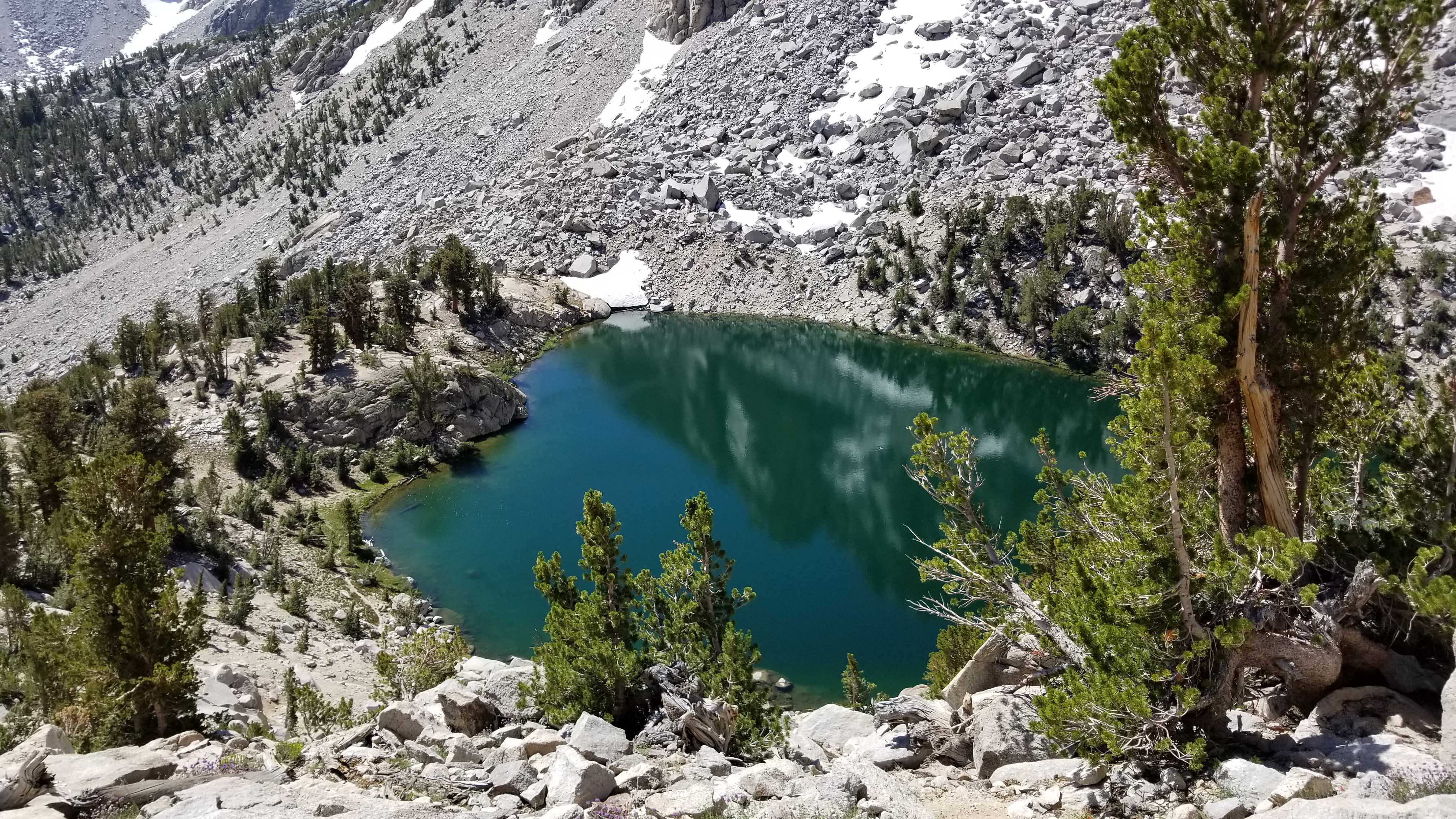
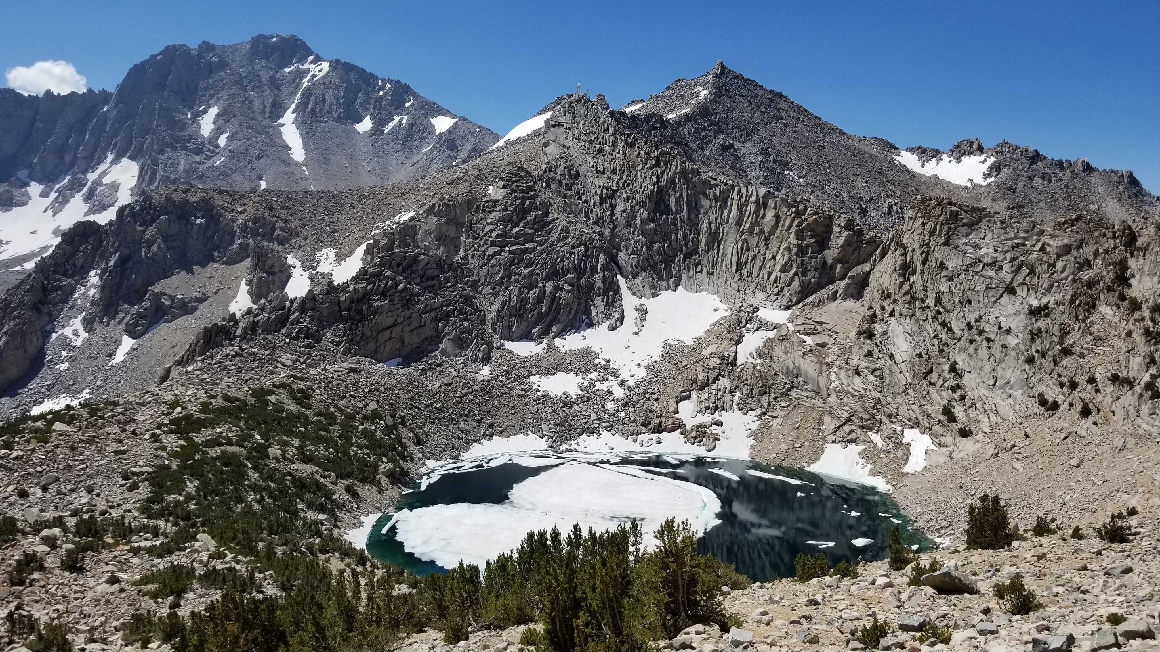
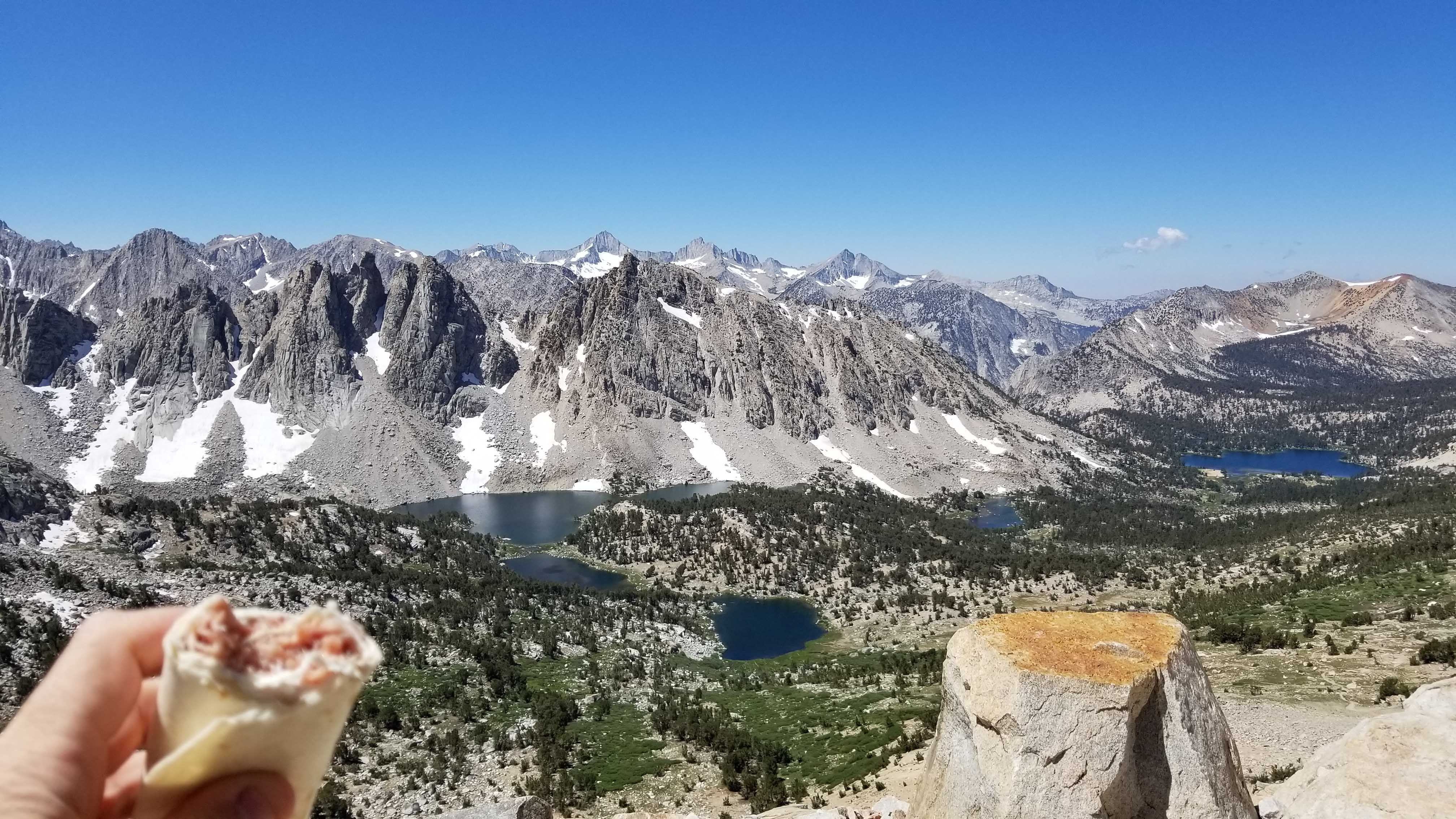
Even though this is my second summer coming up this route, seeing it again did not disappoint. The weather was clear and cloudless and temperatures were in the low 70’s. My legs and lungs felt great as I reach the top of Kearsarge Pass a full hour faster than the previous year. From the top, you’re greeted immediately with the view of the Kearsarge Lakes and Bullfrog Lake to the west. This continues to be one of my all-time favorite views in the entire Eastern Sierra. I stop for a quick lunch as I’m eager to get down to the lakes and fill up on more water. I planned this first day to be the shortest of the entire trip to help with altitude acclimation, and to give me plenty of afternoon time to practice my camp set-up routine.
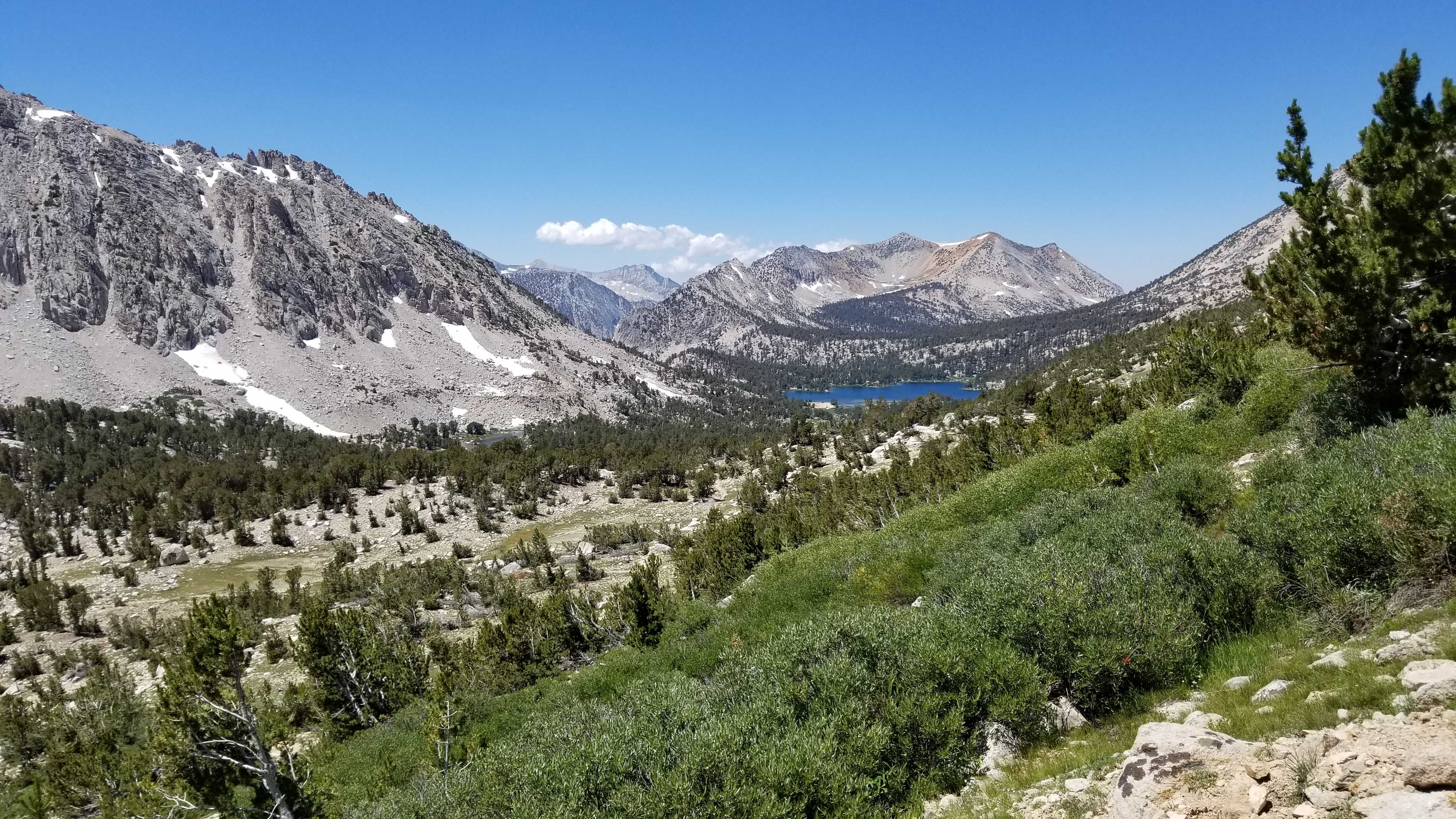
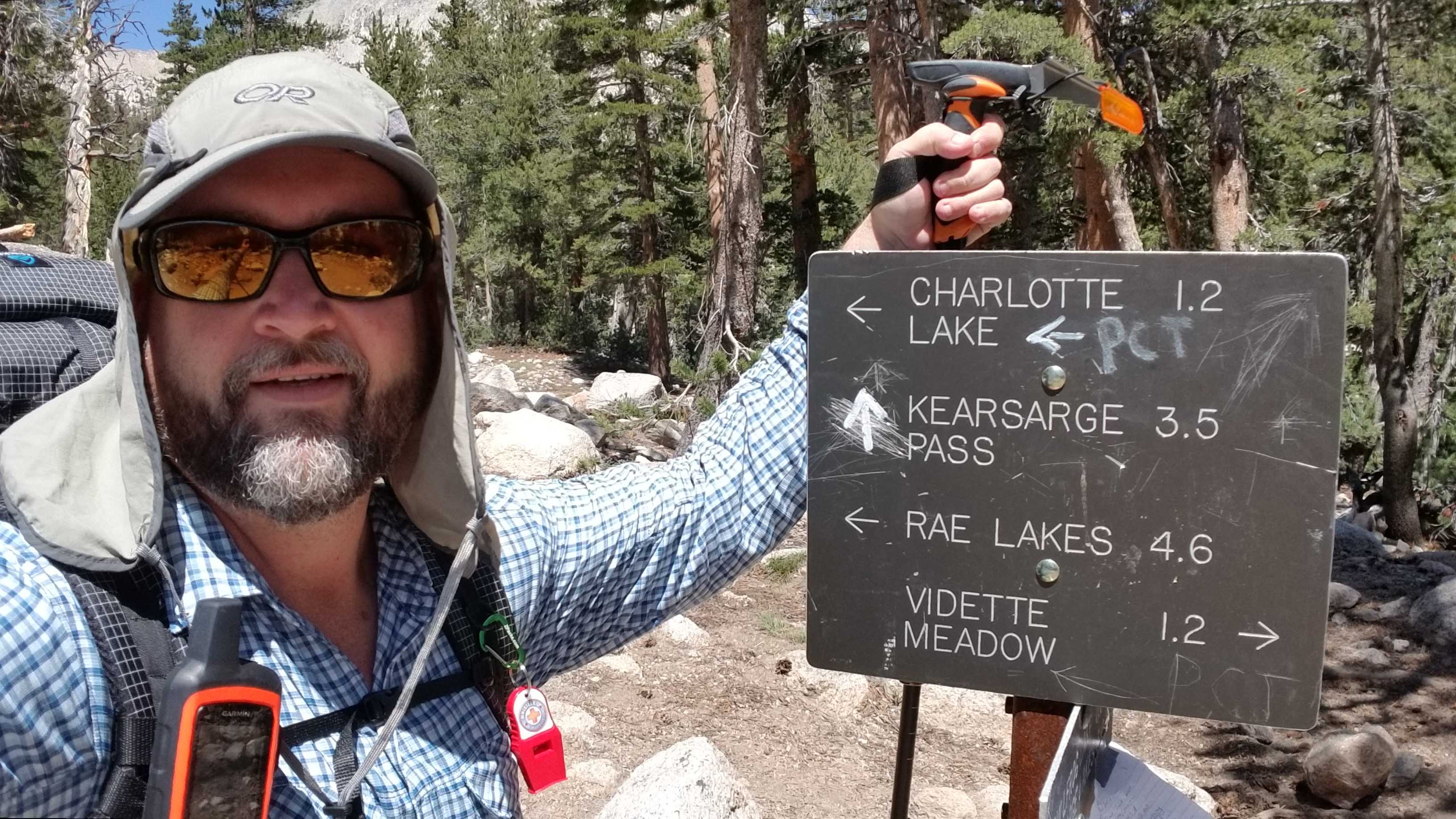
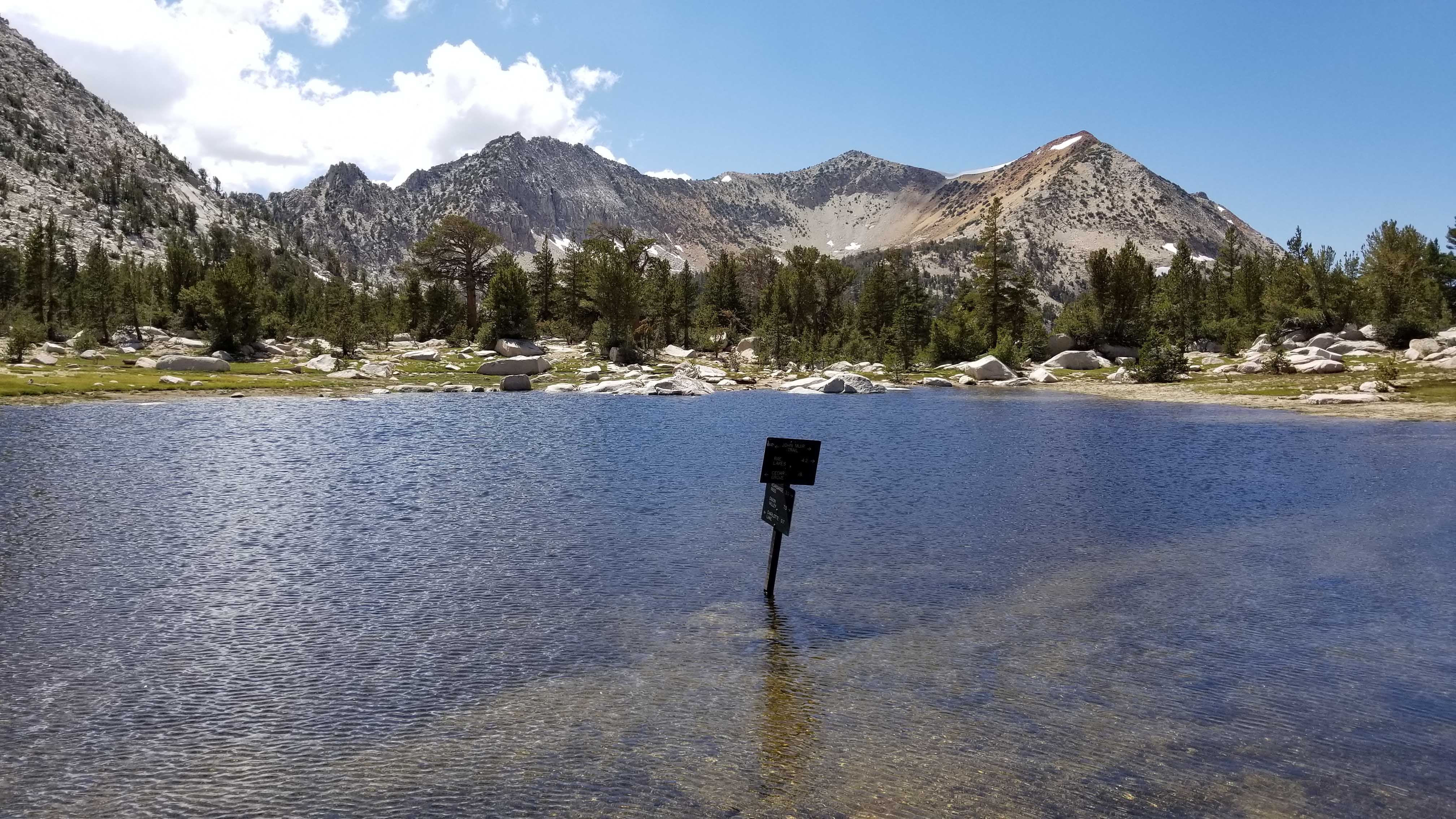
With the big climb of the day behind me now, it’s time to move through the valley and down to Charlotte Lake for my first night. Walking through this valley is a real treat, and clear running water is everywhere. I stop for a couple liters of cold water as I pass by Kearsarge Lakes and down to Bullfrog Lake. Just below, I officially meet up with the JMT and start heading north to the Charlotte Lake junction which is a side trail to the JMT proper. At this junction, you can either continue north to Glen Pass or drop 200′ down to Charlotte Lake. I’ll be back here tomorrow to conquer Glen!
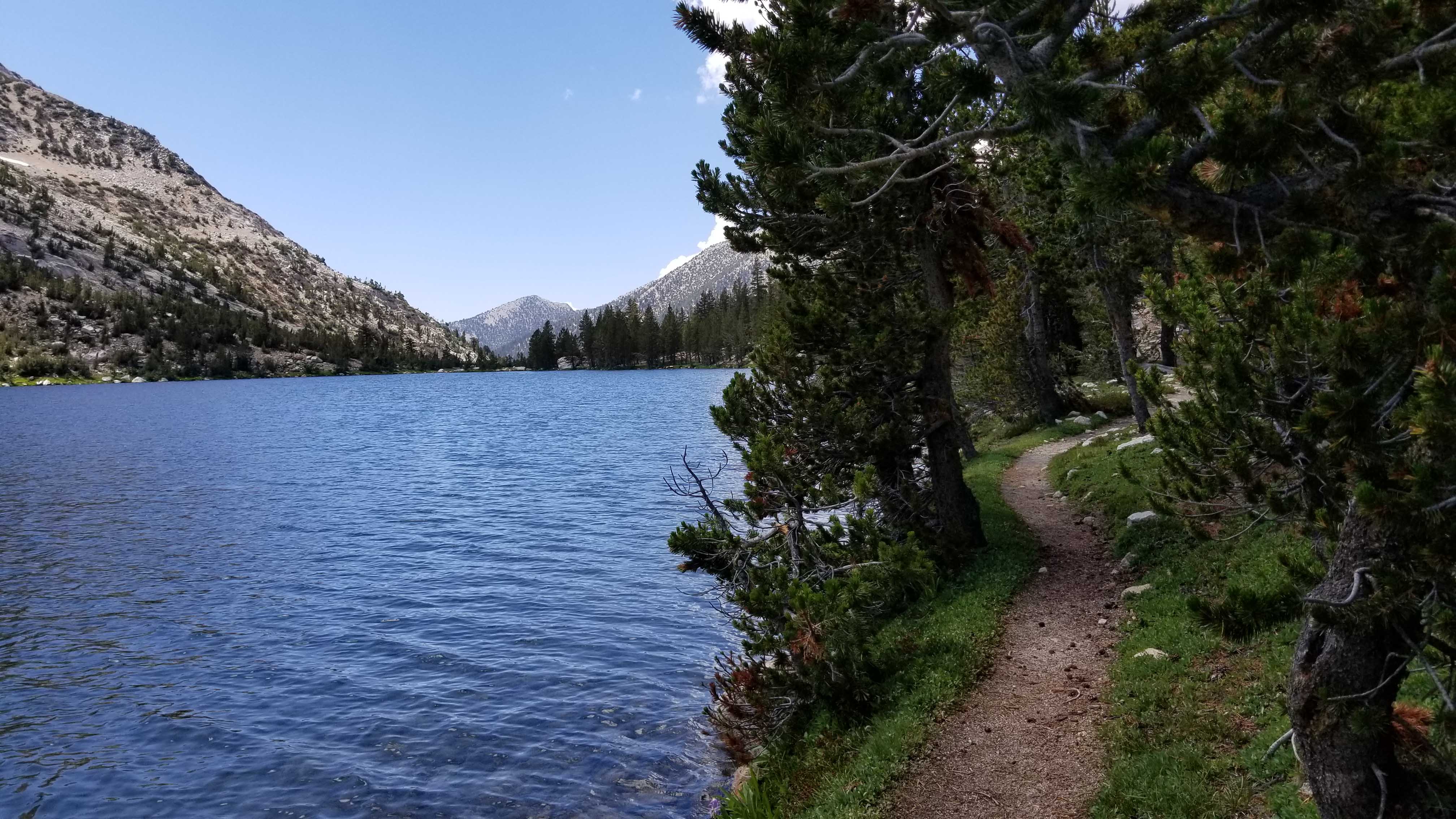
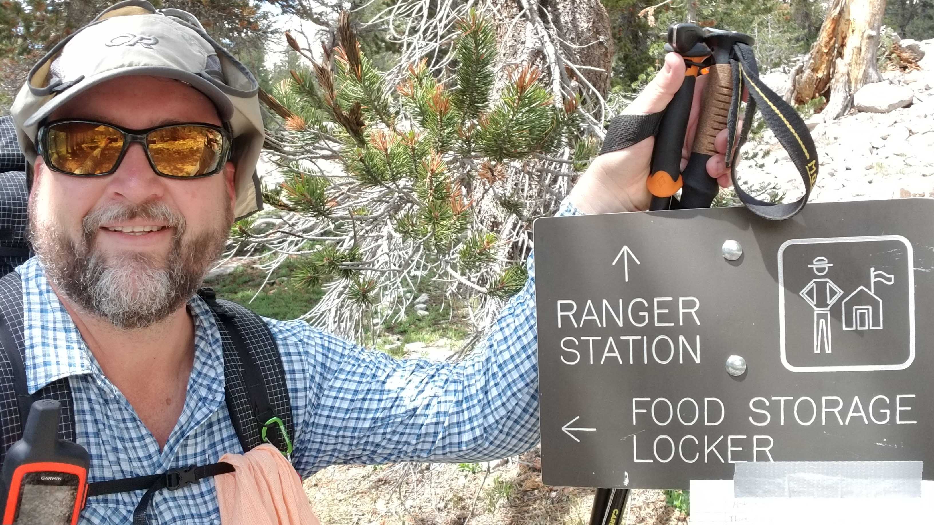
The Charlotte Lake Trail descends quickly into the valley to the west of the JMT junction. It’s heavily wooded and a very rocky trail full of larger boulders, but it goes by quickly as I approach the lake. I come across the lush green drainage that fills Charlotte Lake with snowmelt, and the views of the lake itself are a pleasant sight. The trail follows along the northern shore of the lake, many times within only a foot or two of the water. Trout are darting around and I somewhat regret not bringing my fishing gear on this trip. I pass the ranger station and locate the bear locker, then climb up the slope to some developed campsites that I’ll call home for the night.
I set up camp and my Zpacks Solplex goes up quickly. I’ve found a great flat spot up the hill from the lake and somewhat near the bear locker, where I store my first 2 day’s food for the night while the rest stays in my bear canister at camp. I make dinner, chat with a nice couple camped a few hundred feet to my west, and I climb into my tent for a decent first night’s sleep.