Date: June 3, 2018
Hiking Distance: 17.52 round-trip
After a last minute invite to join 2 friends on their permit to Keet Seel at the Navajo National Monument, there was no way I was going to pass this up. Permits are hard to get, and their 3rd person had to bail, so it was my lucky day. I had heard rumors and seen some pics of this place, and it was going to be the most complete and largest native ruins site that I have ever seen in person.
So we made it a road trip to not only see the ruins site, but to also go the day before and drive through Monument Valley on the UT/AZ border. We drove up from Phoenix on Saturday morning 6/2/18 and set up camp at the Navajo National Monument camp area, then loaded into 1 car and drove up to Monument Valley, stopping at the visitor center for pictures as well as stopping along the highway for the classic pics. We made it back to our campsite late that afternoon and got some rest. Sunday was hike day.
This 17.5 mile round-trip hiking adventure can be done in one full day in and out, or is recommended that you backpack in one day, stay at the backpacker’s campground overnight, and exit on the 2nd day. If you’re up for doing 18 miles roundtrip including an almost 2 hour guided tour, be my guest. That’s what we did, and it was a sunrise to sunset day but wort
Interactive Map – how to use
On a PC, drag the map around and zoom in/out. On a mobile device, use 2 fingers to move the map around and to pinch for zoom. Click or tap on a track or a waypoint dot for more details about that feature. Mouse or finger slide over the elevation profile graph and look to see where that point is located on the map as you move along it.
Click the white arrow in the lower right corner of the main map to expand a mini-map that gives reference to the surrounding area around it.
Download this map file for your own use:
Download the tracks and waypoints files in various different formats via clicking the small icons on the top right corner (GPX, GeoJSON, KML, or GeoRSS) and saving to your computer/mobile. GPX format is the most versatile, and has all track and waypoint data. The KML download feature currently is only providing some waypoints, but no track data.
![]()
Mouse over this icon (if visible) in the upper right corner of the map to get an option to select an individual track section for which you’d like to see details, or to see it on the elevation profile graph below the map. (for maps with multiple tracks only)
![]()
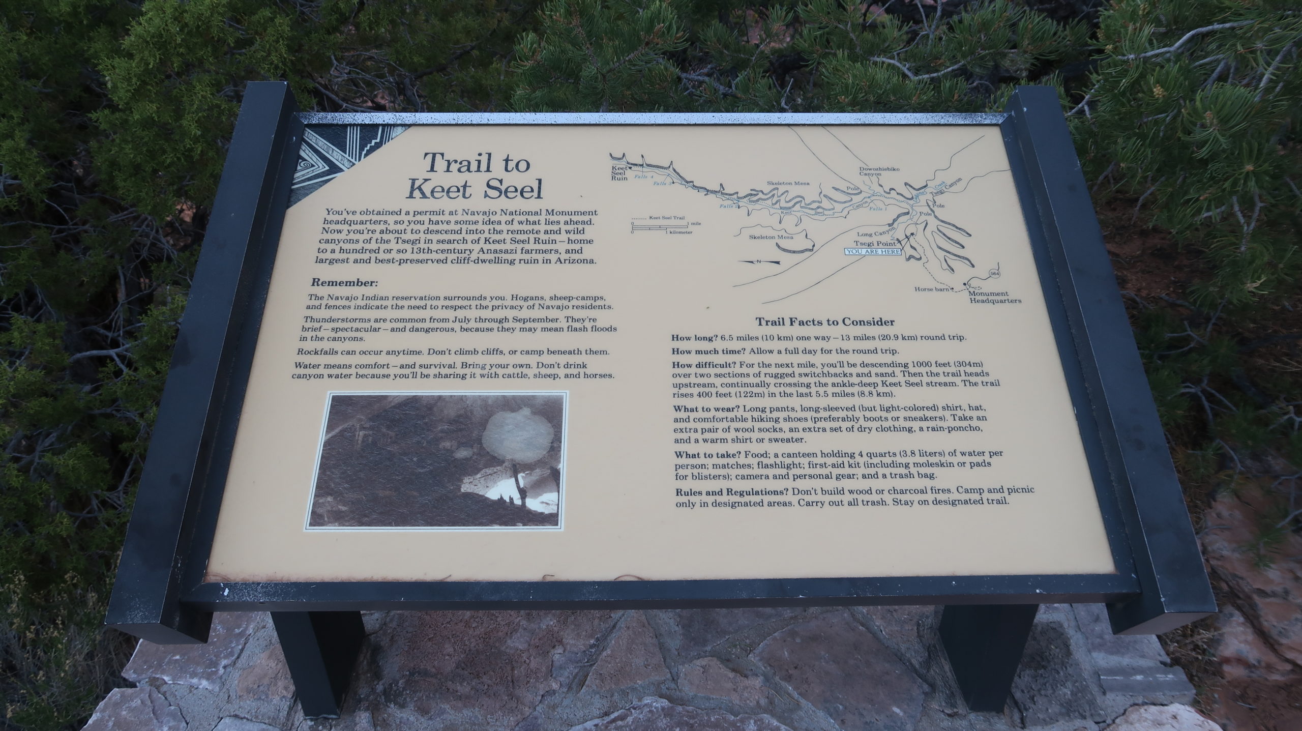
After going to the visitor center and signing in and confirming your required permit reservation, you are required to watch a somewhat short live presentation and watch a short video on Keet Seel’s history as well as the rules. Be punctual for this presentation and show respect, as you are guests on this land and have the privilege that few get to see this amazing massive ruins site.
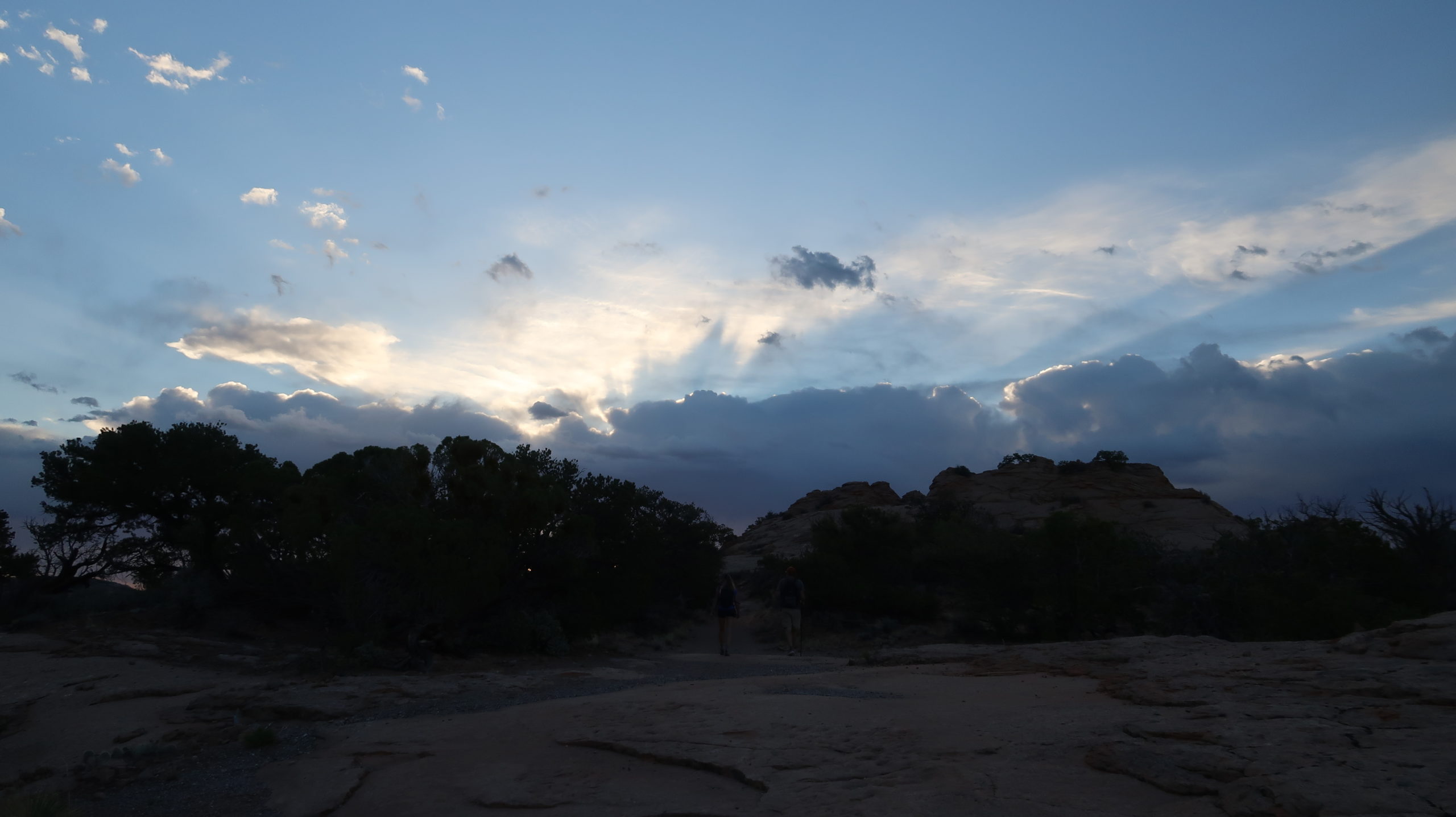
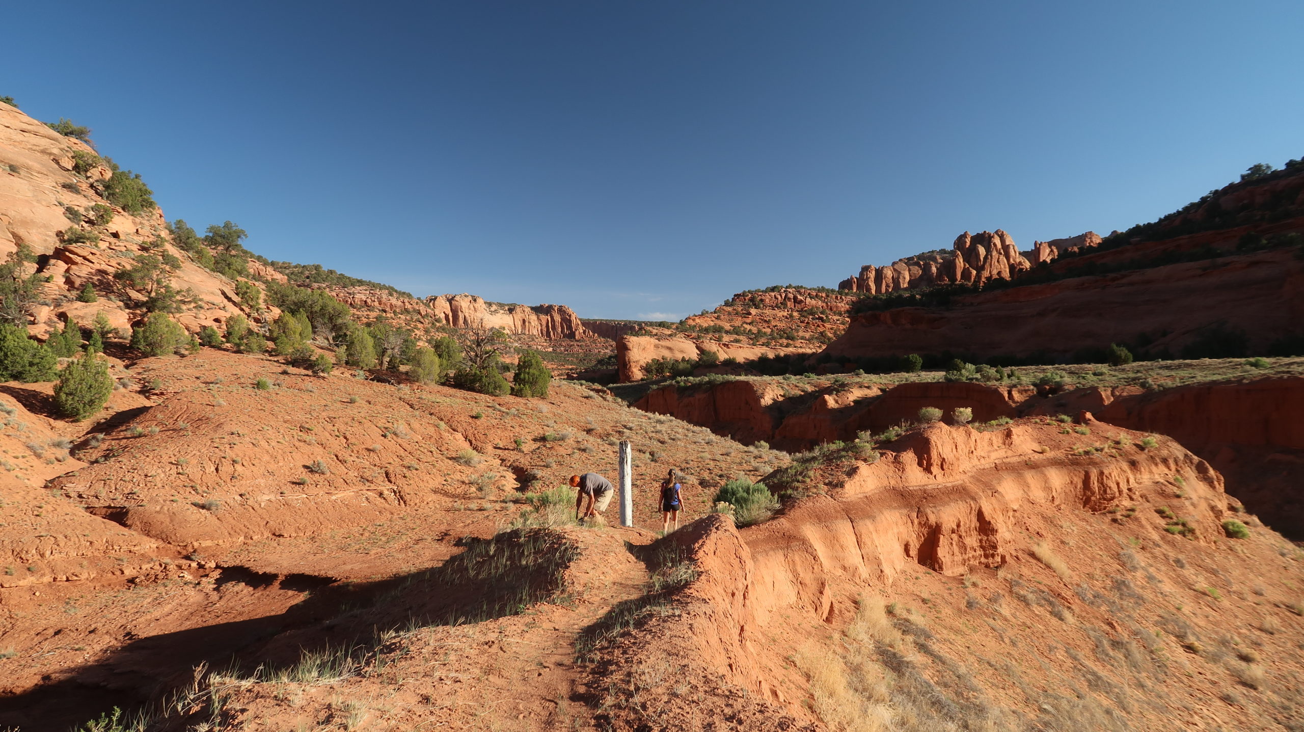
Once the presentation is complete and you have your physical paper permit, you are ready to get in your car and drive a short way to the trail parking area. Once there, lock up and take a short half mile or so road walk, through a simple gate on the road, and then to the start of the trail which is where the descent down into the valley begins.
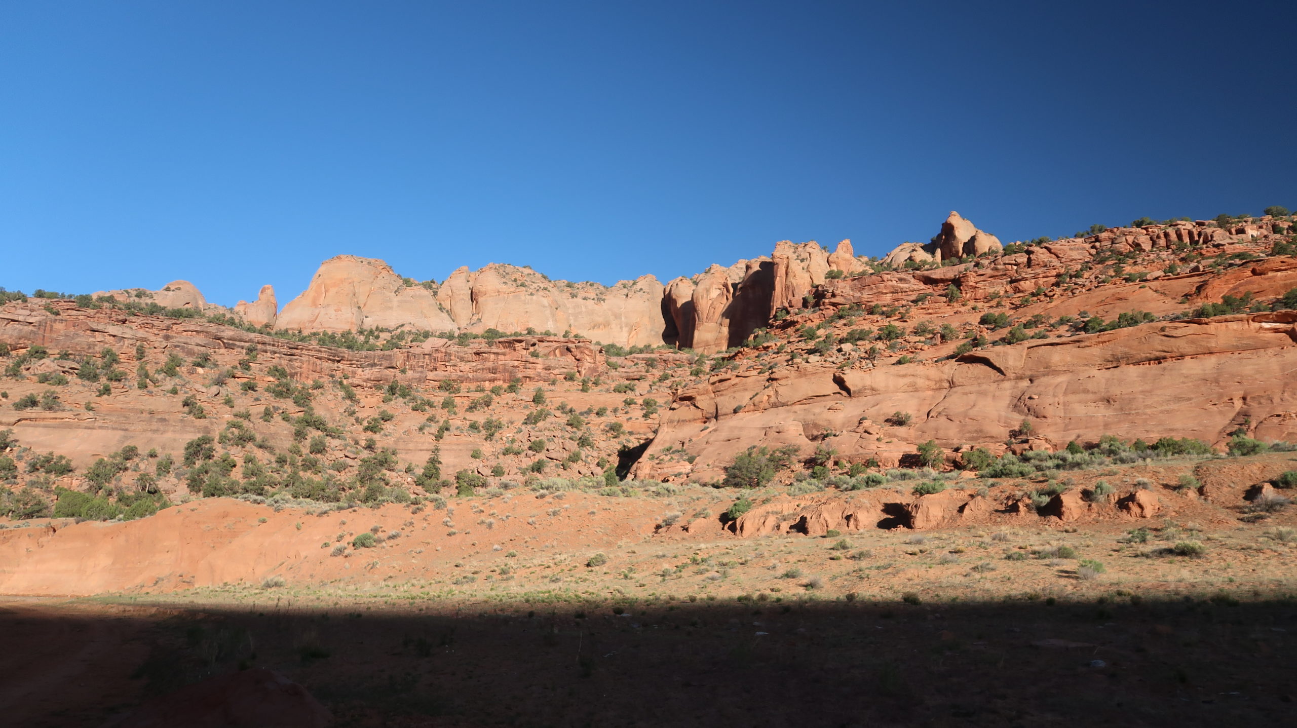
The trail starts winding down a sandstone ridge quickly but it is engineered well and there is no exposure unless you’re screwing around. Stay on trail.
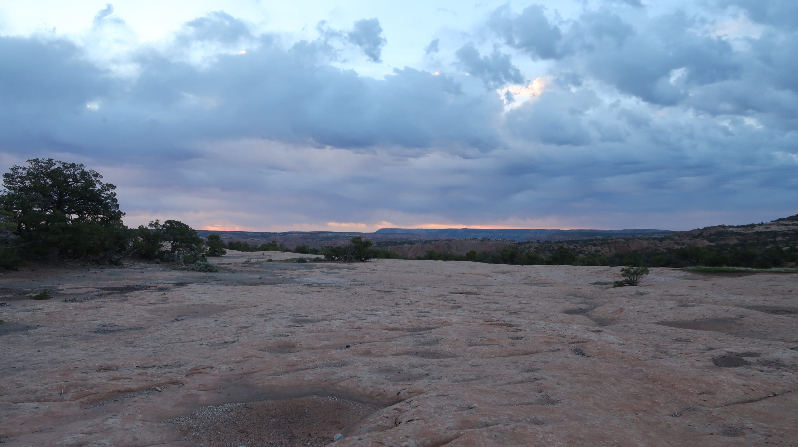
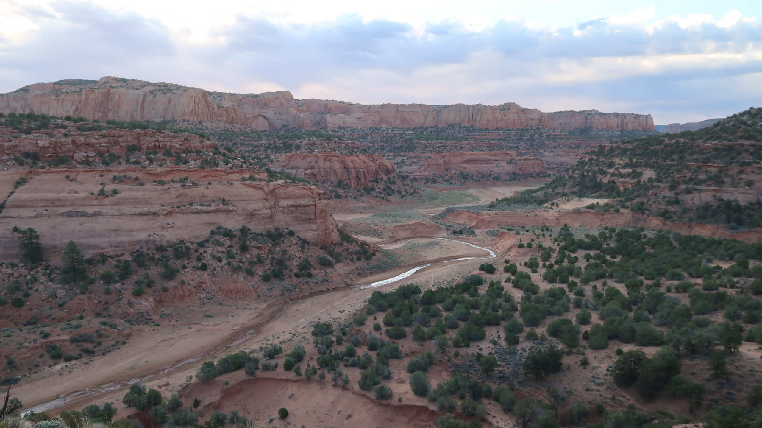
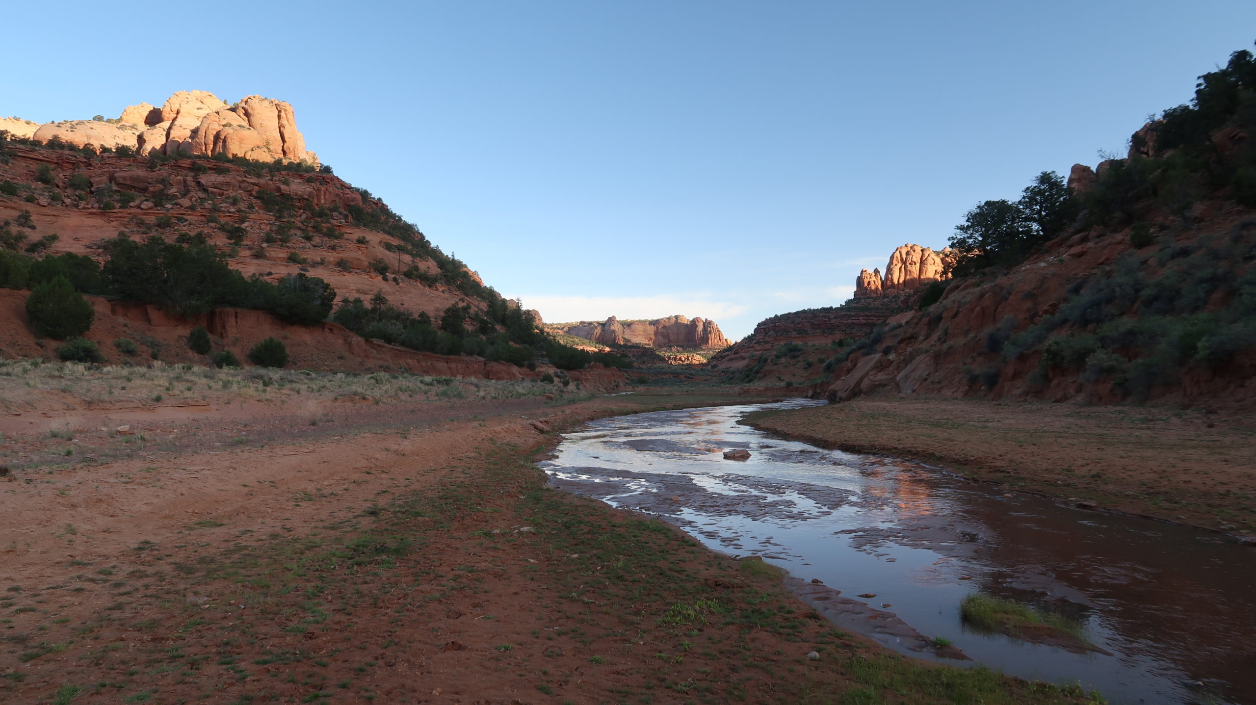
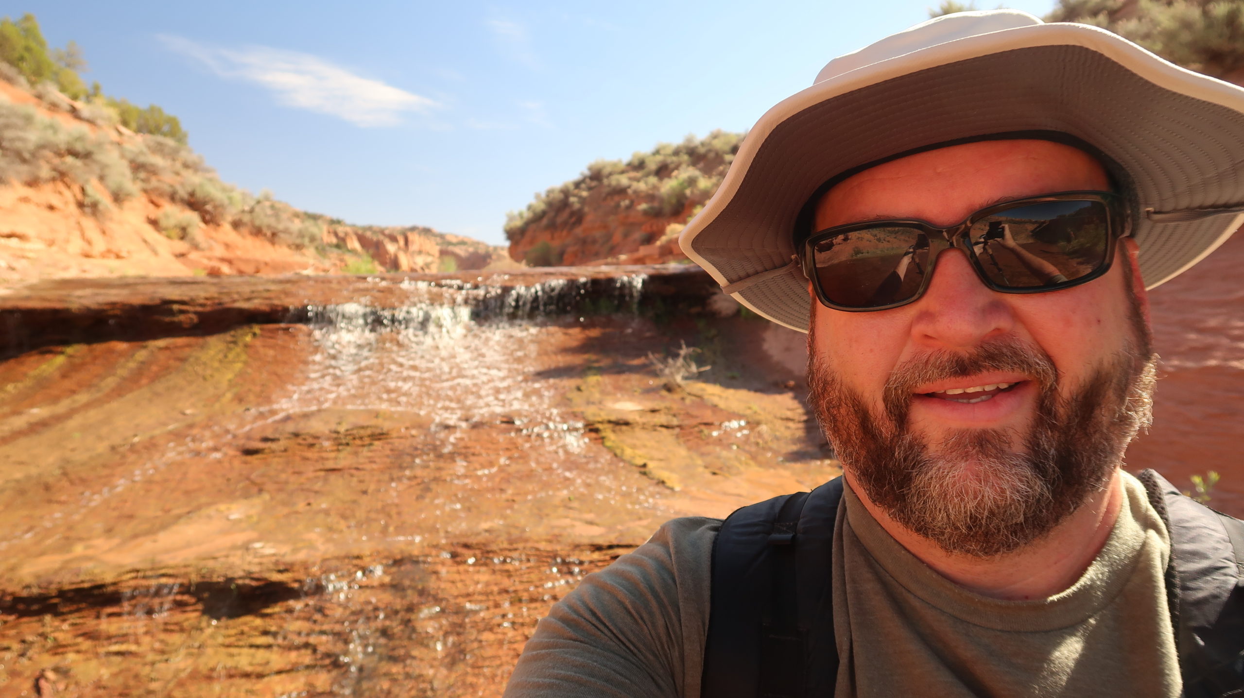
As the sun came up for us, the canyon’s colors really showed and we got our first glimpse of the stream running through the canyon. We finally get down the sandy last bit of the descent and reach the first water crossing at the first junction. Stay left here instead of continuing straight/right and follow the water.
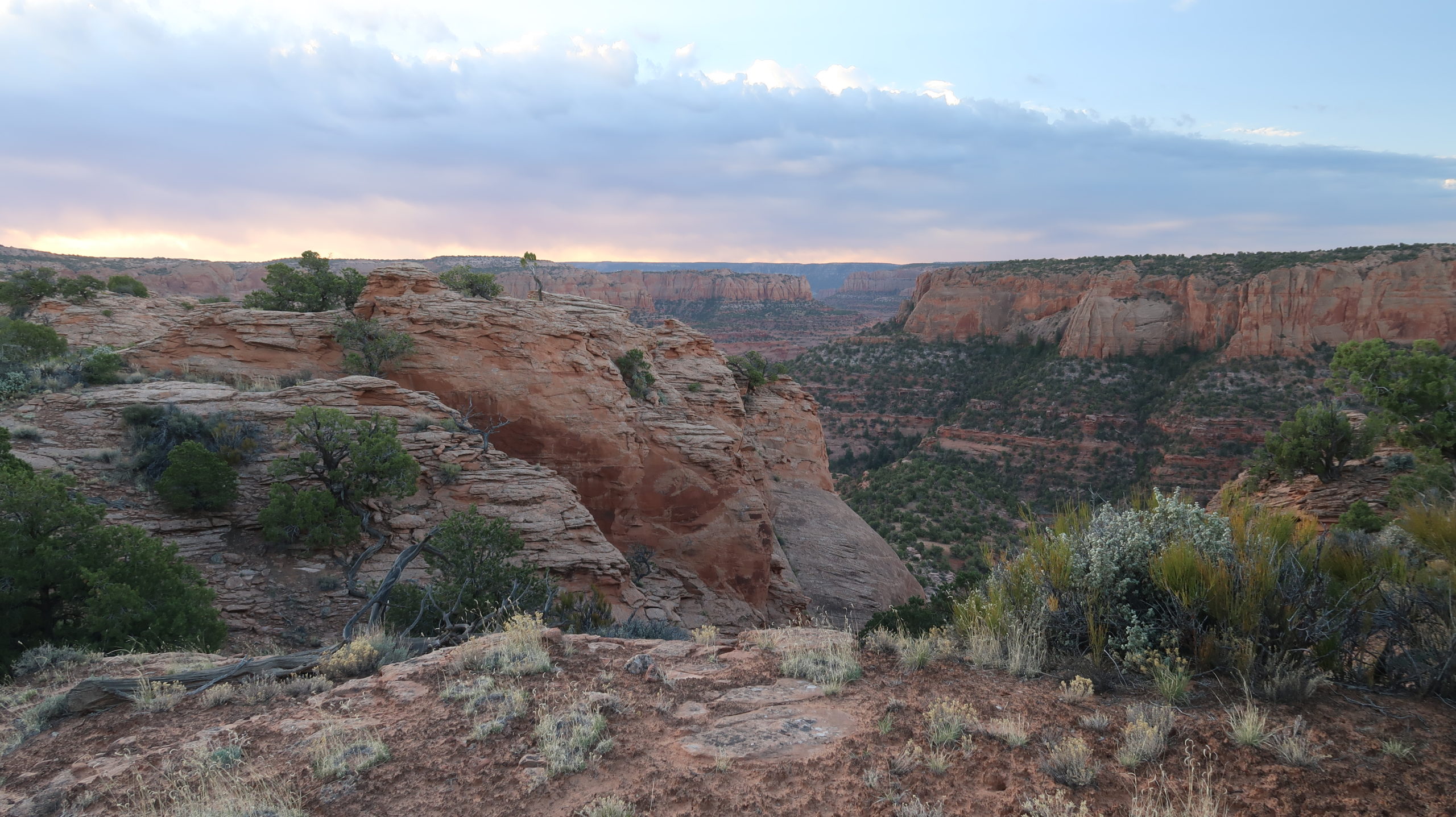
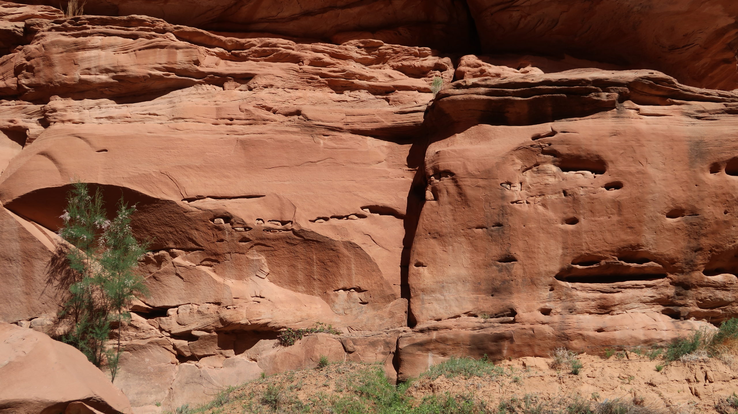
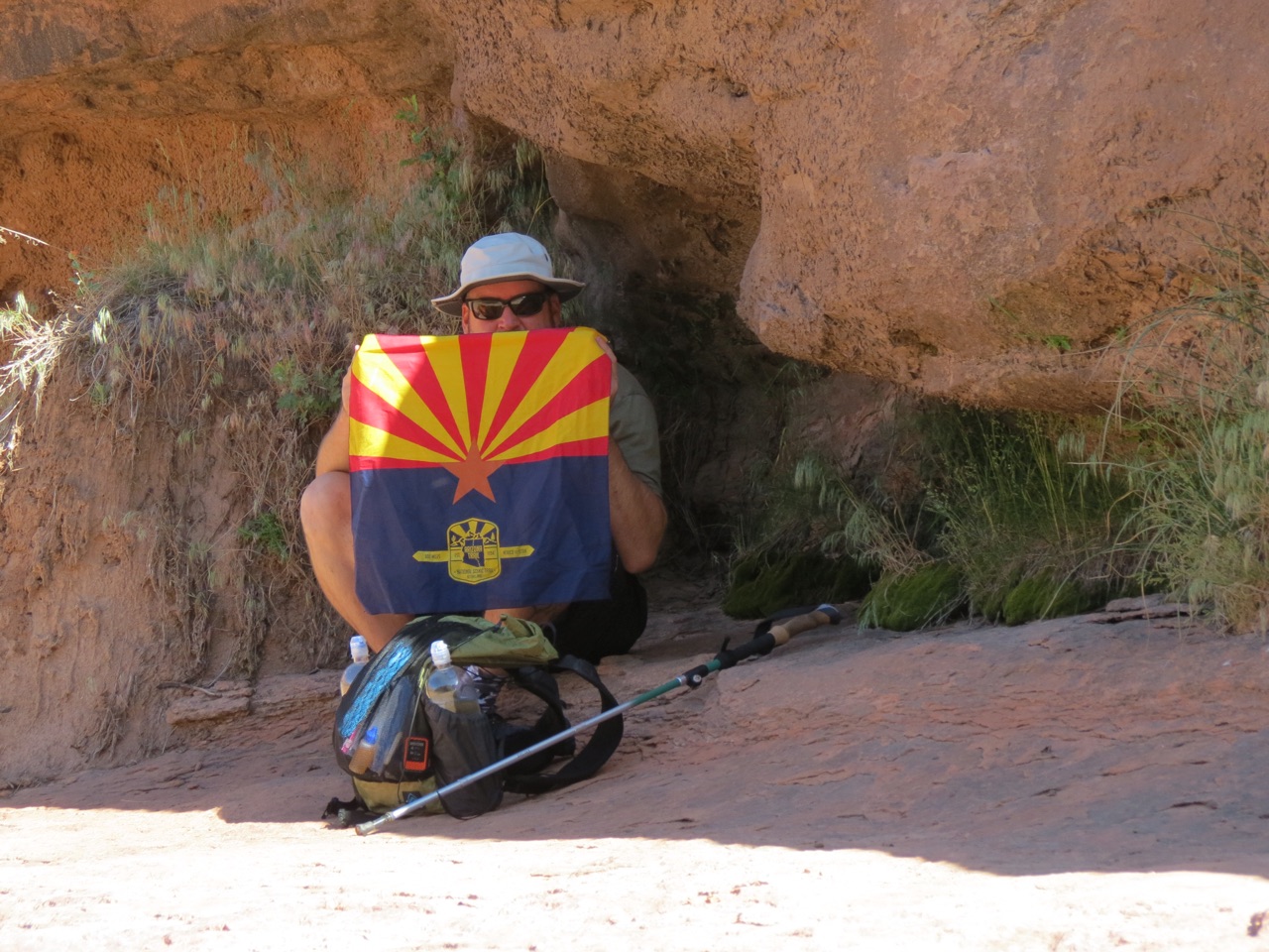
All different shapes of rock formations are here at this junction of the valleys. It’s not the tallest canyon, but it’s beautiful.
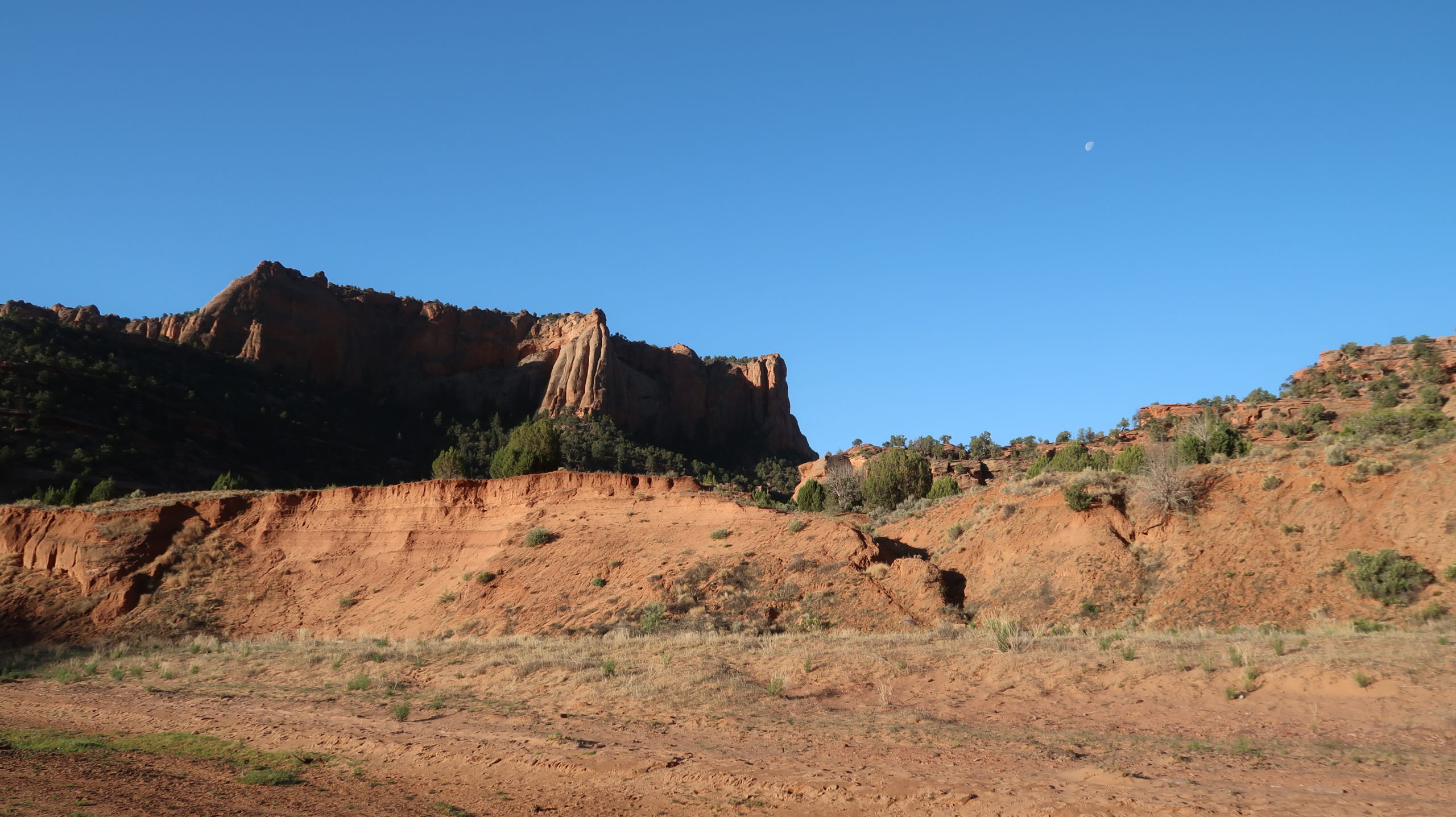
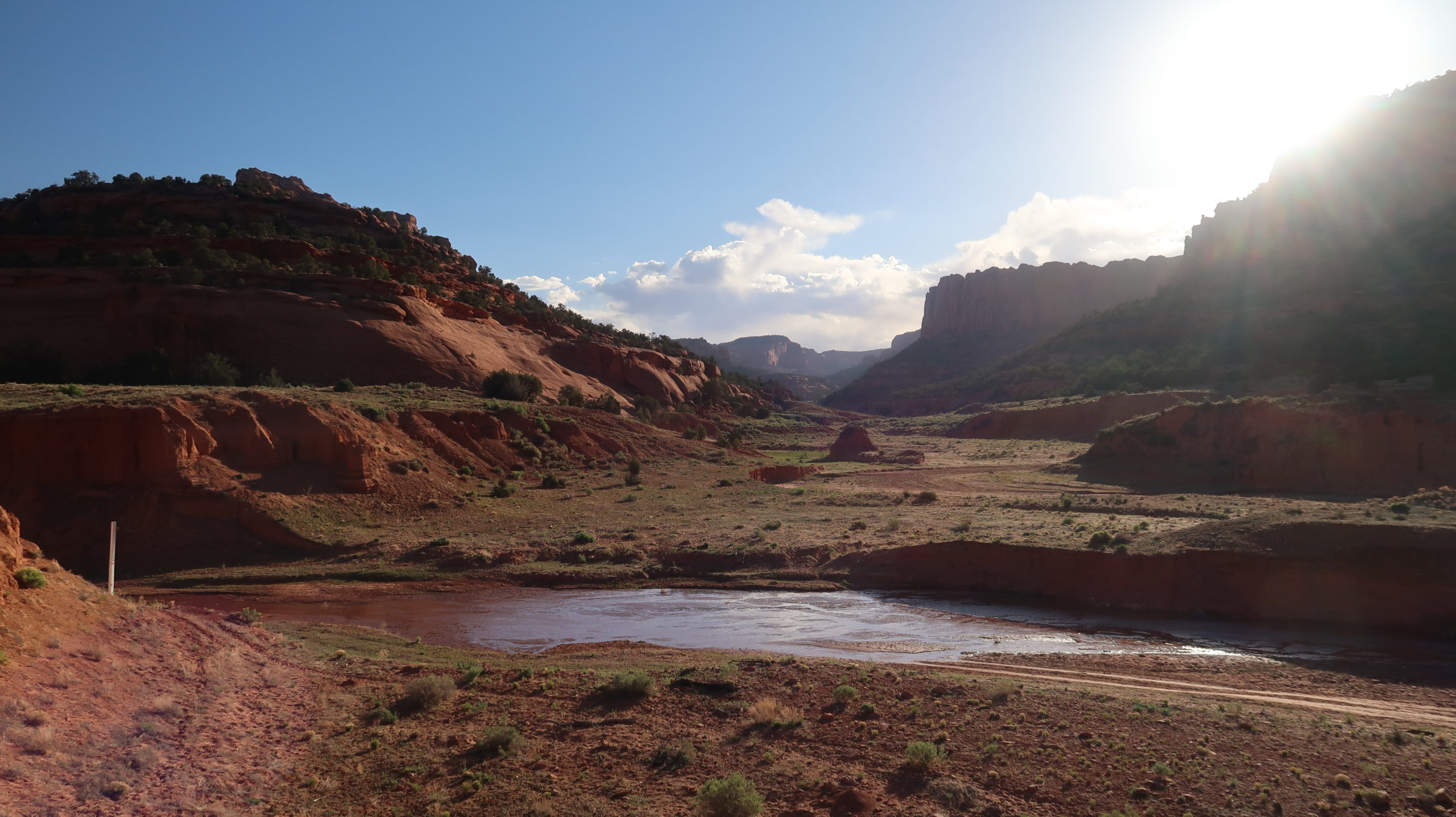
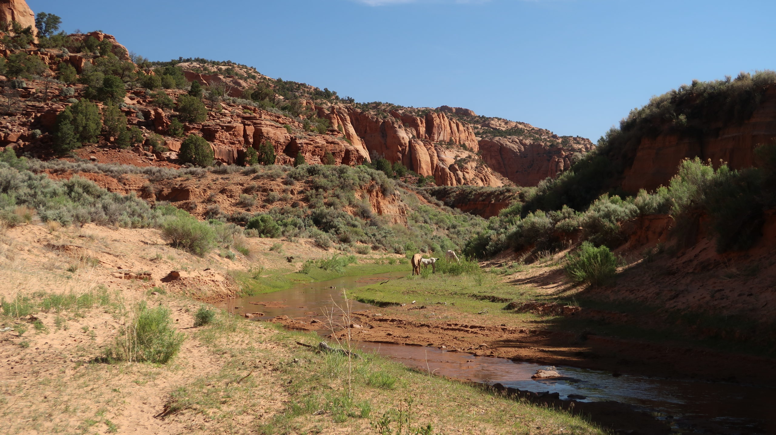
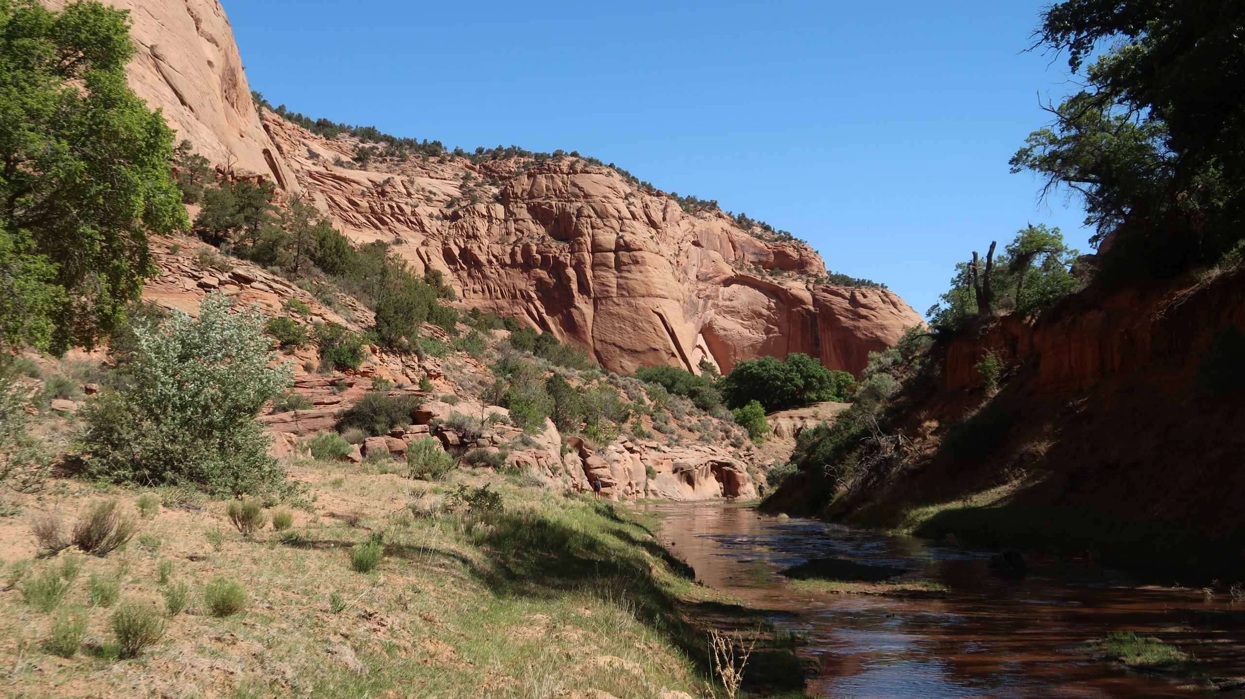
Now it’s time to grind out miles. The canyon feels flat but has a very unnoticeable uphill grade that doesn’t even count as a climb. You’ll stay in this left canyon all the way to the ruins now, so you can really look around and enjoy the scenery without worrying about missing a turn.
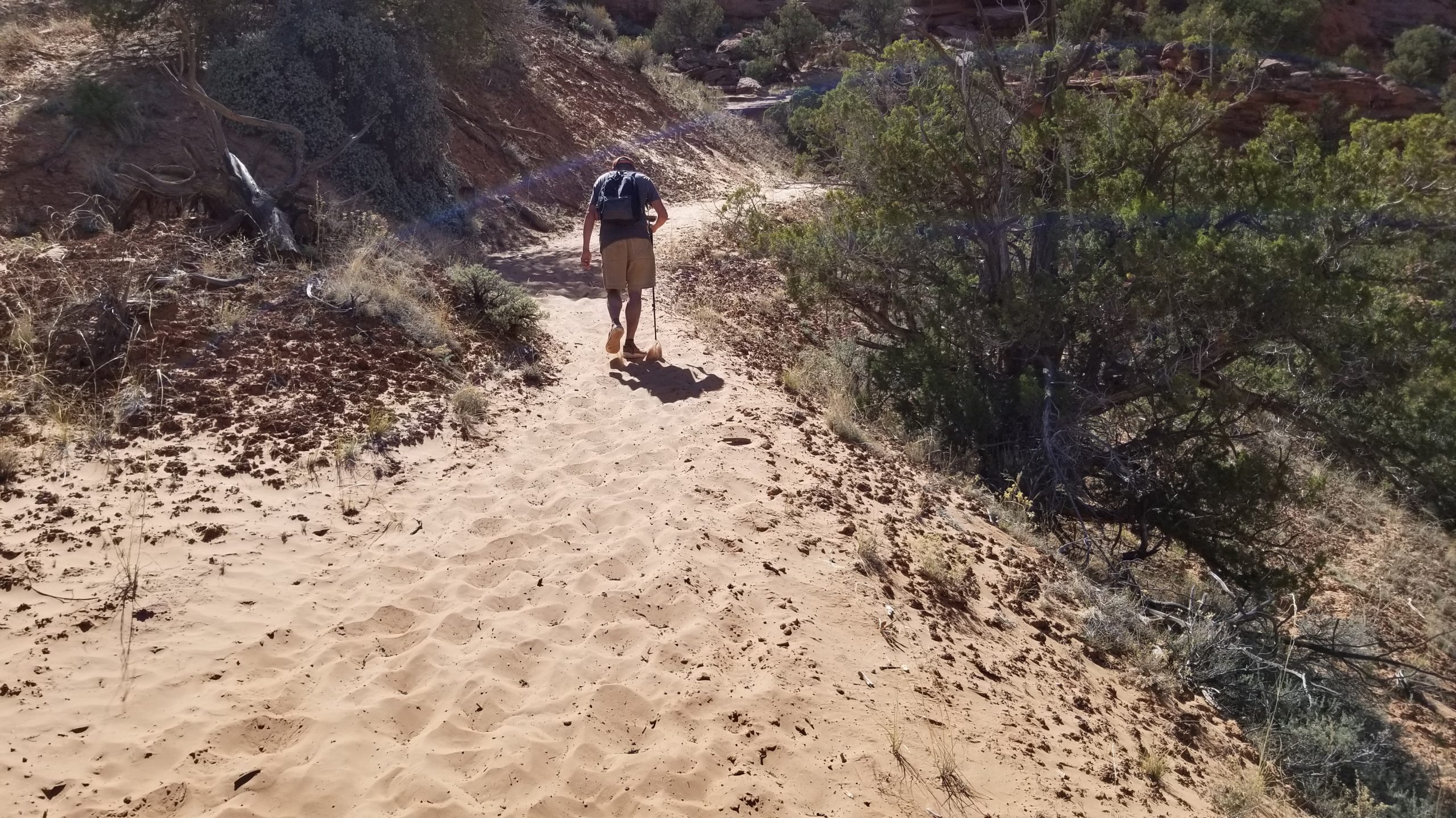
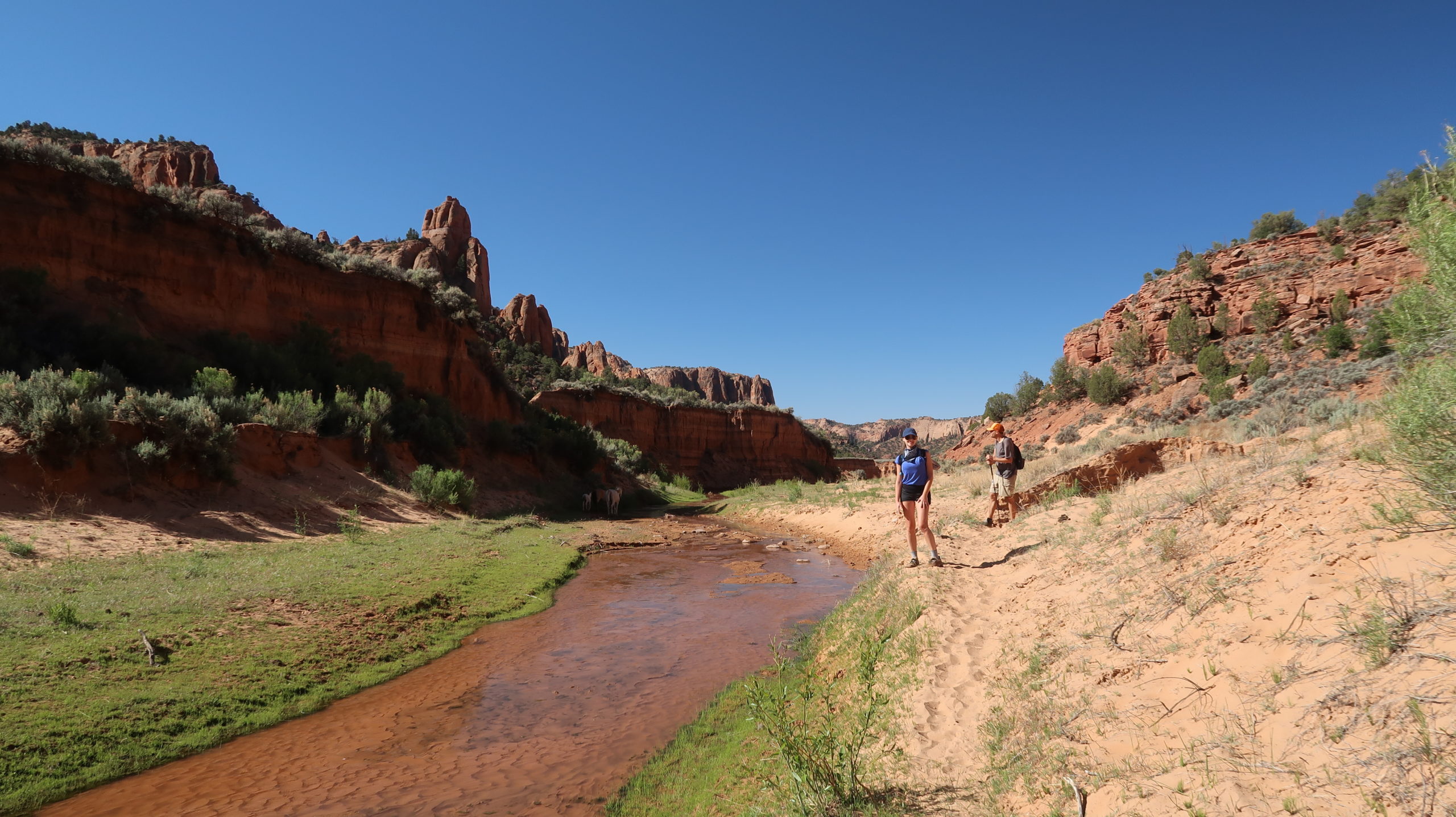
You’ll cross the stream at least a couple dozen times here, so don’t bother with separate water shoes or you’ll hold up the hike too long. Just wear shoes that are comfortable for hiking in sand and on some rock but that can get wet and stay wet. Just deal with it. Rumors say you can’t drink this water because it is too contaminated with livestock. Big deal. Bring a good filter like a Sawyer or other brand you prefer that can take out microbes as small as bacteria and you’re good to go. I drank over 2 gallons filtered from this stream and I’m here to say that it’s good to go. It was actually rather clear but does have some silt in it and the taste was quite good.
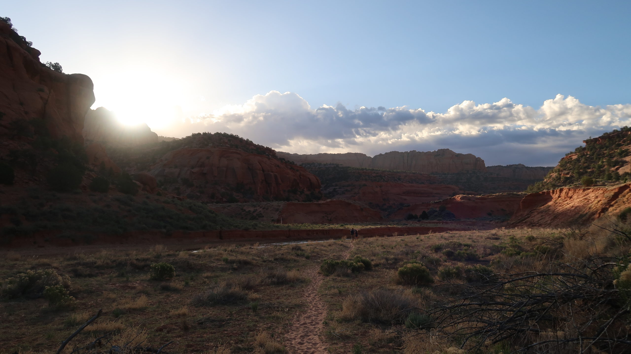
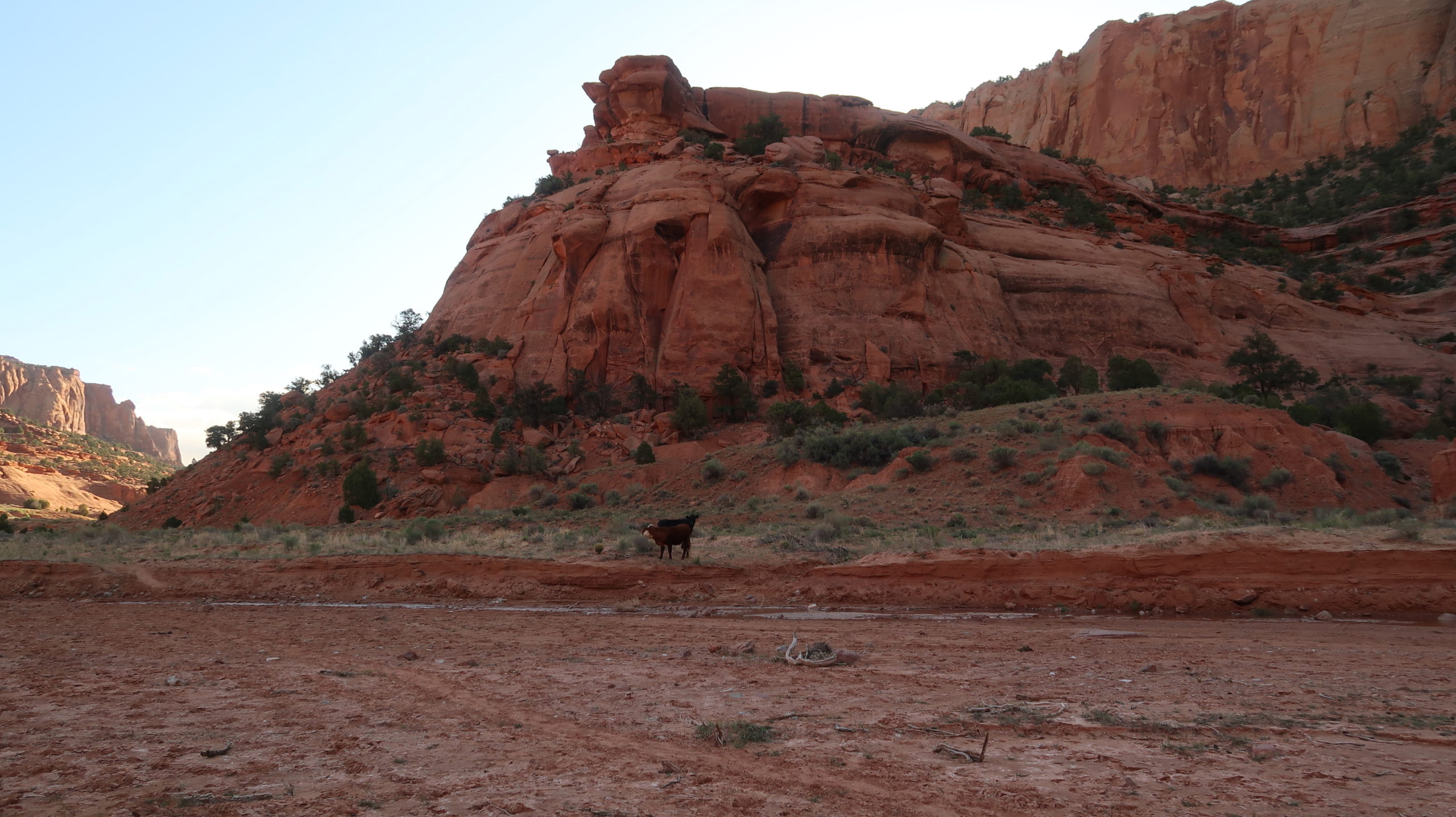
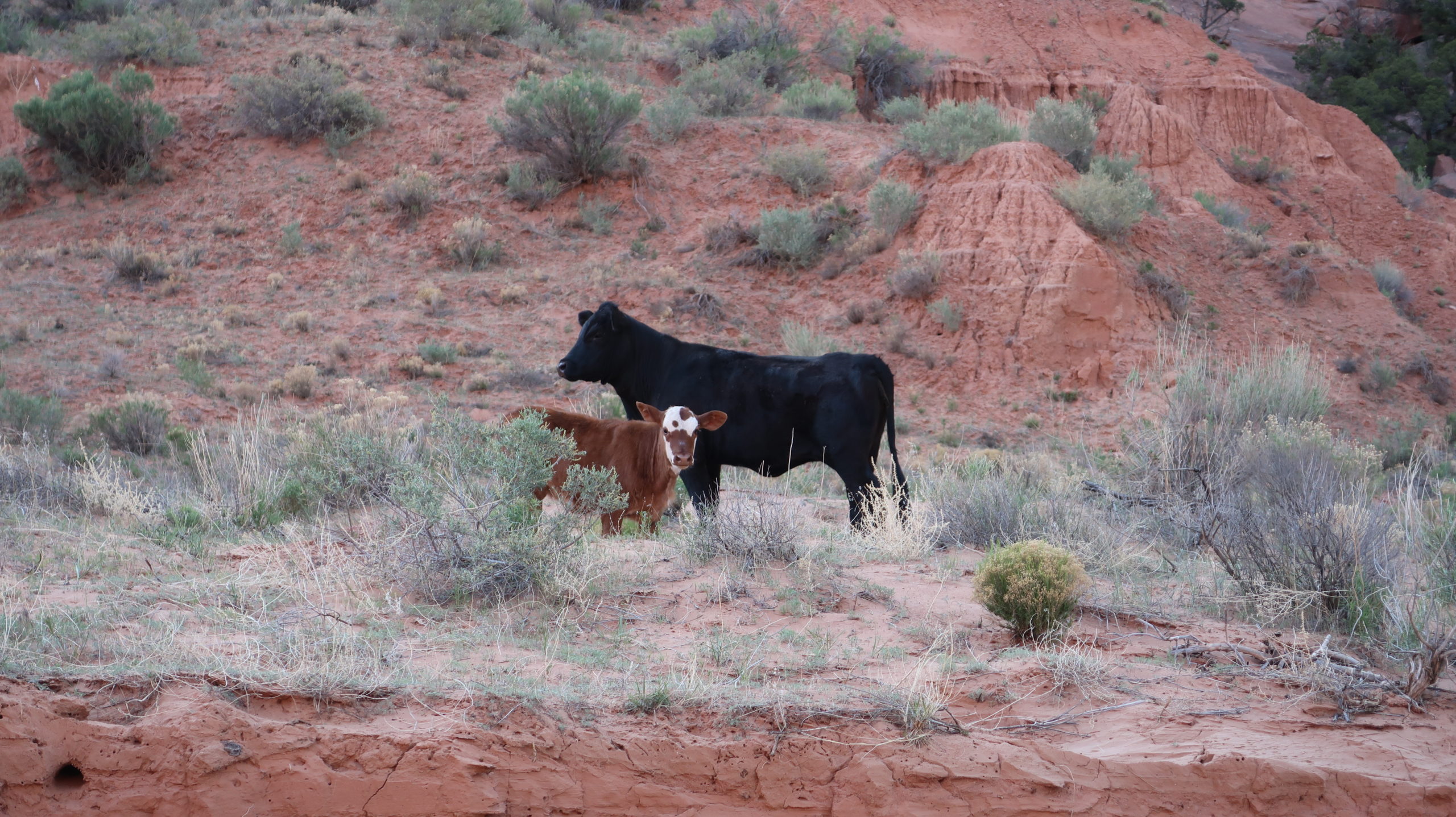
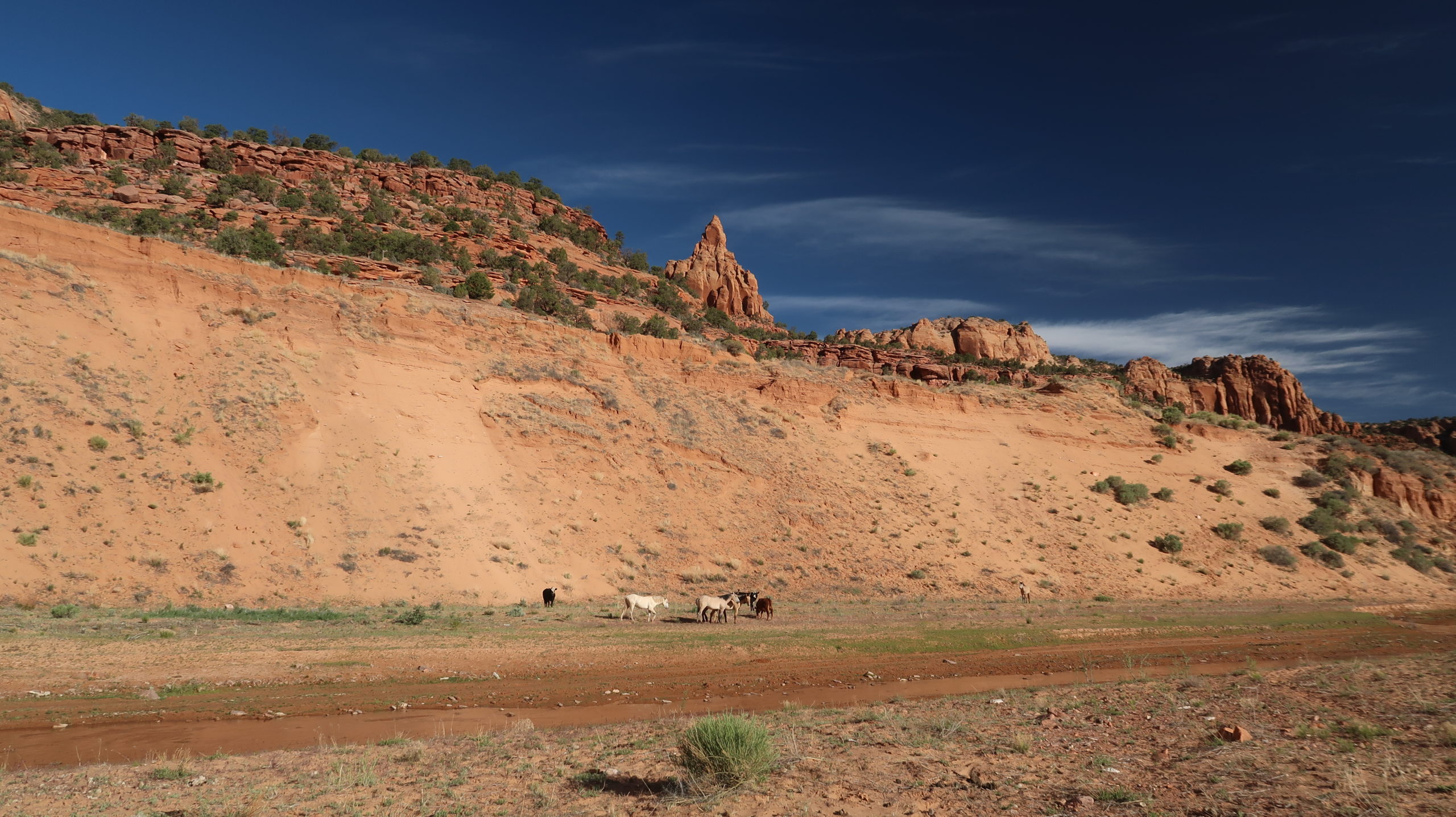
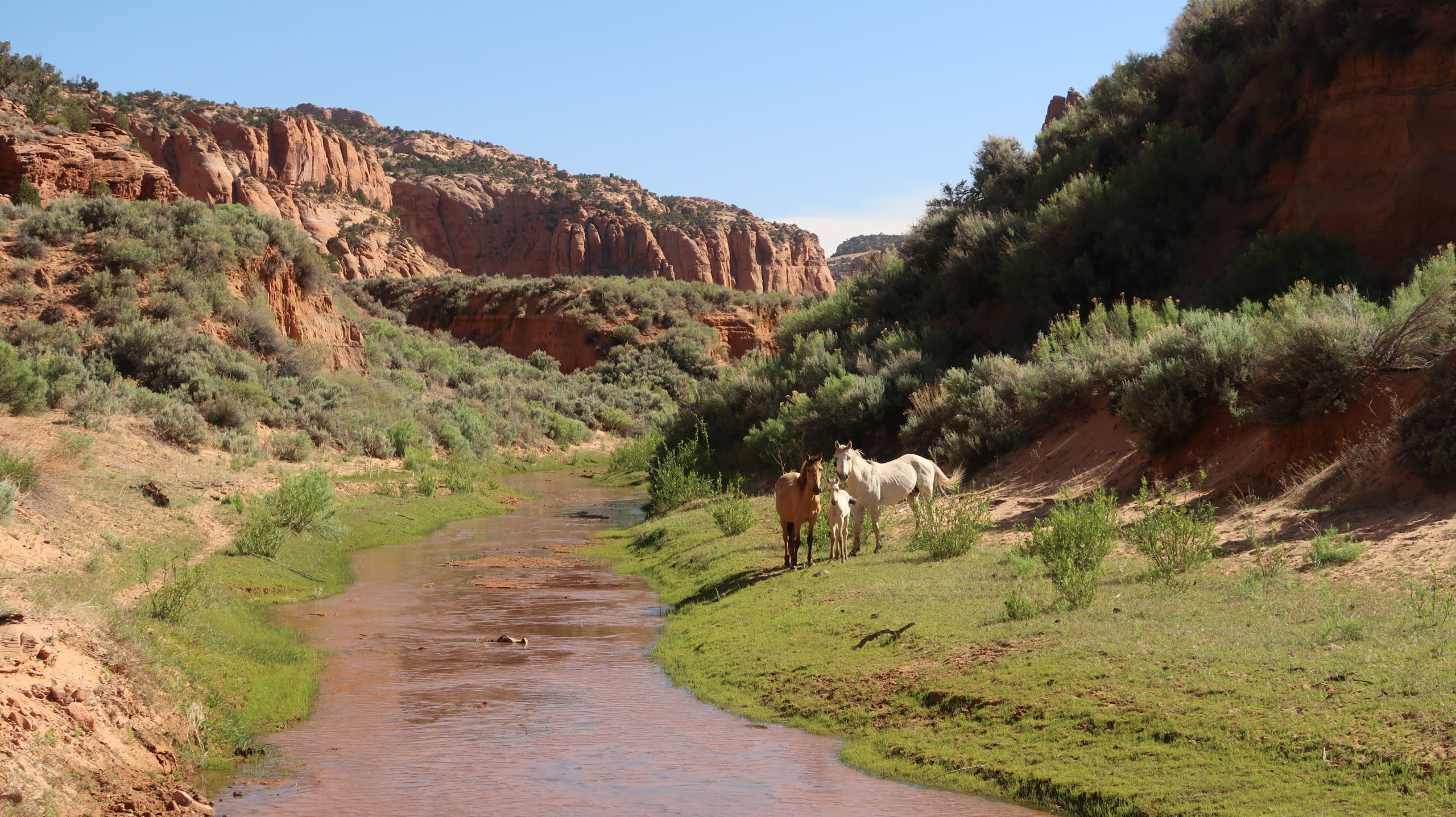
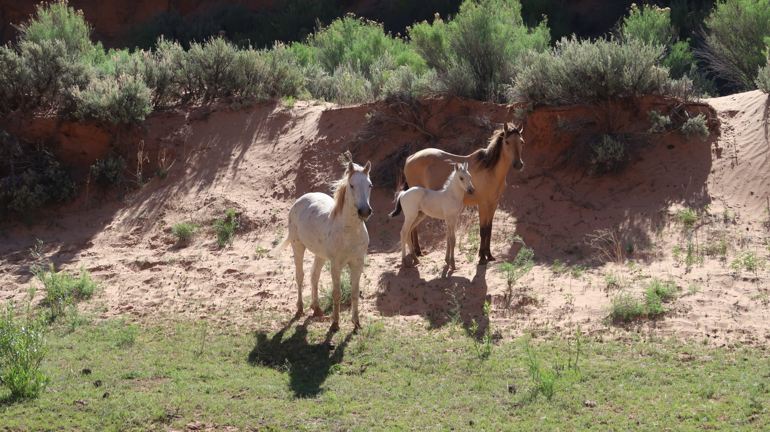
At one point about halfway in, we ran across a family of feral horses (not true wild horses, but left behind by previous people), some cows, but mainly it was just canyon wall scenery and splashing through the cool water. Enjoy this stroll.
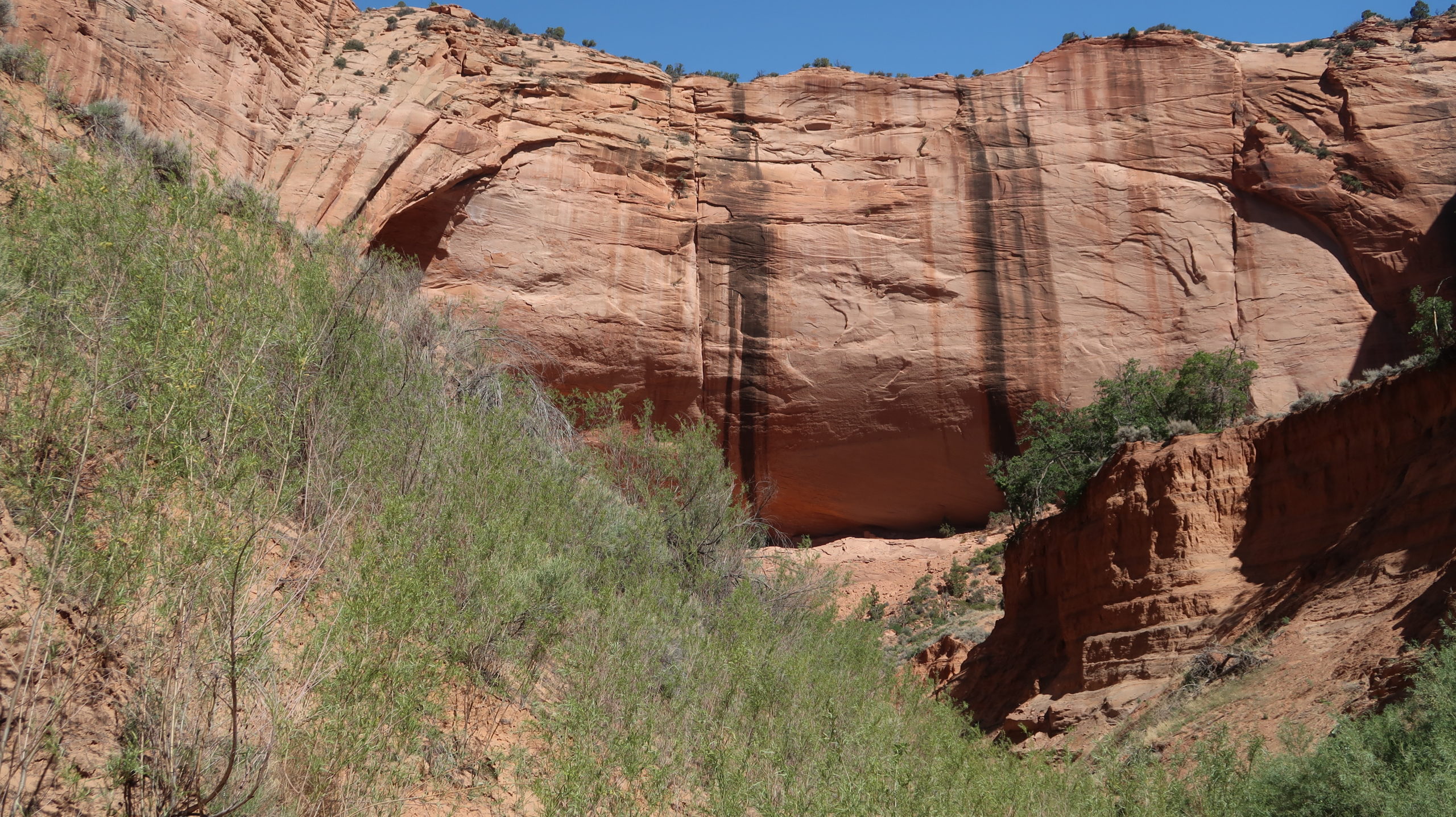
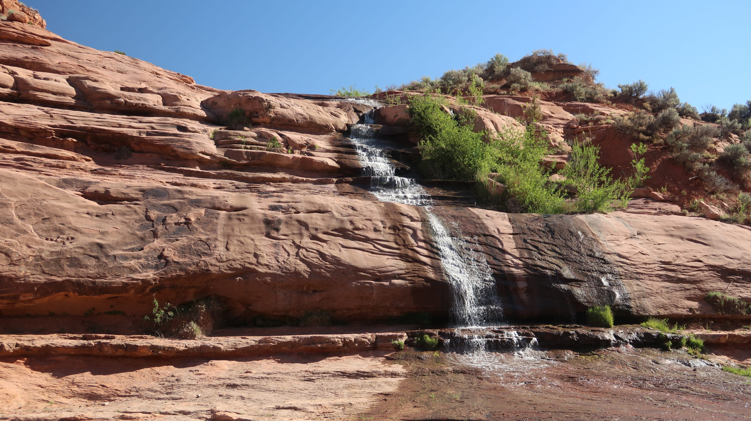
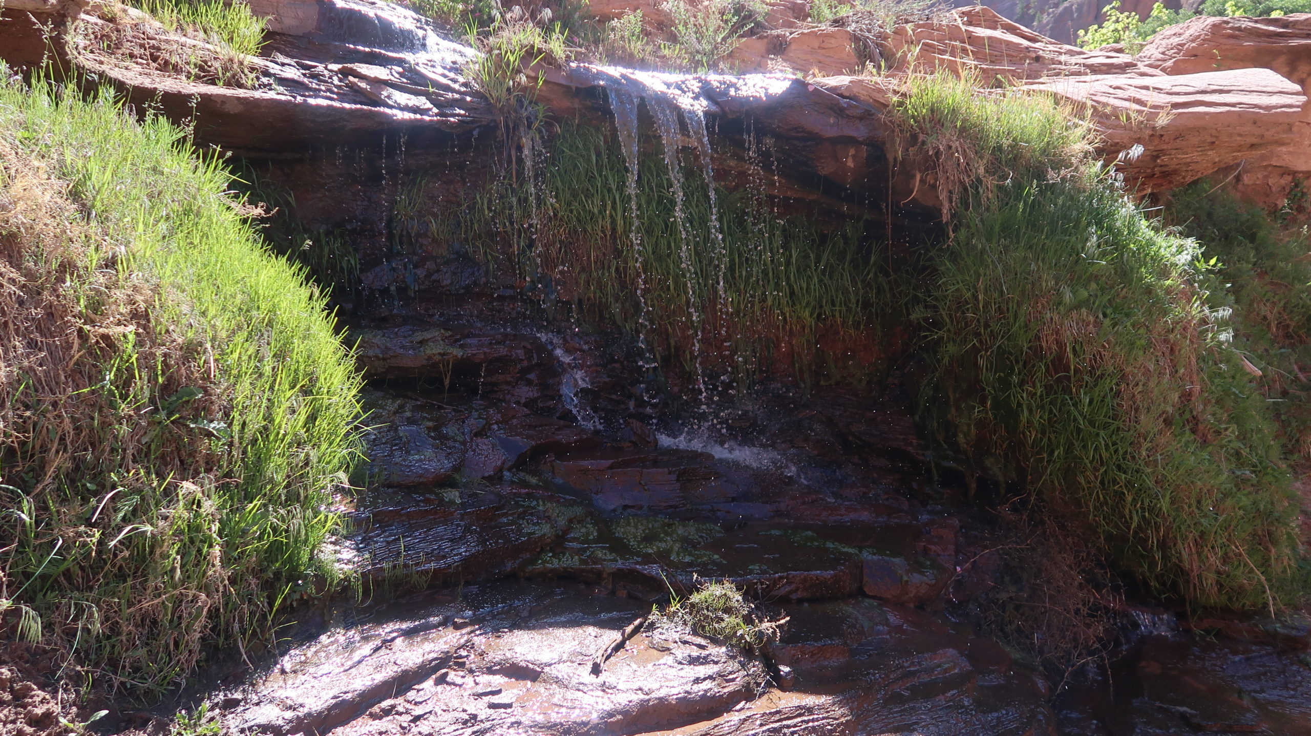
There are a couple tributary streams that may be draining water into the main canyon. Enjoy these spots and filter some water and take a break. You’re getting close to the ruins.
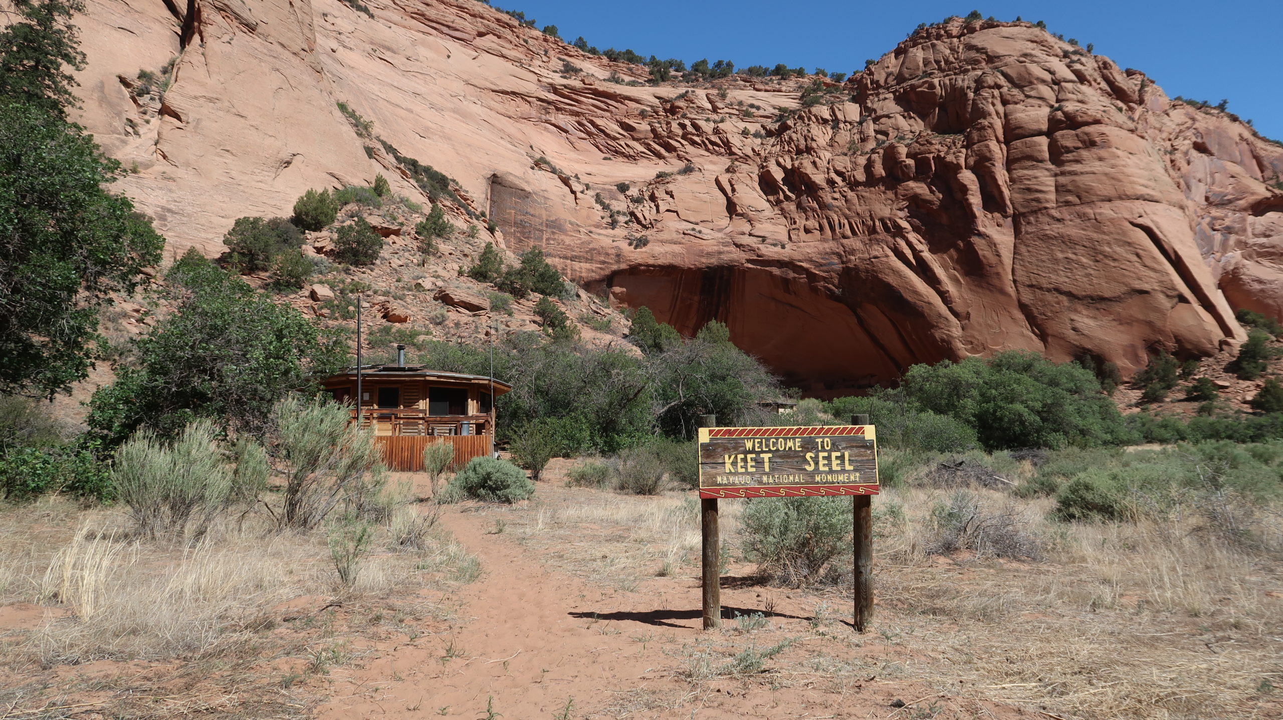
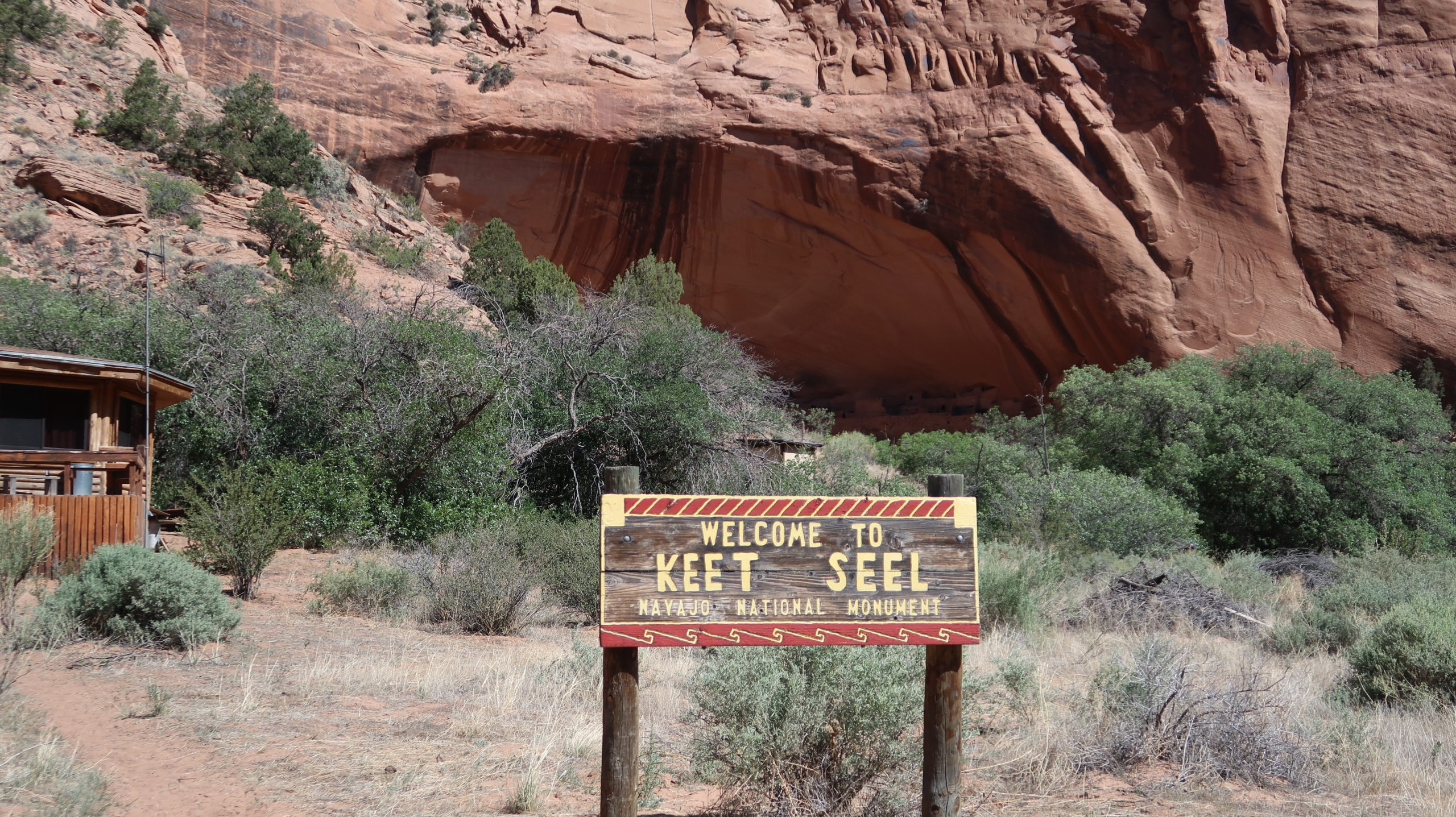
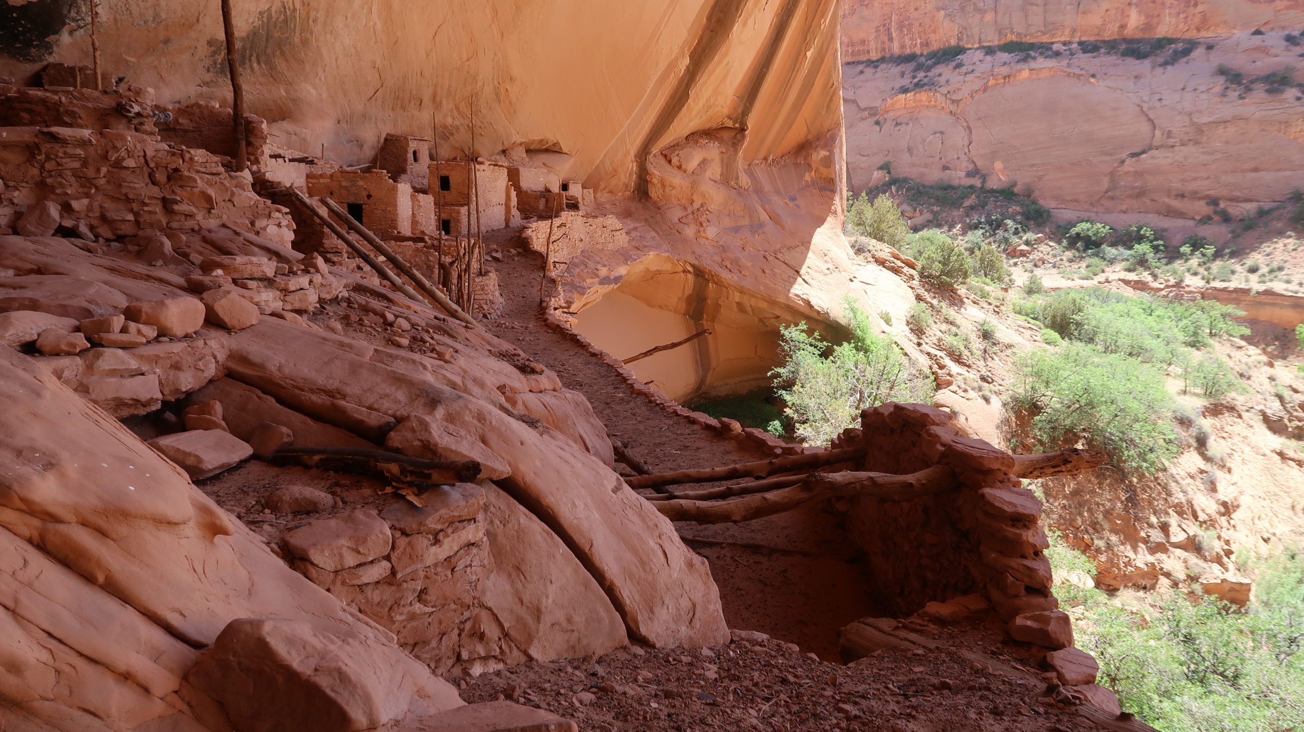
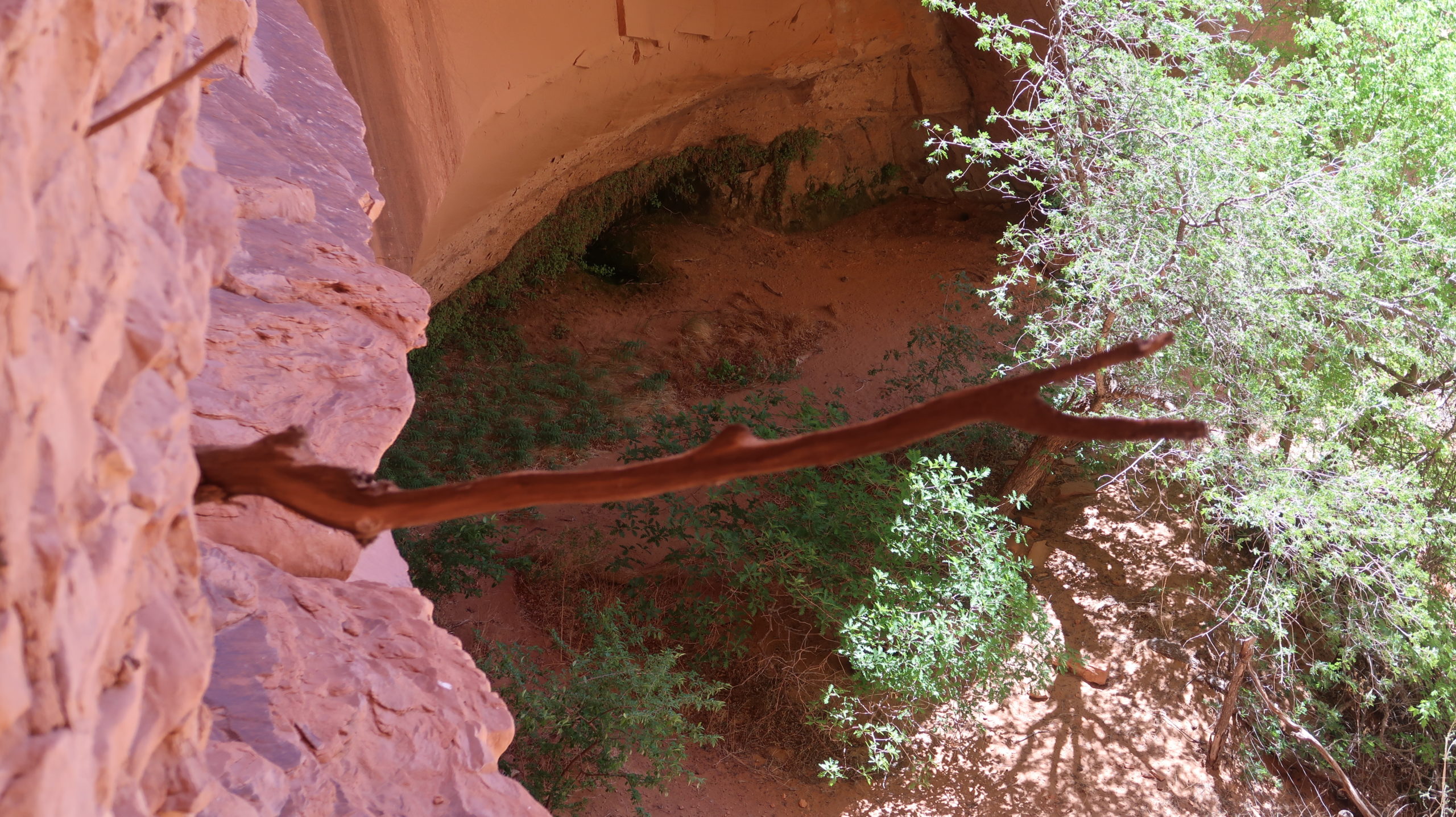
As you get close to the end, the biome changes and there’s more grasses and you start seeing some trees. The geology along the stream gets a little rockier but still easy to follow and walk on. All of a sudden you see the campground on your right and the hogan on your left. The Keet Seel sign is right after the hogan. There is a picnic table in the shade of some trees here. Get ready for the hike with dry socks and your small pack so you can bring water but are hands-free while you climb up the ladder to the ruins.
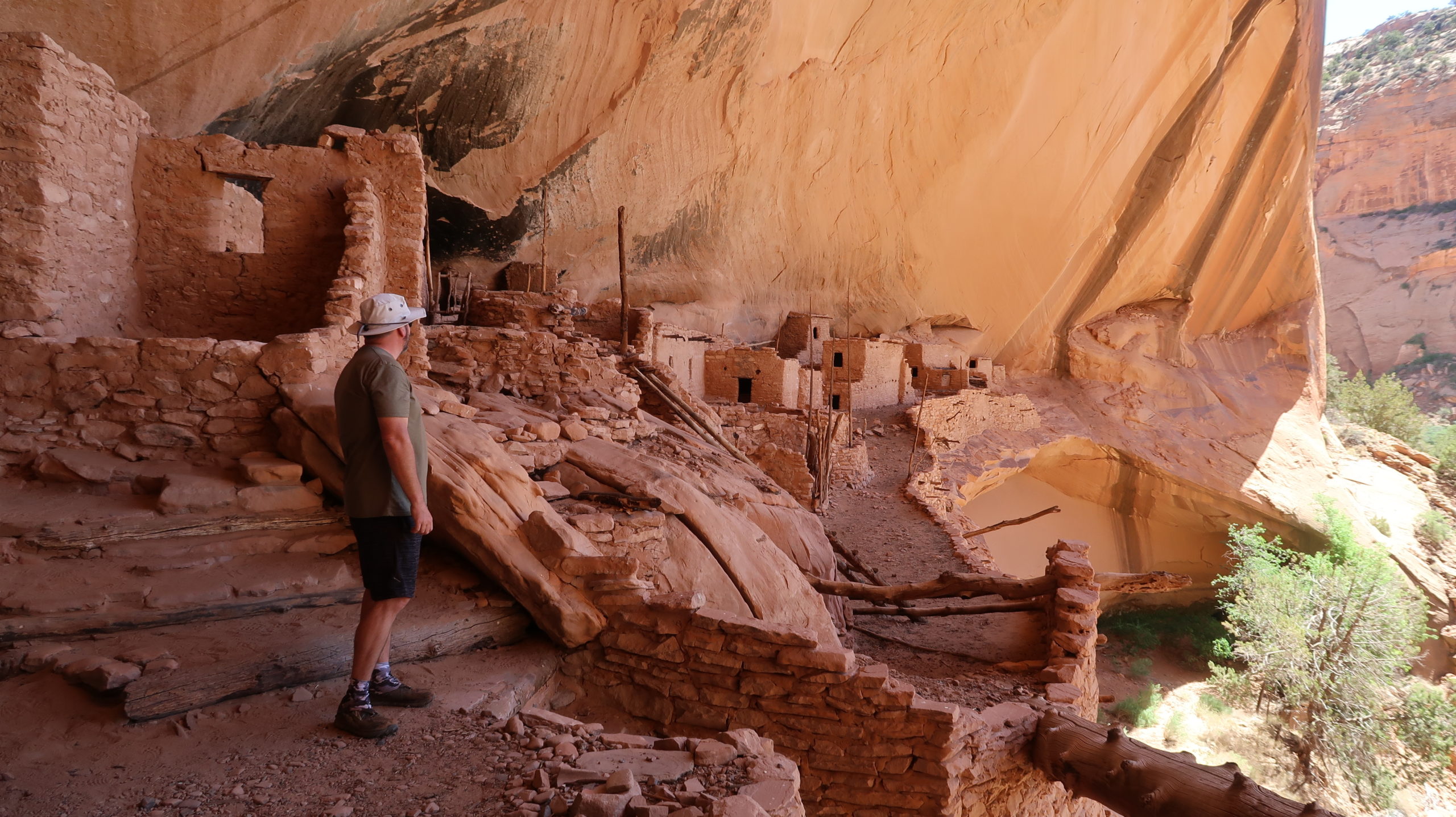
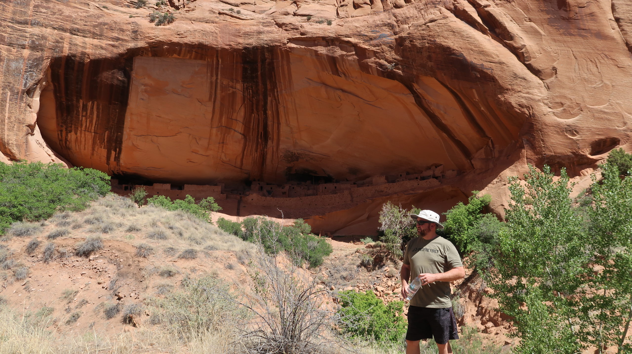
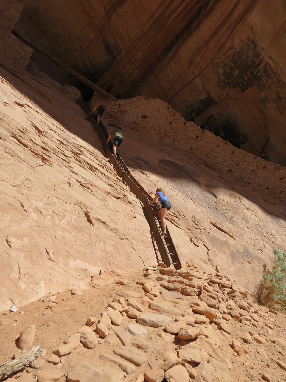
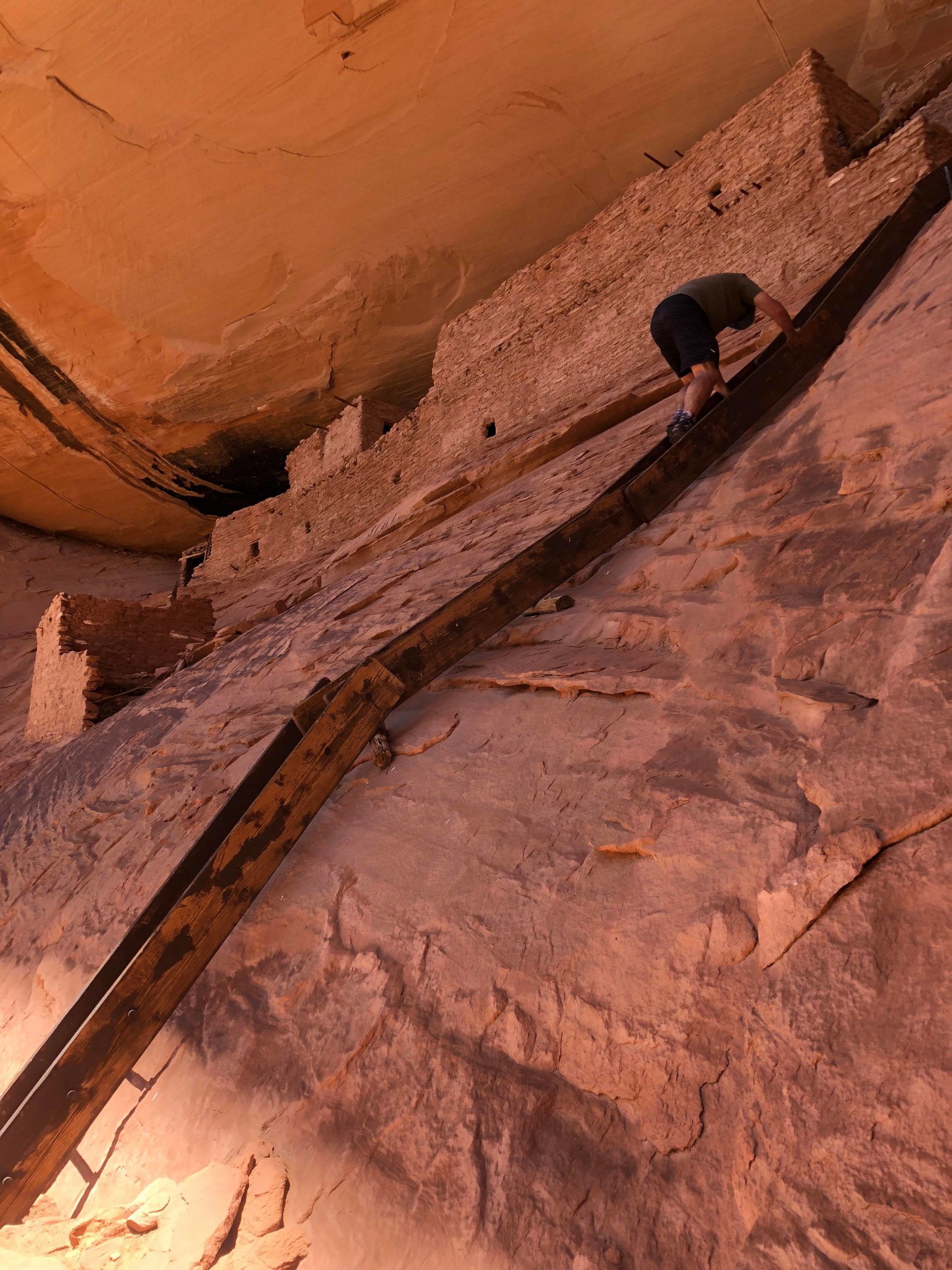
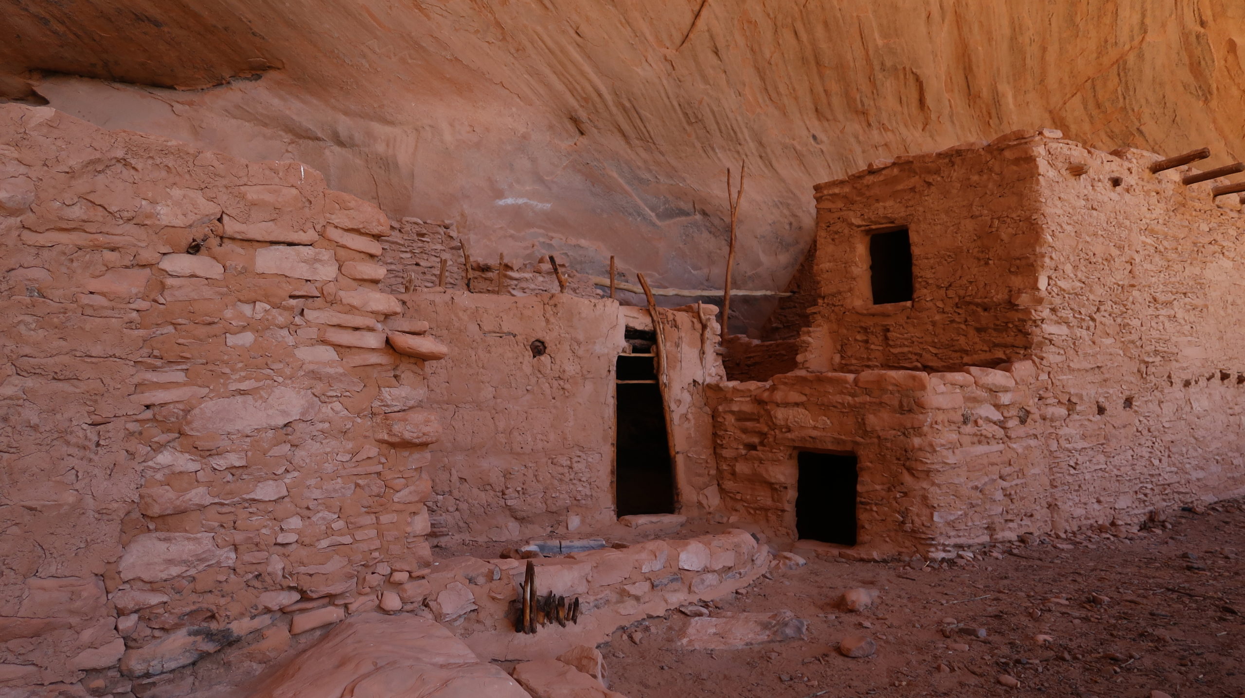
You’ve made it to the ruins. Take a break on the picnic table, make contact with the resident guide(s) and wait for them to start the tour. You may need to wait around to see if any other visitors show up, or if others are already there and waiting for you, then the guide will take a small group of about 6 people or so. The trail up is narrow and short, and you arrive at the ladder to ascend up to the alcove with the actual ruins.
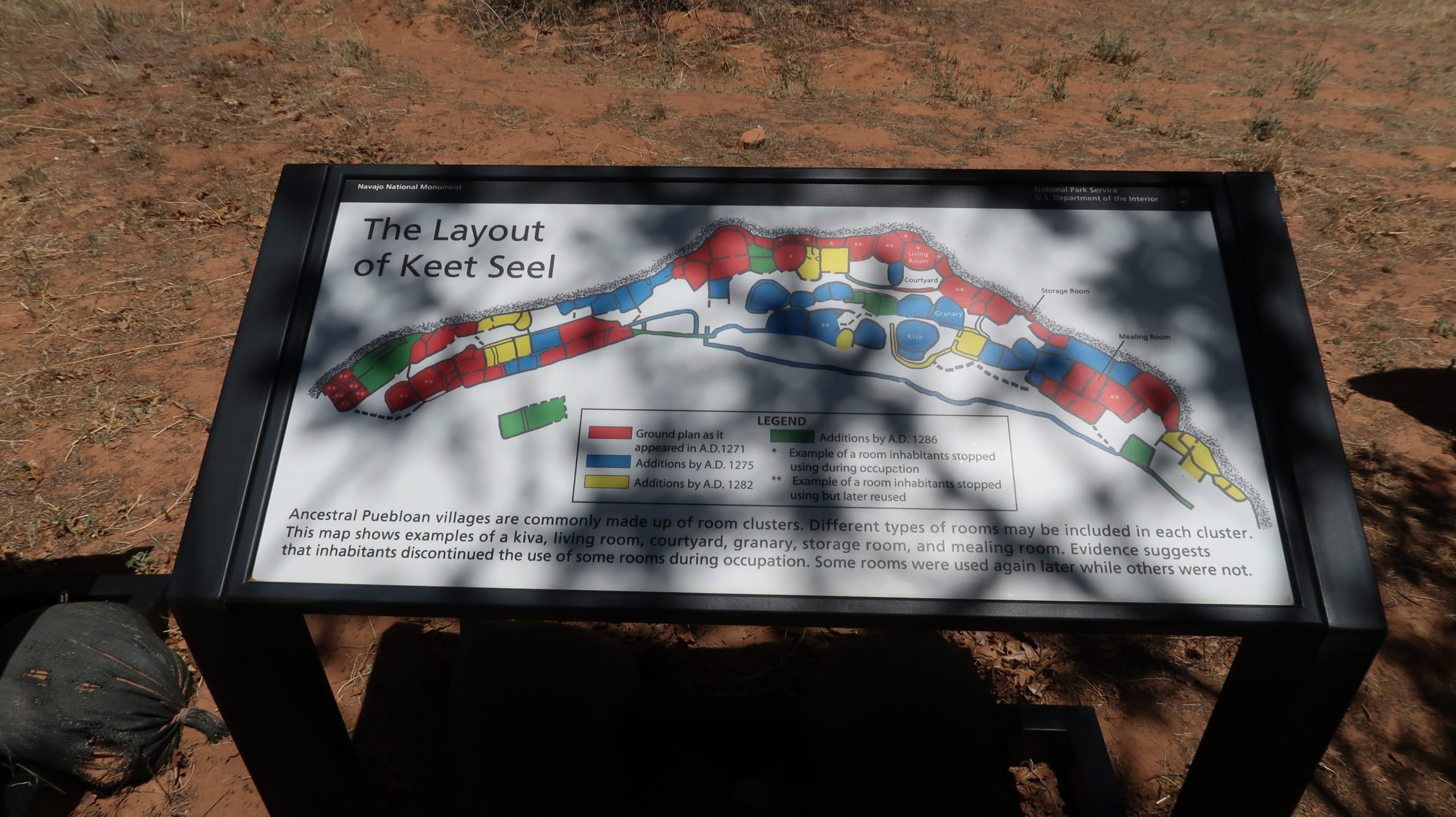
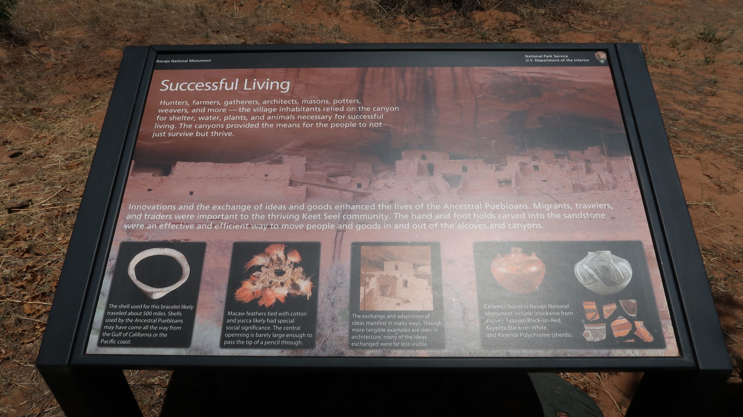
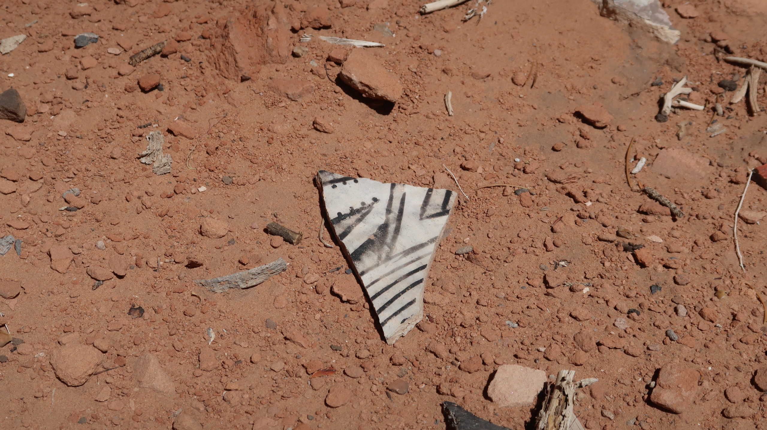
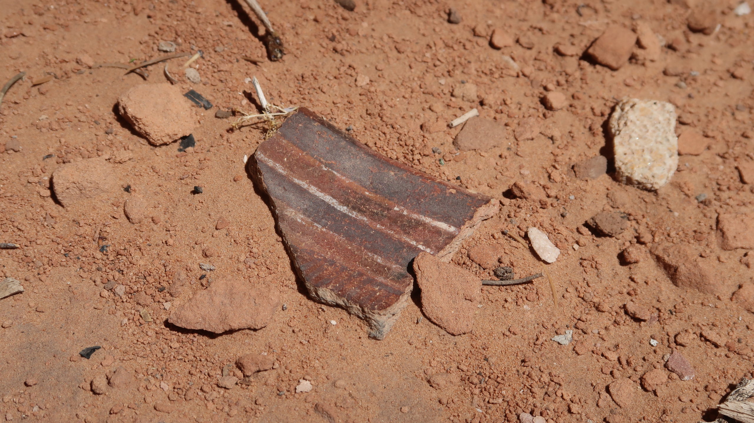
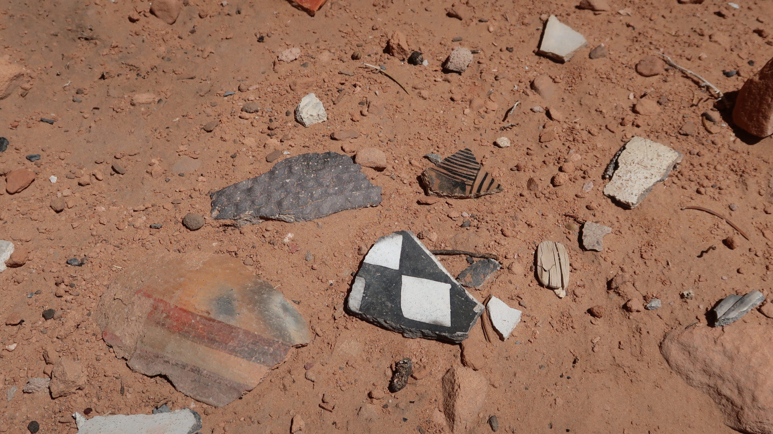
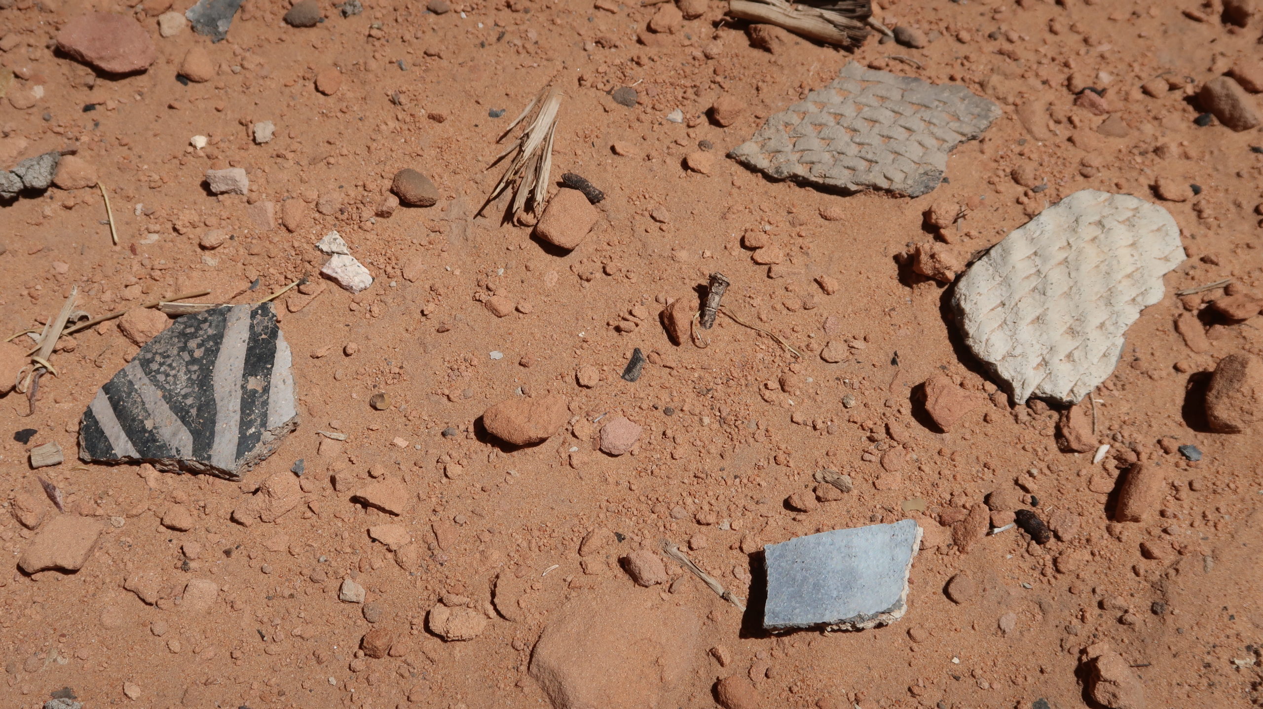
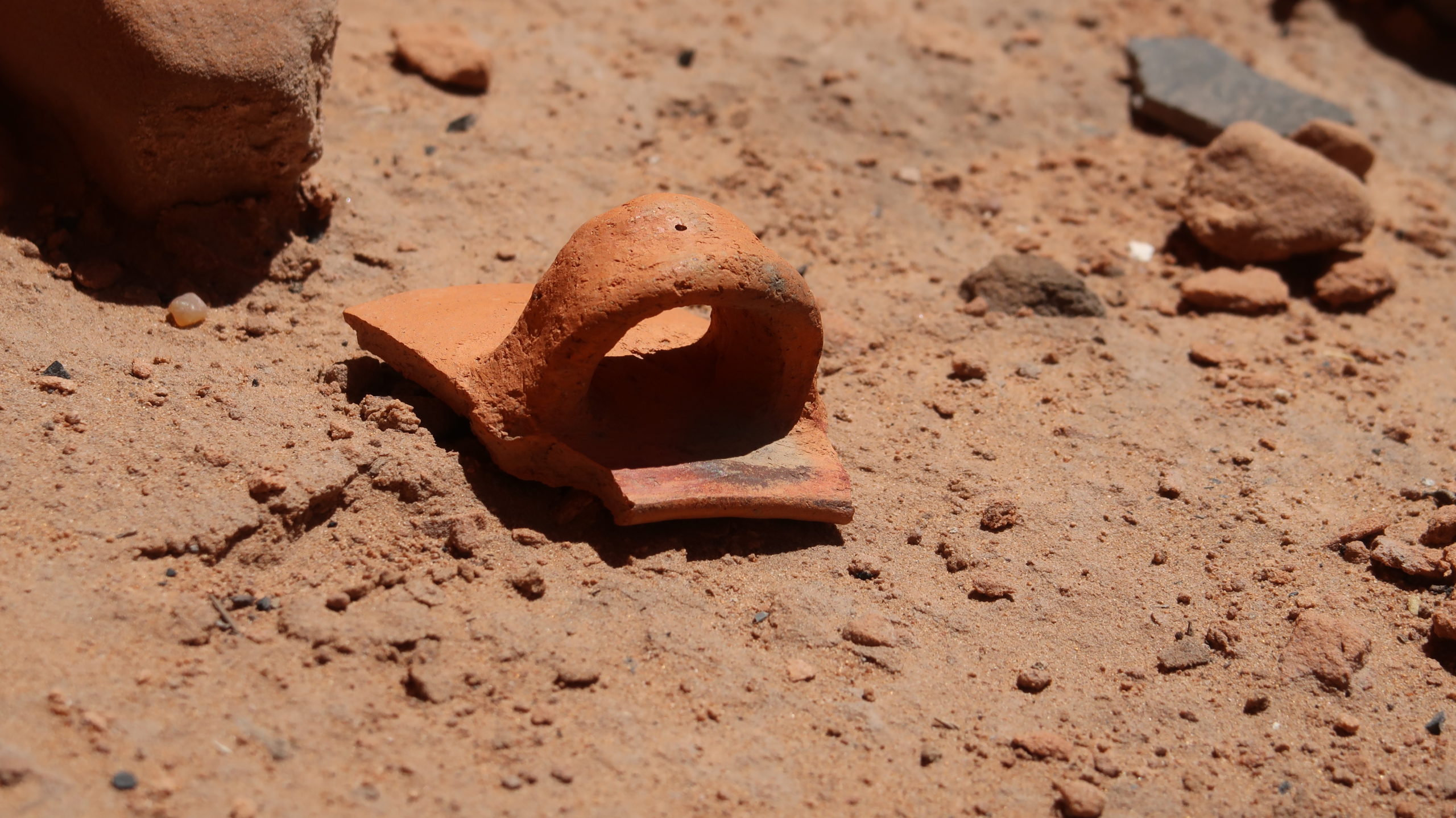
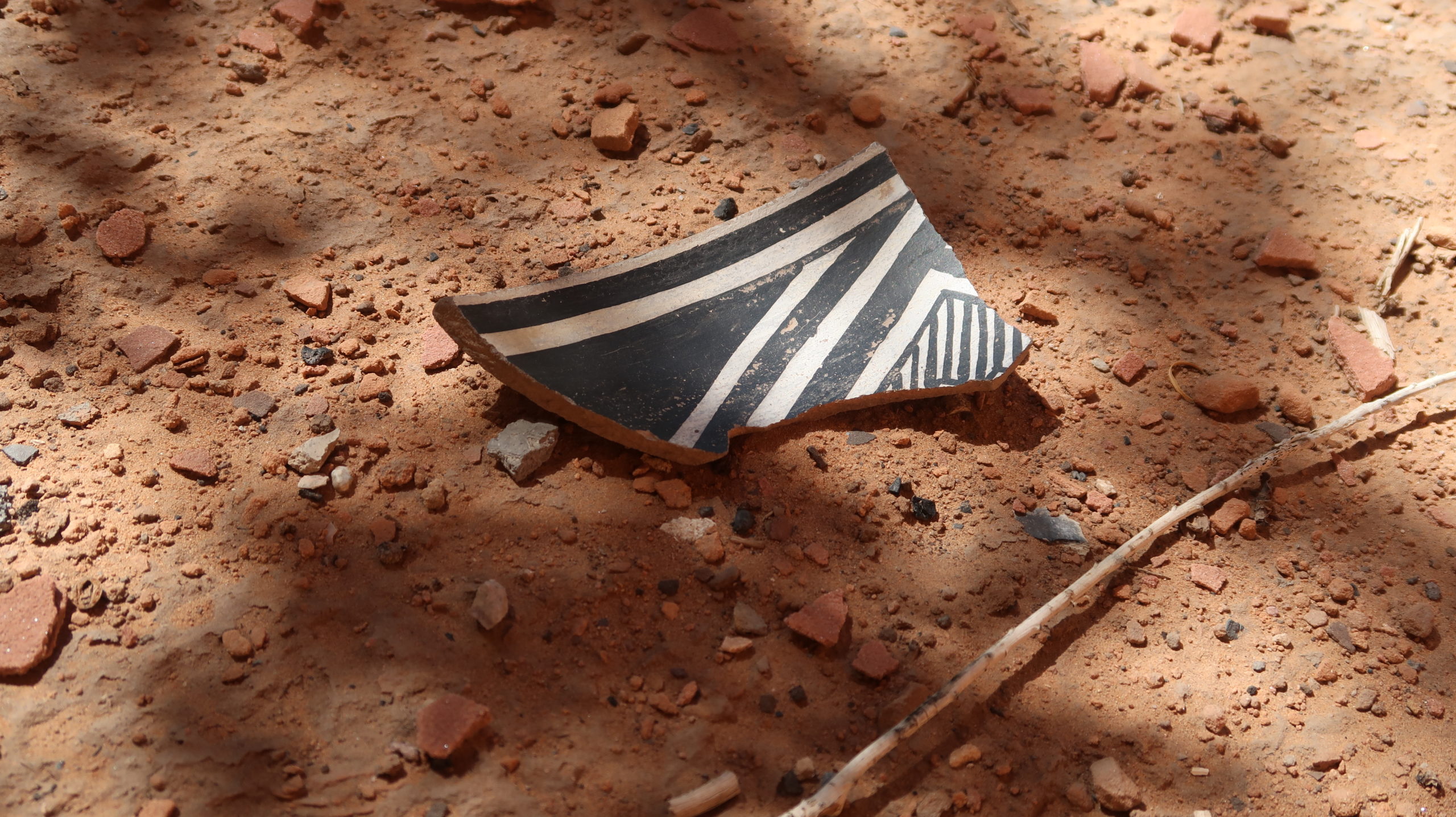
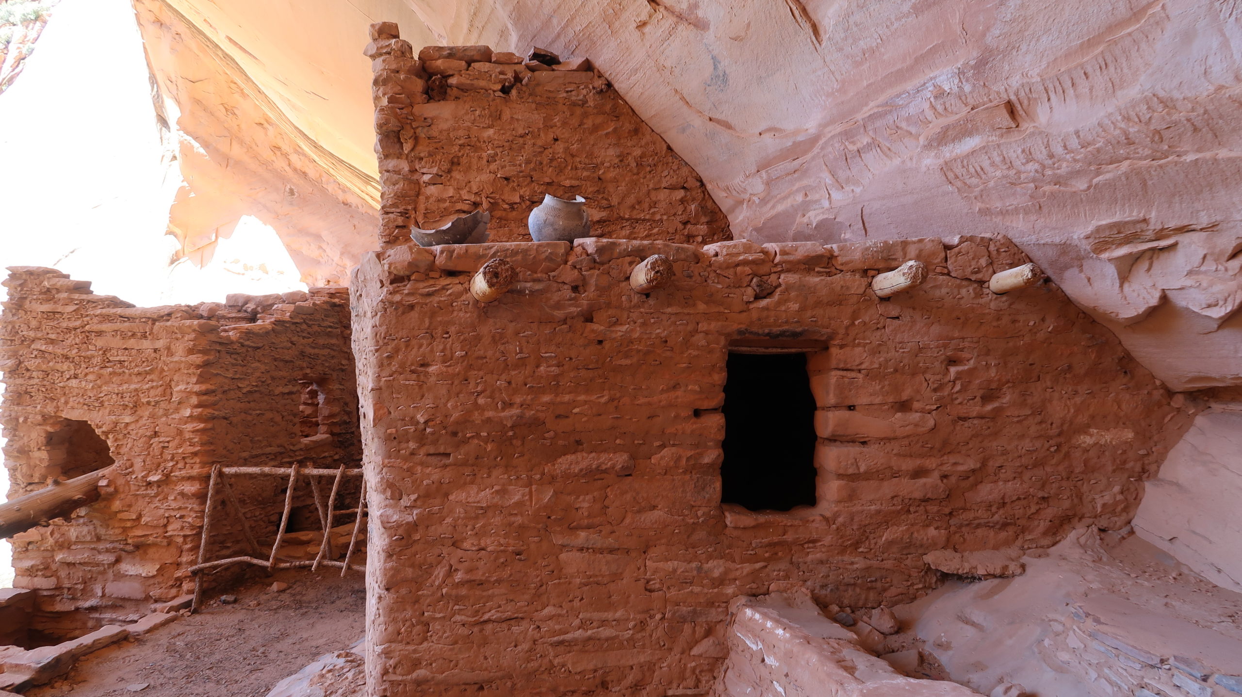
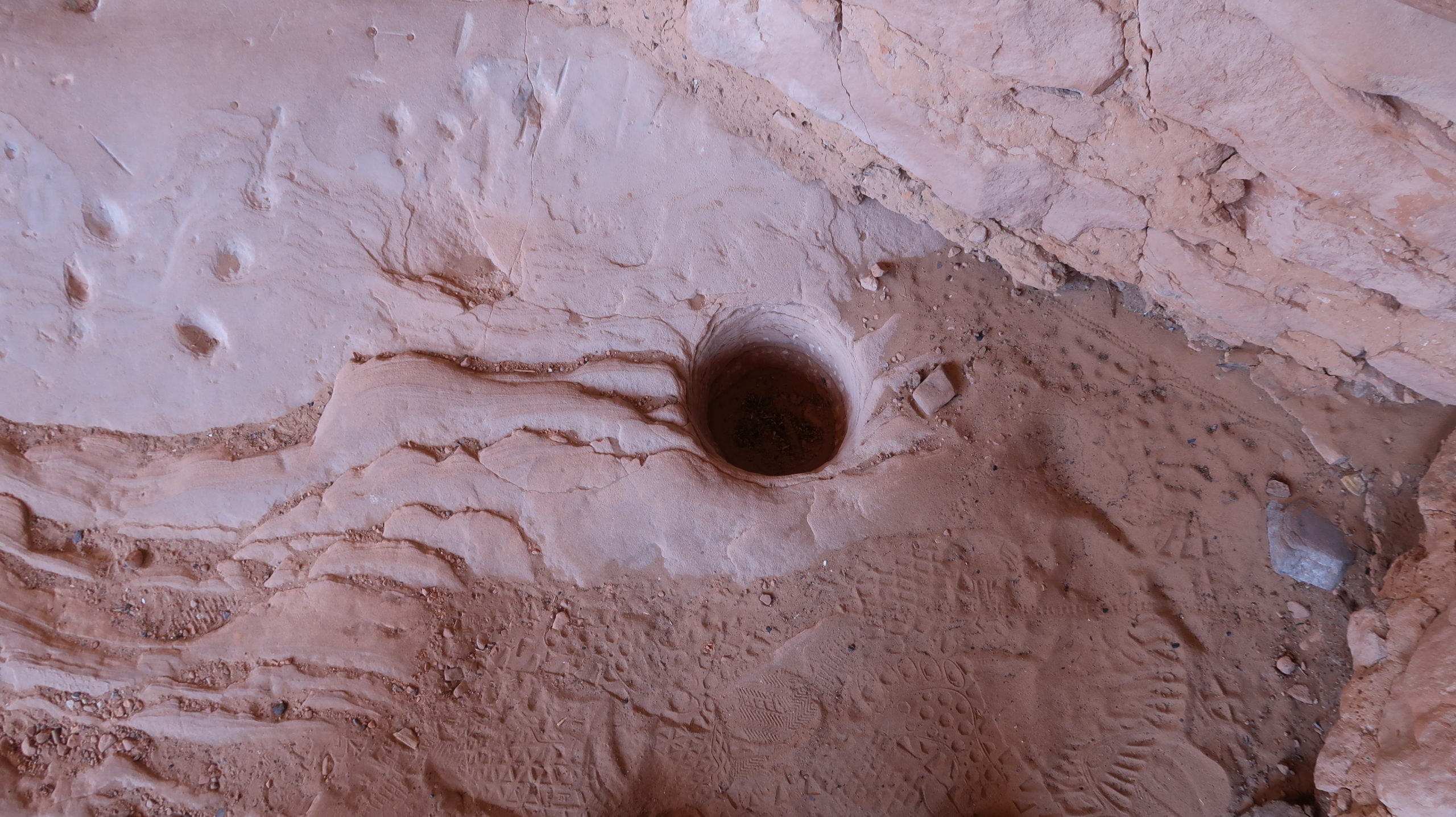
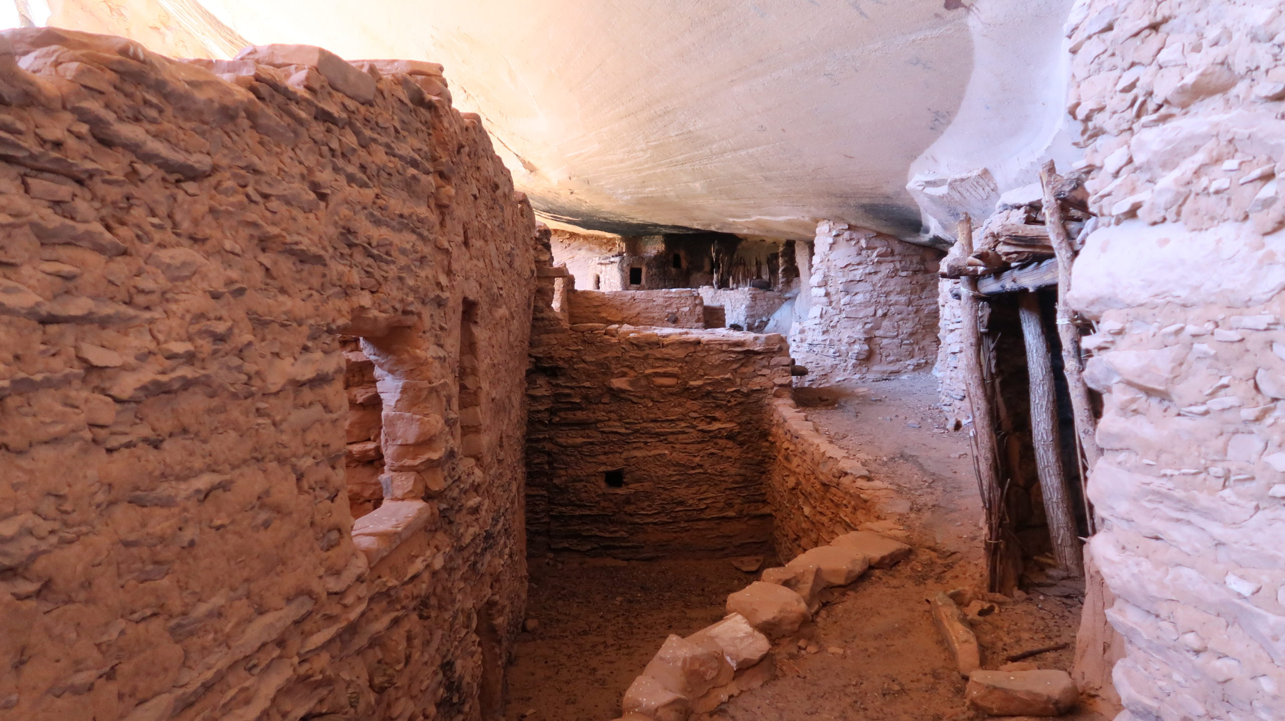
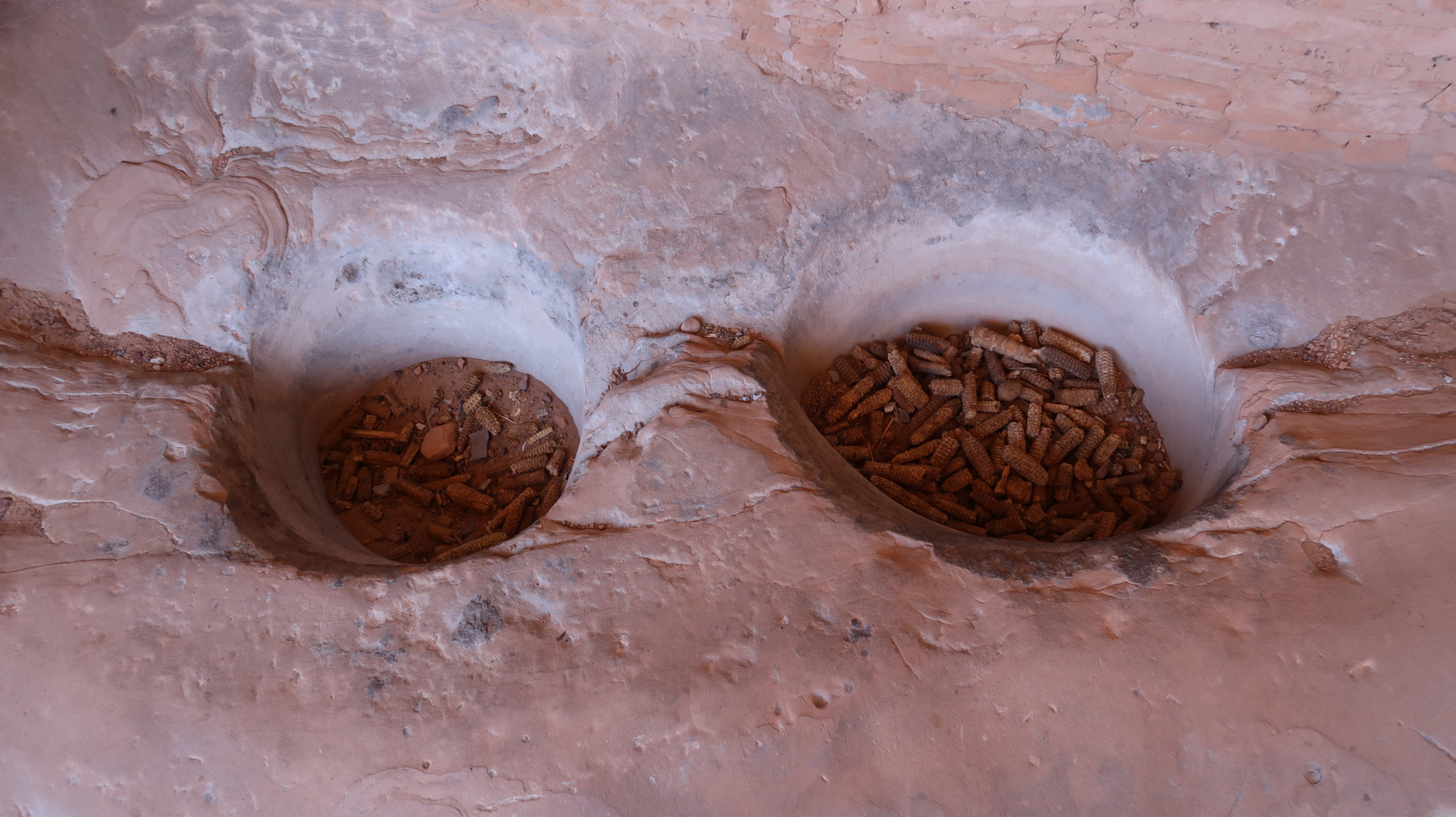
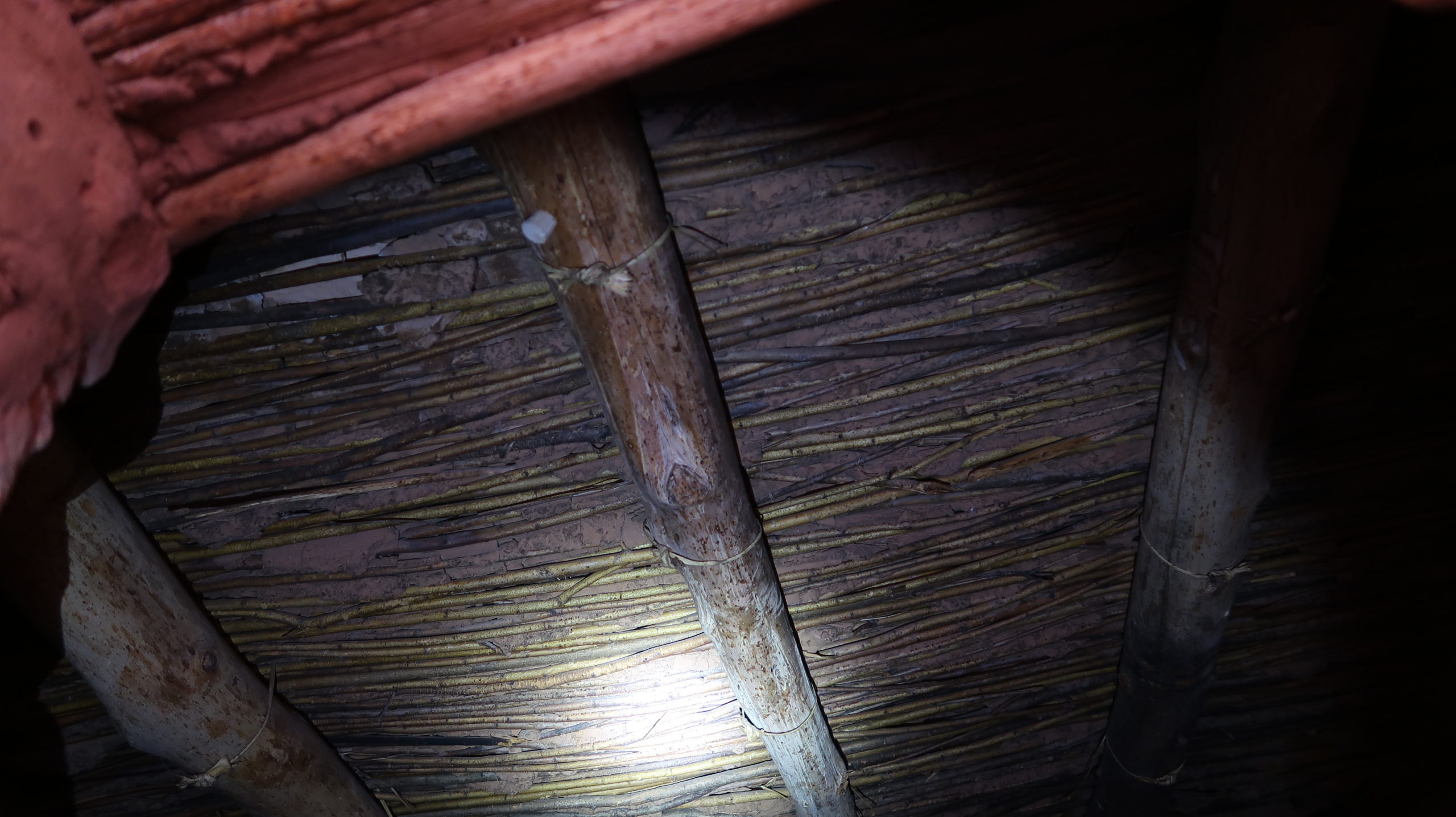
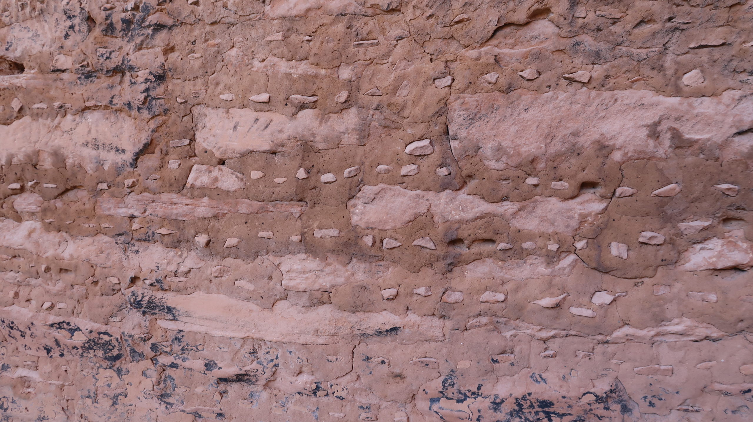
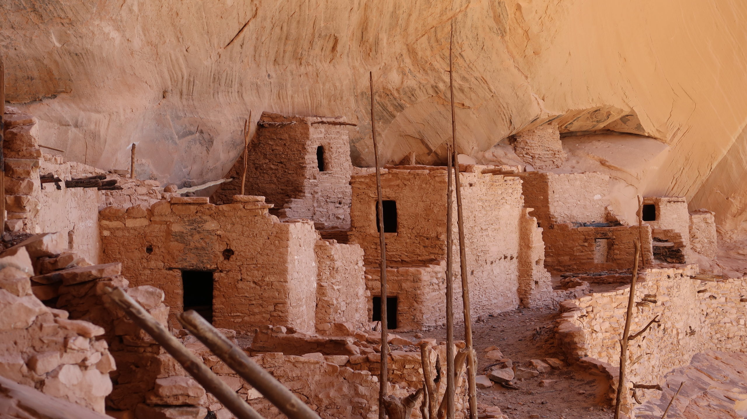
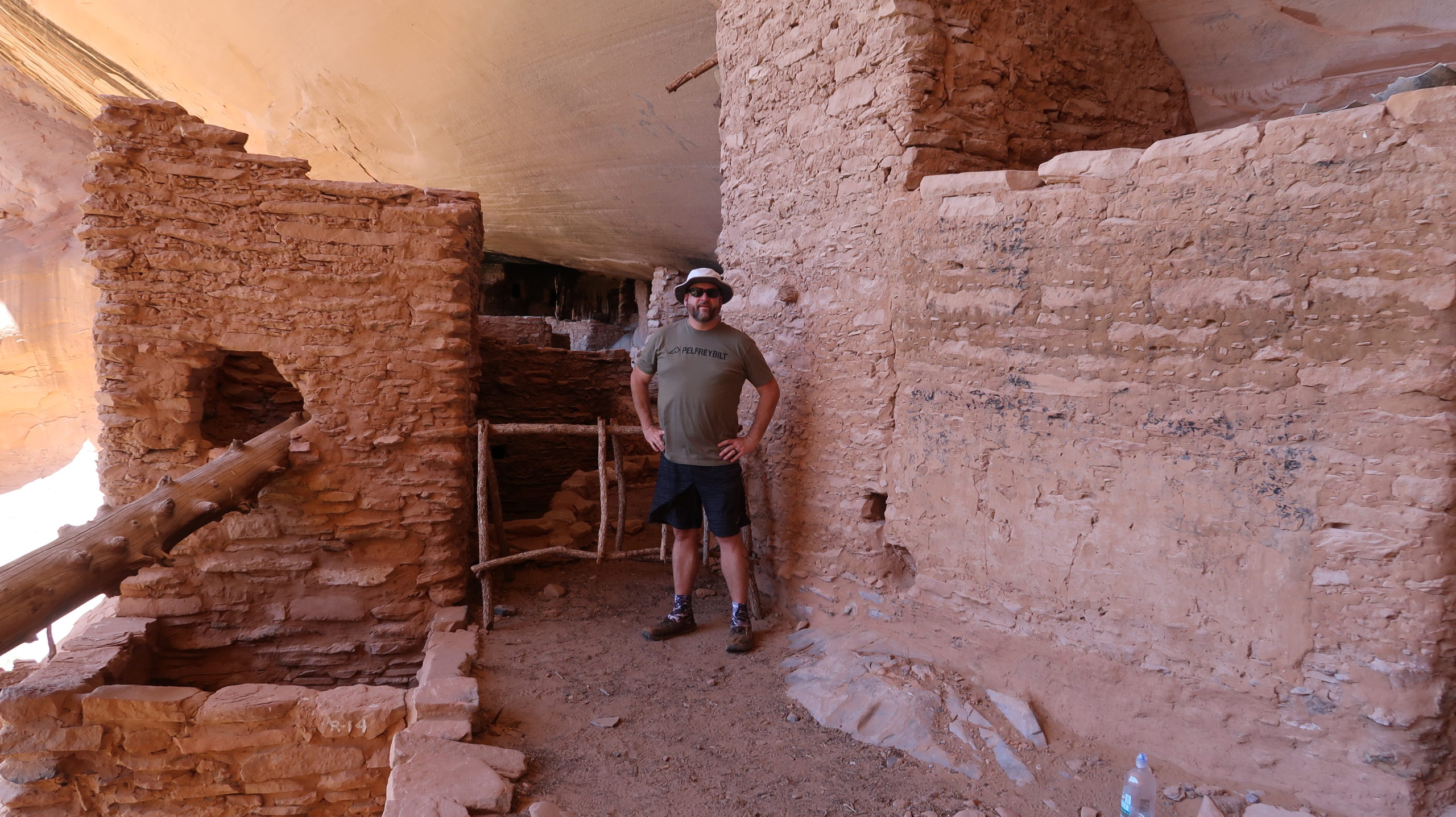
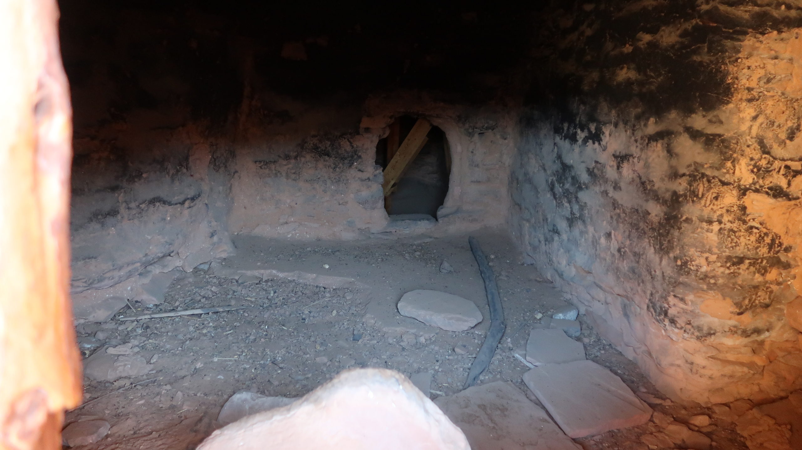
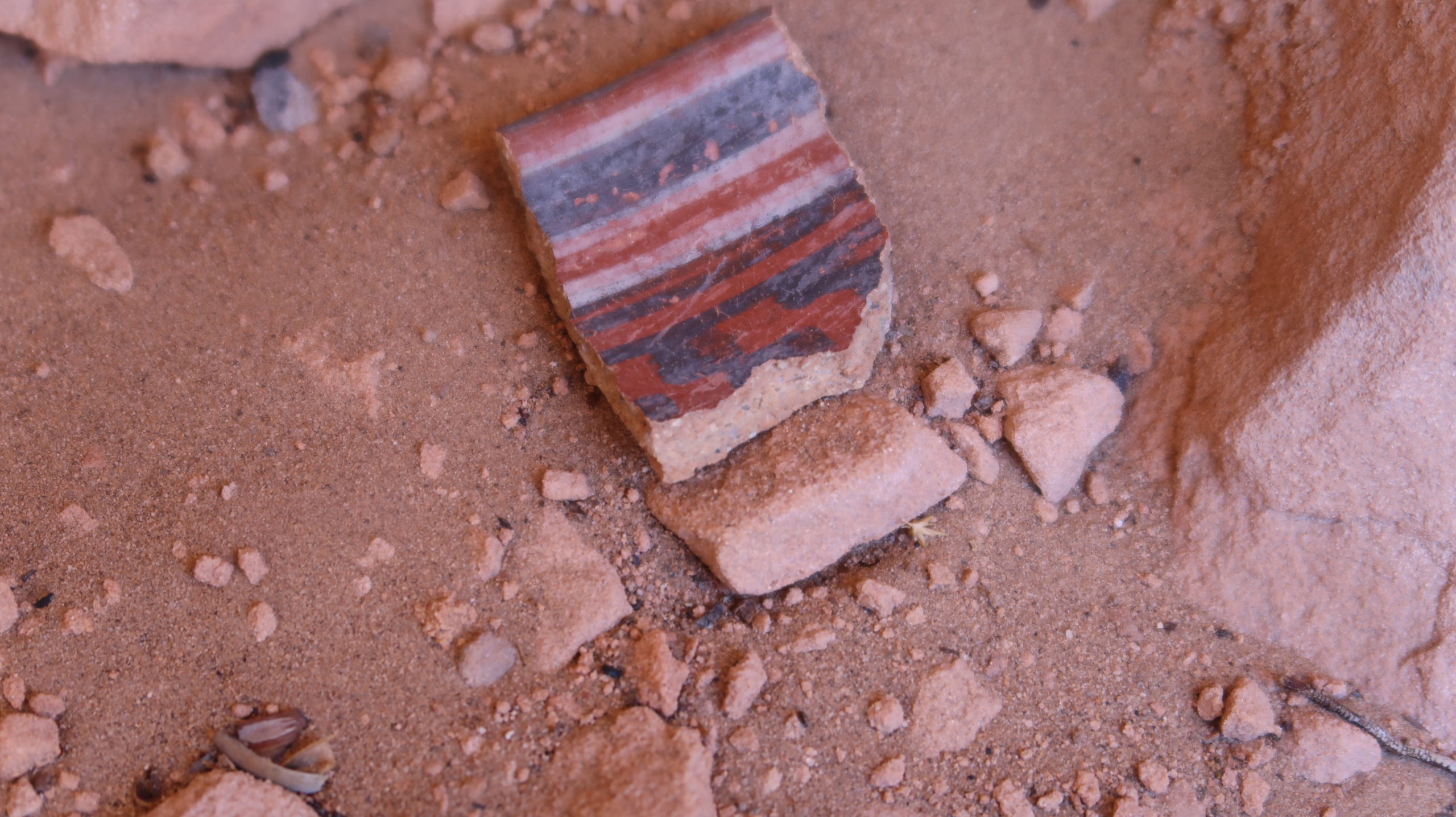
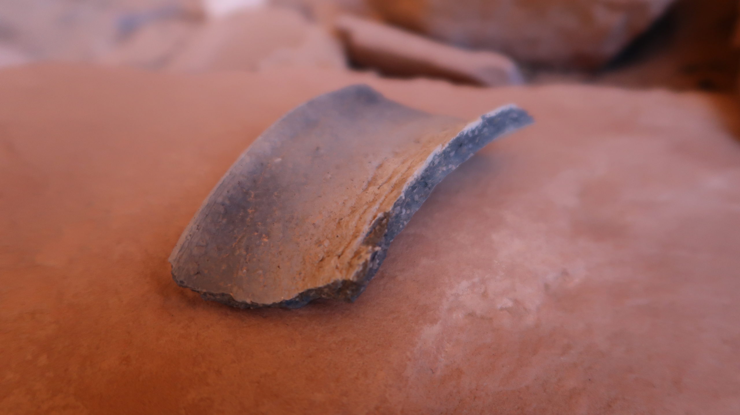
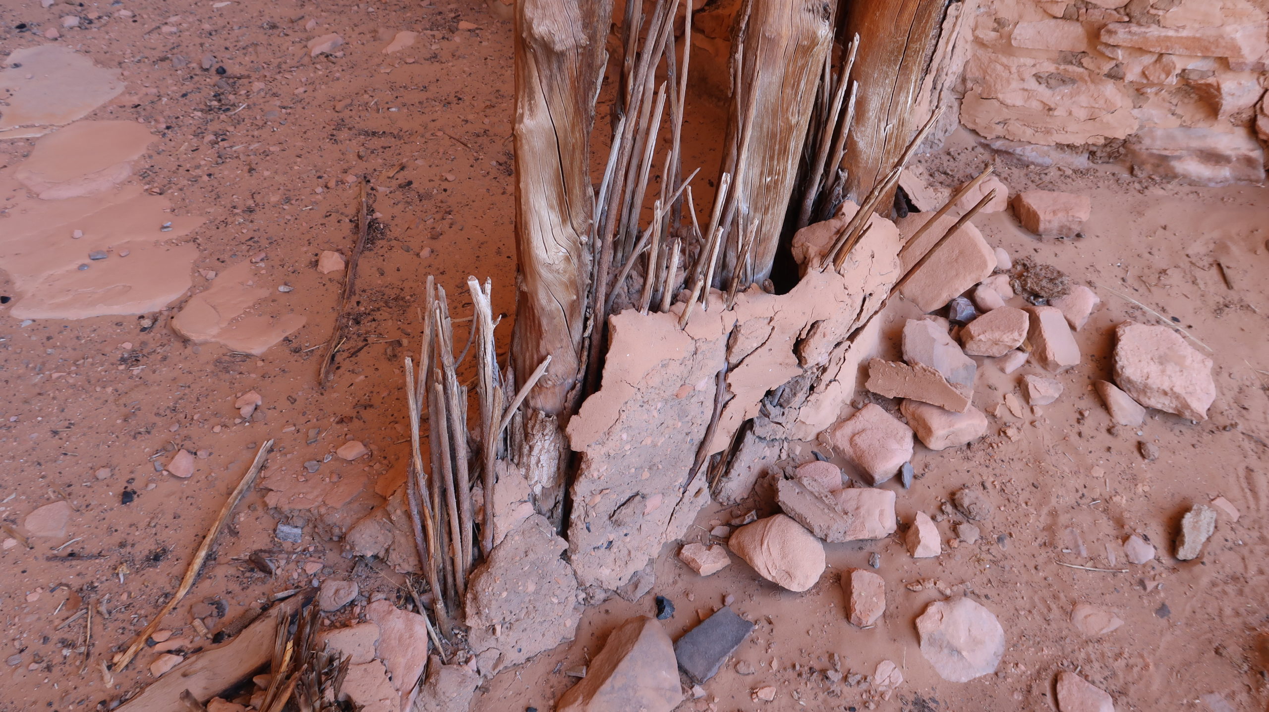
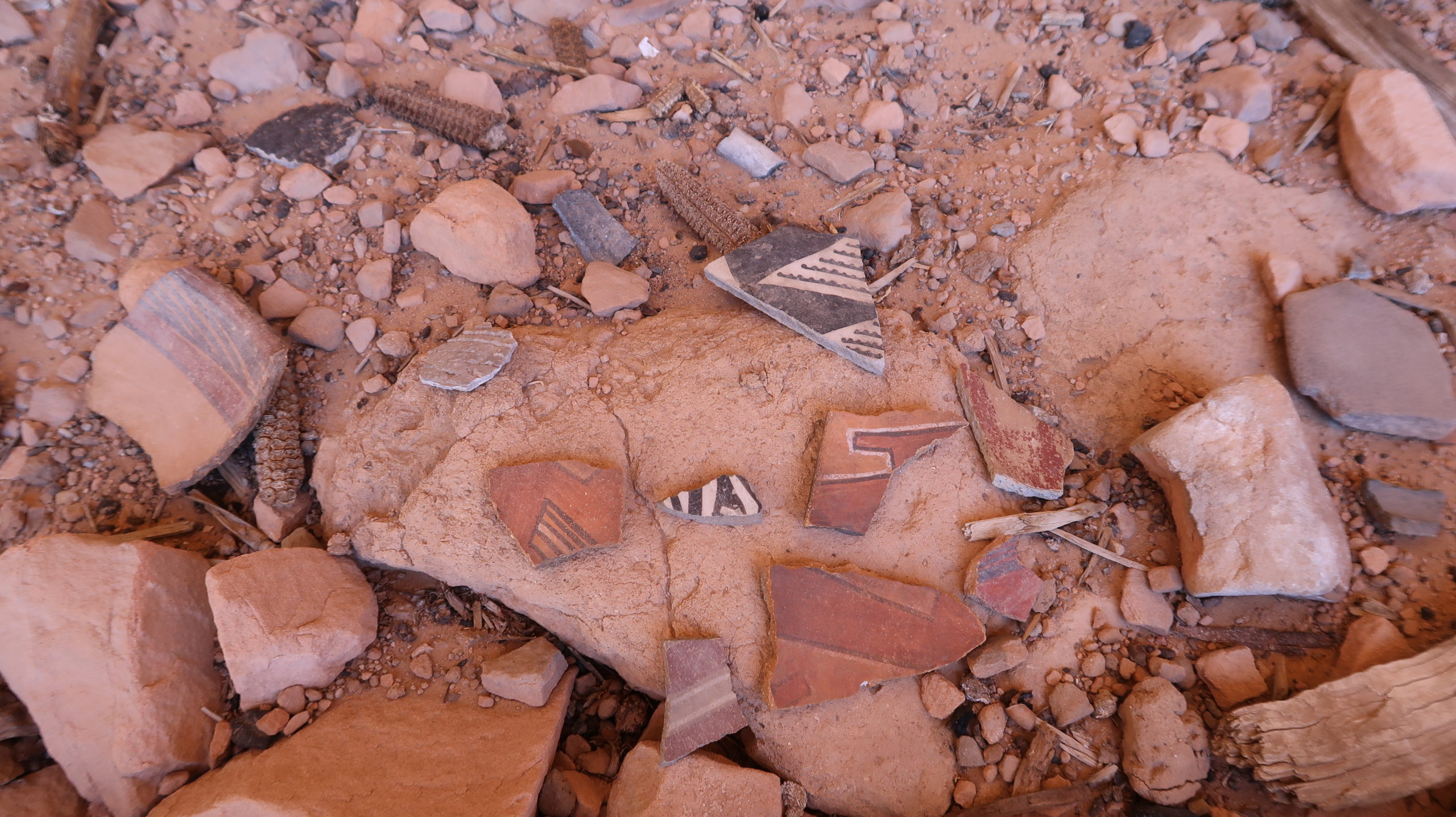
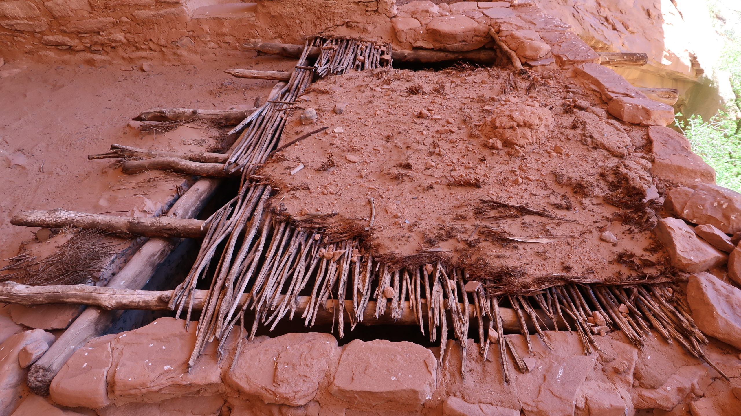
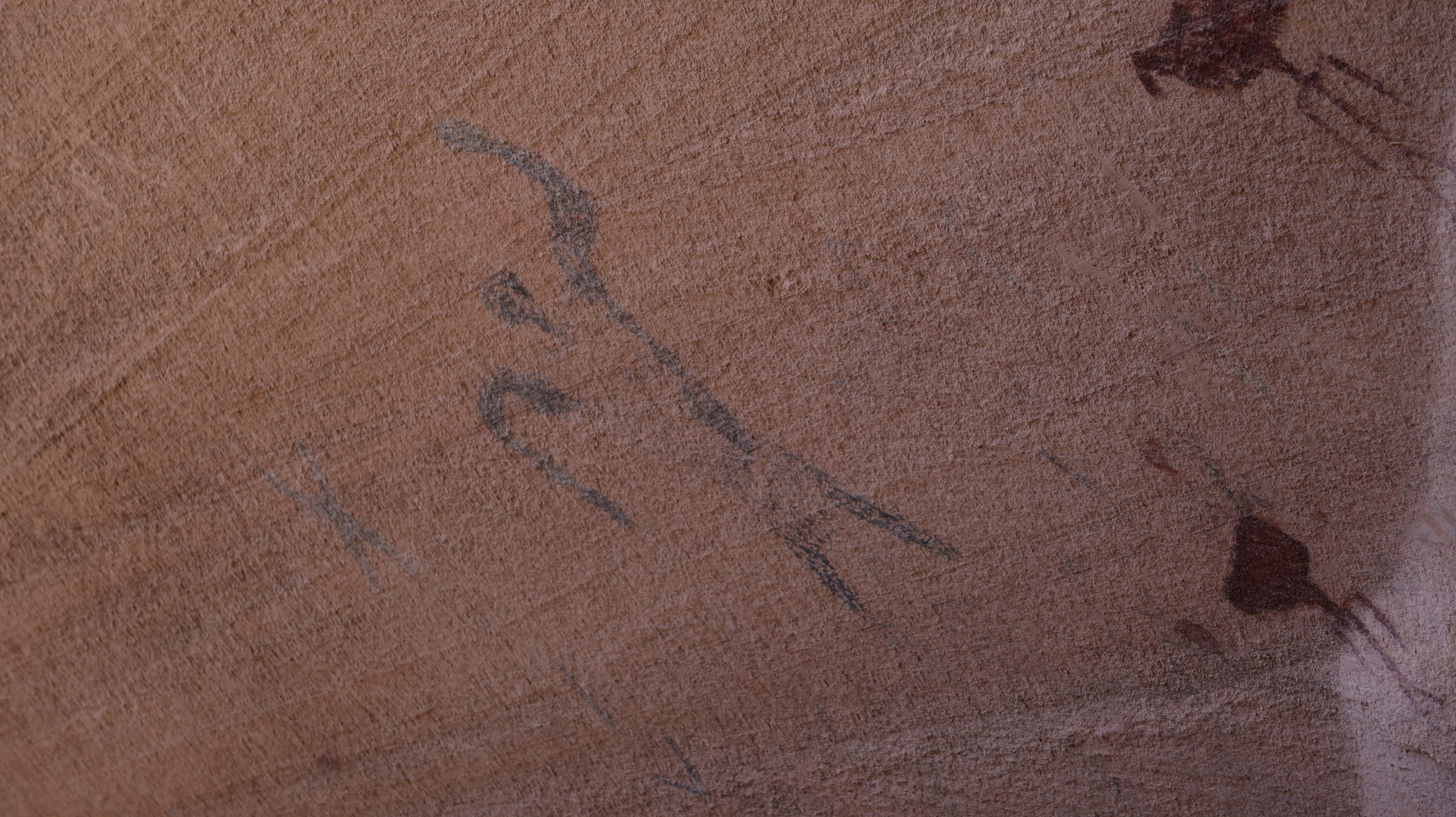
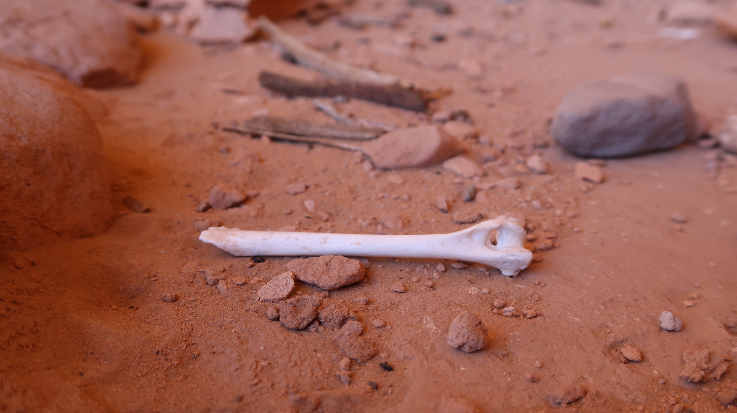
At the base of the ladder is where the jackpot of pottery sherds is found. All different types of pottery in every color and texture imaginable are laying everywhere. It’s immediate “wow” factor and you haven’t even gone up to the ruins yet. Now climb the ladder carefully and gather the group up top. Listen to the guide(s) because they are loaded with the history of the ruins and the area and have a great story to tell. There is plenty of time for taking pictures when the guide stops talking. You’ll get to see every bit of the ruins except for a part on the west side that was closed for restoration when we were there. It’s fascinating how these people lived, and there’s signs of their work everywhere you look. There are even leftover small corncobs scattered about and in some of the worn stone mortars and in some of the food storage chambers.
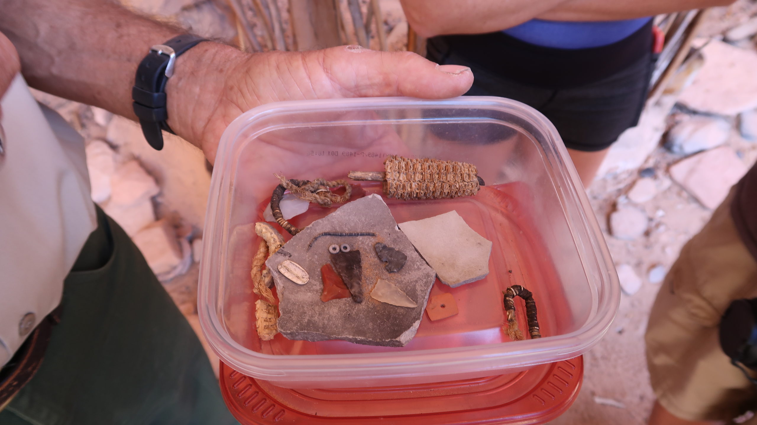
You’ve now seen the ruins and also seen so much pottery variety you can imagine, and the guide will then show you a hidden collection of some very special rare pieces at the end that are worth the wait. Jewelry, beads, even some still on threads, and amazing detailed crafts and pieces of tools.
Soak it all in, pay attention, and then get all of the pictures you want. They say pics don’t do it justice, but I think mine captured it pretty darn well.
The tour is over, and you have the backwards sketchy climb back down the ladder but it’s not as bad as it looks. Get to the bottom and then tip your guide. They are volunteers and love what they do, but they have to pack in their own food and supplies so throw them a $20 and make them smile.
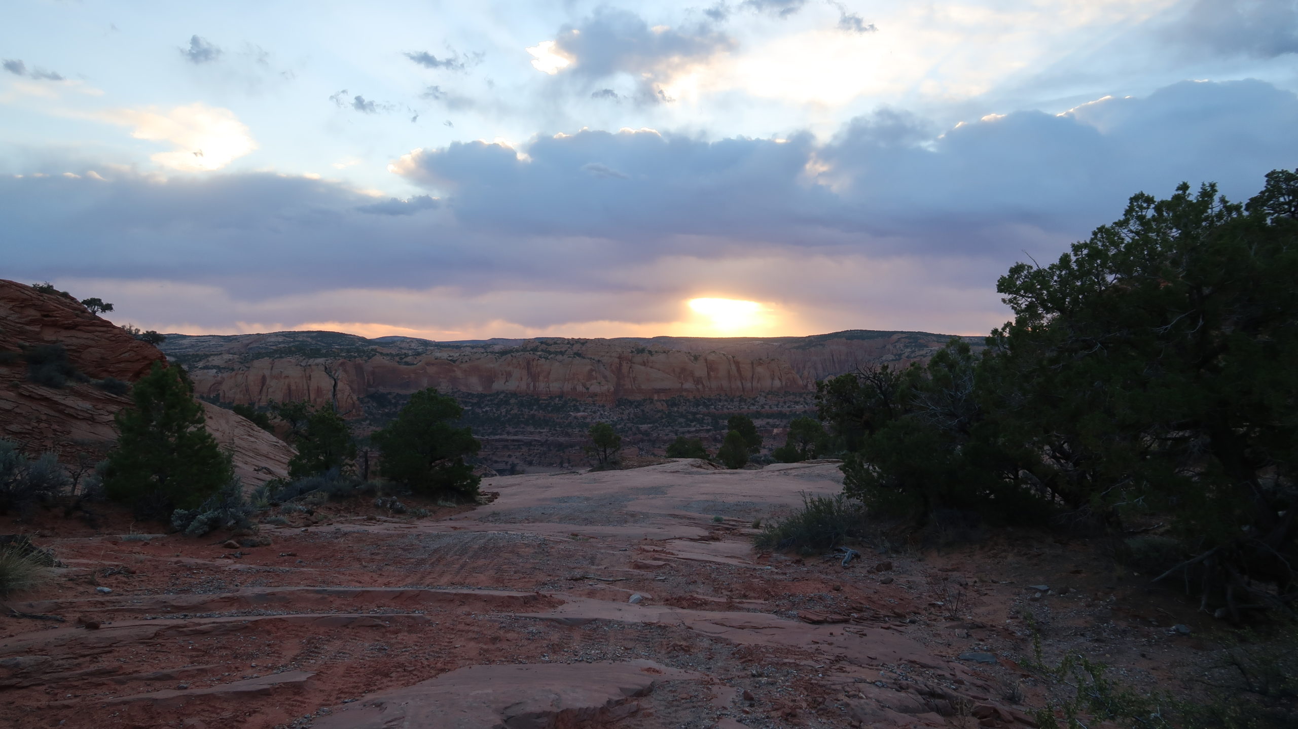
Now it’s time to either stay overnight at the backpacker’s camp across the stream, or hike back out. We headed out in mid afternoon and were back to our cars by sunset. The long drive home was tough after a long day, but you leave with a lasting memory of an amazing piece of American history.
